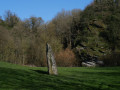
Moulin Neuf circular in Beaupréau-en-Mauges

Let the sounds of nature guide you along the River Èvre through the Beaupréau countryside. Pass by the mills beside the river

Details

12383305
Creation:
Last update:
Last review:
  • Walking
    Activity: Walking
  • ↔
    Distance: 6.32 mi
  • ◔
    Average duration: 3h 15 
  • ▲
    Difficulty: Moderate

  • ⚐
    Back to start: Yes
  • ↗
    Ascent: + 351 ft
  • ↘
    Descent: - 367 ft

  • ▲
    Highest point: 344 ft
  • ▼
    Lowest point: 180 ft
  • ⚐ Country: France
  • ⚐ City: Beaupréau (49600)
  • ⚑
    Start/End: N 47.204568° / W 0.977676°
  • ❏
    IGN map(s): Ref. 1423SB, 1424SB
  • Hour-by-hour weather

Description of the walk

Park in the Biocoop car park, near the Sainte-Anne Chapel, on Rue Sainte-Anne.

Red markings

(S/E) Walk down Rue Sainte-Anne. At the roundabout, take the third exit, staying on the same road, then turn right towards the tunnel under the D742. Go through the tunnel, then keep left towards La Combe. At Haut Pré, turn right. Take the stony path to La Combe, then Haut Pré, and you’ll reach the track known as the Beau Soleil.

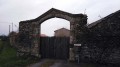
(1) Carry on straight ahead along a farm track crossing a field. At the end of this track, turn right onto the small road known as the Voie. At the end of this road, after about 500 metres, you’ll arrive at the Moulin Neuf lodge.

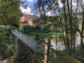
(2) Carry on and cross the River Èvre via the Moulin Neuf bridge.

(3) Turn left after the bridge and follow a grassy path running alongside the River Èvre for almost 2 km.

(4) A good fifty metres after the path has moved away from the Èvre, turn left at the hairpin bend to stay close to the river. Continue for 400 m to the Moulin de Pomail.

(5) Do not cross the bridge over the River Èvre but continue along the path to the right as far as La Hérissière.

(6) Turn left onto the tarmac road, then take the first grassy path on the right 300 metres further on. Continue across the fields until you reach a new tree-lined path.

(7) Follow it to the left. Stay on this path, keeping the field and the trees on your right.

(8) Cross the road to take the path opposite. At the fork (marker 105), continue to the right until you come out onto a tarmac road.

(9) Turn right and follow the road uphill until you reach a ‘give way’ sign on the right. Turn right at the junction, follow the road uphill to the large farmhouse and take the grassy path on the left, which you should follow until you reach the road

(10) Cross over to take the path opposite, which leads downhill, and head towards the Moulin Neuf bridge.

(3) Cross the bridge and follow the route back the way you came to the car park and the Sainte-Anne Chapel (S/E).

Waypoints

  1. S/E : mi 0 - alt. 325 ft - Sainte-Anne Chapel
  2. 1 : mi 0.47 - alt. 292 ft - Farm track opposite
  3. 2 : mi 1.04 - alt. 233 ft - Moulin Neuf lodge
  4. 3 : mi 1.14 - alt. 203 ft - Moulin Neuf Bridge - barrage sur l'èvre pour moulin à eau
  5. 4 : mi 2.17 - alt. 262 ft - At the junction, take the hairpin bend to the left
  6. 5 : mi 2.48 - alt. 190 ft - Pomail Mill
  7. 6 : mi 2.7 - alt. 282 ft - La Hérissière
  8. 7 : mi 3.14 - alt. 322 ft - Path junction, turn left
  9. 8 : mi 3.7 - alt. 341 ft - Tarmac road, opposite
  10. 9 : mi 4.53 - alt. 302 ft - Tarmac road, on the right
  11. 10 : mi 4.99 - alt. 276 ft - Tarmac road, opposite
  12. S/E : mi 6.32 - alt. 325 ft - Sainte-Anne Chapel

Reviews and comments

4.4 / 5
Based on 3 reviews

Reliability of the description
4.7 / 5
Ease of following the route
4.3 / 5
Route interest
4.3 / 5
User 12380865

Overall rating : 4.7 / 5

Date of your route : Nov 12, 2025
Reliability of the description : ★★★★★ Very good
Ease of following the route : ★★★★☆ Good
Route interest : ★★★★★ Very good
Very busy route : No

Lovely walk

Machine-translated

gelinoto
gelinoto

Overall rating : 4.3 / 5

Date of your route : Jan 15, 2024
Reliability of the description : ★★★★★ Very good
Ease of following the route : ★★★★☆ Good
Route interest : ★★★★☆ Good
Very busy route : No

The markings aren’t blue, but red. You’ve rated the difficulty as ‘easy’, but it would be better to rate it as ‘medium’ as there are quite a few steep sections.

Machine-translated

pap20cmss17
pap20cmss17

Overall rating : 4.3 / 5

Date of your route : Sep 26, 2021
Reliability of the description : ★★★★☆ Good
Ease of following the route : ★★★★★ Very good
Route interest : ★★★★☆ Good
Very busy route : No

We didn’t follow the GPS waypoints; instead, we followed the blue signposts suggested by Osez Mauges, as well as the description of your route: a small change would be welcome here, as there are many tree-lined paths and it’s possible to mix them up between points 6 and 8. It might be a good idea to specify at point 7 – where it says ‘follow the field and the trees on the right’ – that you’re walking alongside a tree nursery. This would help you get your bearings if you’re unsure.

The first part of the route is interesting because of the river, and the second part because of the very unobstructed view: would it be better to do it the other way round?

Machine-translated

Other walks in the area

For more walks, use our search engine .

The GPS track and description are the property of this route's author. Please do not copy them without permission.