The Montfaucon Blockhouses

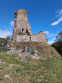
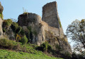
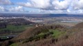
Fort Woirol, built in the late 19th century, with its signal post, anti-aircraft batteries, forward battery and redoubts. Then a leap back 1,000 years to the feudal castle perched on its rocky spur. Walkers with a less military mindset will enjoy this woodland walk and its views over the Doubs valley, the Saône plain, the Jura Mountains and, on a clear day, the Alps, from the Bernese Oberland to Mont Blanc.

Details

19725663
Creation:
Last update:
Last review:
  • Walking
    Activity: Walking
  • ↔
    Distance: 3.98 mi
  • ◔
    Average duration: 2h 20 
  • ▲
    Difficulty: Easy

  • ⚐
    Back to start: Yes
  • ↗
    Ascent: + 554 ft
  • ↘
    Descent: - 554 ft

  • ▲
    Highest point: 1,978 ft
  • ▼
    Lowest point: 1,680 ft

Photos

Description of the walk

Car park at Montfaucon, Rue du Belvédère, at the hairpin bend, at the junction with the cul-de-sac, the Chemin du Mont. Yellow-red, yellow-white and yellow-blue markings. Various sections without markings.

(S/E) Set off along the quiet, almost car-free tarmac road, the Chemin du Mont, which offers beautiful, unobstructed views over the Saône plain and the Jura mountains. Turn round for a glimpse of the massive silhouette of Mont Poupet on the horizon.

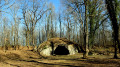
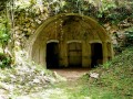
(1) You’ll soon reach the strangely named Combe aux Bâtards, at a crossroads. Carry on straight ahead for about twenty metres until you reach a fork in the road (blocked by a gate). Then head down to the left along a dirt track which immediately crosses another. Carry on straight ahead and the stone-lined path curves to lead you to the powder magazine beneath the rock. rockfalls.

(2) Set off again along the path that climbs the hillock to the left. Enter the woodland by crossing a dry-stone wall (a pile of stone gathered from fields) via a small, descending path which may be obscured in places by seasonal logging operations. You’ll soon reach (on your left) a corner of a pasture which you cross, joining another path which you take to the left, running alongside a large, collapsed dry-stone wall. You’ll emerge onto a wide stony track; head up it to the left.

(3) You’ll reach a small gravel road (car park for the climbing site). Turn right to walk past the Fontaine du Champ des Creux (view over the Doubs valley). The road becomes a lovely stony path that enters the woods.
At a signpost, take the first track on the left towards the Chemin des Falaises and the Château. You’ll reach some pastures; follow the path through the grass, keeping the edge of the woods on your right. At the fourth pasture, leave the path and head right at the end of the field, keeping the edge of the woods on your right at all times.

(4) Carry on to the corner of the woodland and climb the path which curves slightly to the left. Caution: do not take the first path ten paces before this. At an octagonal stone marker, at a fork in the path, follow the left-hand path to the Batterie de l’Avancée.

(5) At the battery, you can carefully climb up the small (slippery) path on the left to see the foundations of a cannon and carry on as far as the redoubt, but no further, as you’ll get caught up in the brambles. Turn back and walk past the battery.
This path leads you to a wider, stony track, which you follow to the right (MTB marker 113). There’s a view over the Saône plain and the mountains, and perhaps Mont Blanc on a clear day.

(6) You’ll soon reach some more blockhouses. Head up into the woods on the right via the path that runs past them. Before leaving them behind, turn round for a 180° view of the valley. Walk past one final casemate.
At the first fork, turn right despite the Yellow Cross and Blue Cross signs, passing through a beautiful holly wood, which is more vigorous than our Franche-Comté boxwoods, decimated by the box tree moth.

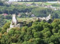
As you approach the edge of the woodland, turn onto a narrow path and head down to the left towards the pasture, but without entering it. Follow the edge of the woodland (staying within the trees) along the path that branches off to the left towards the superb (unsecured) viewpoint overlooking the feudal castle and the Besançon mountains.

(7) Continue by heading back up towards the ditches of Fort Woirol. As you come within sight of the entrance, shortly after the second ‘Military Area’ sign, climb into the woods on the left via the path leading to the observation post. Turn your back on the post and head towards the open area, veering left towards the bases of the anti-aircraft batteries.
Join the small tarmac road and follow it to the left for about fifty metres. Head down into the woods along the stony path on the left. At the first nearby fork, leave the path and take a small track that descends to the right.

Shortly after the more open stretch (power line), at the next fork, continue to the right as far as the first houses without entering the open area, but skirting the edge immediately to the left for about ten steps to find a barely visible narrow path that passes in front of a pile of stones, then runs alongside the wire fence to its corner.

Do not continue straight on, as the descent would be perilous. Instead, two steps before the corner, look out for the small path on the left which goes round a rock step of a good fifty centimetres, then descends along the rocks. At the foot of this step is a final bunker, well hidden by the vegetation.
At the bottom of the rocks, follow the path that branches off to the right to join the Chemin du Mont and the car park about a hundred metres away (S/E).

Waypoints

  1. S/E : mi 0 - alt. 1,804 ft - Chemin du Mont
  2. 1 : mi 0.94 - alt. 1,844 ft - La Combe aux Bâtards
  3. 2 : mi 1.21 - alt. 1,795 ft - Powder magazines beneath the rocks
  4. 3 : mi 1.71 - alt. 1,778 ft - Fontaine du Champ des Creux
  5. 4 : mi 2.42 - alt. 1,946 ft - Corne du Bois
  6. 5 : mi 2.48 - alt. 1,962 ft - Avancée Battery
  7. 6 : mi 2.68 - alt. 1,949 ft - Blockhouse
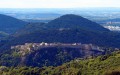
  8. 7 : mi 3.02 - alt. 1,841 ft - Viewpoint overlooking the feudal castle of Montfaucon
  9. S/E : mi 3.98 - alt. 1,801 ft - Chemin du Mont

Notes

A rocky step of a good fifty centimetres to descend. The route includes ledge paths and unsecured viewpoints. The paths are rocky and slippery in places. Sturdy footwear is essential and the use of walking poles is recommended.

Worth a visit

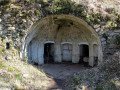
(2) The rock-cut powder magazine stored, in times of war, the black powder used to propel shells. Rock-cut magazines were built from 1885 onwards with the advent of the more formidable torpedo shells.
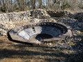
(5) The Avancée battery: built in 1878, it is also known as the Carrière or Mairot battery, as it was situated on the edge of a quarry opened up during the fort’s construction. It controlled the area below it, which was not visible from the fort.
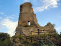
(7) The feudal castle is being restored by a voluntary organisation. The first written records of a castle date from around 1040; it was likely built of timber by Conon (nicknamed ‘Faucon’), a vassal of the Archbishop of Besançon. It has been listed as a historic monument since 7 December 1976.
(7) Montfaucon Fort, or Fort Woirol, dating from the late 19th century, formed part of the fortified camp of Besançon. Its purpose was to keep the Thise plain within range of its guns and to prevent invasions via the Saône plain. On 30 September 1906, a terrifying explosion rocked the village of Montfaucon, shattering the windows. A mishandling of the equipment left part of the fort reduced to a heap of rubble and metal, amidst which bodies lay.
(7) The signal station: a room fitted out for telegraphy using Morse code light signals. The light was provided by a paraffin lamp, later by electricity. During the day, a heliostat captured the sun’s rays through a chimney. The fort communicated with three other fortifications: the Grelimbach redoubt at Salins, the Larmont at Pontarlier and the Lomont defensive breakwater.
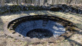
(7) The anti-aircraft battery, comprising six circular emplacements situated between the access road and the optical post, were excavated and built around 1929. Surrounded by protective low walls, they were armed with 75 mm guns.

Reviews and comments

3.9 / 5
Based on 3 reviews

Reliability of the description
3.7 / 5
Ease of following the route
4 / 5
Route interest
4 / 5
meet-and-see
meet-and-see
• Edited:

Overall rating : 4.3 / 5

Date of your route : Apr 09, 2023
Reliability of the description : ★★★★☆ Good
Ease of following the route : ★★★★☆ Good
Route interest : ★★★★★ Very good
Very busy route : No

I was already familiar with the area, but the route allowed me to discover places I hadn’t seen before, including a few of Montfaucon’s structures. If you could describe these structures in a bit more detail – if you know them better – that would be brilliant.
In my opinion, the description of point 2 needs revising. I used my GPS to find my way back. Otherwise, the walk is well described.

Machine-translated

le saut de bonneille

Overall rating : 4 / 5

Date of your route : Mar 07, 2022
Reliability of the description : ★★★★☆ Good
Ease of following the route : ★★★★☆ Good
Route interest : ★★★★☆ Good
Very busy route : Yes

A lovely walk – I really enjoyed the little forest paths
What’s more, the sections leading to the bunkers and the fort are really interesting
Just one thing – we couldn’t find the path down towards the houses at the end of the route

Machine-translated

clochettefb
clochettefb

Overall rating : 3 / 5

Date of your route : Sep 12, 2011
Reliability of the description : ★★★☆☆ Average
Ease of following the route : Not used / Not applicable
Route interest : ★★★☆☆ Average
Very busy route : Yes

We went on the walk yesterday afternoon. The starting point wasn’t very clear, particularly as the description mentioned a ‘metal barrier’. Where we were, we came across three of them.
We met other people who, like us, had chosen this short, easy walk (which was indeed not misleading) and had turned on their GPS. After a bit of hesitation, they found the right path and we followed them.
Nevertheless, our walk was thoroughly enjoyable: we came across a multitude of signposted paths and enjoyed an excellent view of Montfaucon Castle...

Machine-translated

Other walks in the area

For more walks, use our search engine .

The GPS track and description are the property of this route's author. Please do not copy them without permission.