


 Country:
 City:
City:


Park in the car park opposite the stadium, at the top of the village of Montfaucon. Yellow-blue and yellow-red markings; a short section is unmarked.
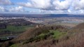
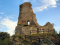
(S/E) Walk up Rue de la Comtesse Henriette, the path along the castle’s banks. On the right is an old fountain with a pump. Take a look at the valley and the castle ruins, then continue uphill to the right along Rue du Château, before turning sharply left into the dead-end Chemin des Poudrières, with lovely views to the right over the Besançon hills. Follow mountain bike route 113.
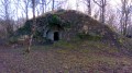
(1) After the last house, the path becomes stony and climbs the wooded hillside. Take care – there is a risk of falling rocks. You’ll pass a rock shelter comprising five casemates built between 1890 and 1893, which could have been used as barracks in times of war; most of them have now collapsed. Do not be tempted to explore them.
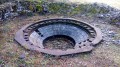
(2) You’ll reach the entrance to Fort Woirol and turn right onto the path that runs alongside the ditches. Opposite the third sign reading ‘Military Property – No Entry’, take the track on the right towards the observation post. Leave the post behind you to discover the plinths, the remains of the anti-aircraft batteries. At the last battery, rejoin the small tarmac road and turn right towards the fort’s entrance.
A few metres before the stony path we took on the way up, you’ll come across a track leading off to the left into the woods. At the start of a section of moss-covered stone wall, look out for the marker and the path that climbs to the left, running alongside the ditches of the Montfaucon Redoubt.
You’ll pass beneath the TV transmission pylon. At the fork in the paths, continue to the right. At the small strip of meadow, carry on to the viewpoint along the track that crosses it.
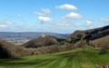
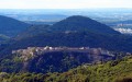
(3) Leave the viewpoint on the left (facing the valley) via a few stone steps, walking along the ledges 2 metres from the edge, with lovely views over the valley and the Citadel. You’ll enter a copse and reach another viewpoint overlooking the valley, the Citadel and the Montfaucon valley.
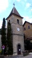
(4) Set off again along the path that leads away from the ledges. You’ll reach Rue des Pâturages, which you follow downhill. At the bottom of the street, turn right onto the ‘no entry’ road (except for residents), which you follow downhill to the church. Then take Rue des Fontaines opposite the porch and, just before the town hall, Rue de la Fruitière, which takes you back to the car park (S/E).
 The route includes ledge paths and unsecured viewpoints. The paths are rocky and slippery in places. Sturdy footwear is essential and the use of walking poles is recommended.
 Visorando Member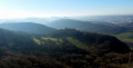

 Average
