


Refine your search for walks in Valjouffrey
Valjouffrey walks


 Chalp Valley
 Visorando Member
 4.01 mi
 +3,465 ft
 -3,465 ft
 4h 50
 Difficult
 Departure from Valjouffrey (Isère)
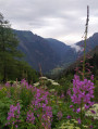
Ascent through the wild and unspoilt Chalp valley. With a bit of luck, you’ll spot plenty of marmots and chamois.The climb is quite steep. It begins in the forest, then cuts across beneath the rocky ridges of the valley, which the path crosses on the left (as you ascend).
The Orgues de Valsenestre and return via the Combe Oursière
 7.98 mi
+3,632 ft
-3,609 ft
6h 50
Difficult
Departure from Valjouffrey (Isère)
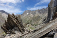
A hike in several stages:- The Orgues de Valsenestre (or the ‘great library’), a geological curiosity featuring a multitude of perfectly aligned vertical strata.- The Col de Côte Belle, offering panoramic views over the Font Turbat valley.- A return via the balcony path to the small hanging valley of Combe Oursière.- Finally, you’ll cross a forest of ‘crooked’ larch trees (larch trees bent by the weight of the snow).... Not forgetting the Hobbit house
Important: please read the practical information carefully.
Pic de Valsenestre circular walk
 Tourism professional9.97 mi
+5,866 ft
-5,863 ft
9h 40
 Extremely difficult
Departure from Valjouffrey (Isère)
This hike is reserved for very experienced walkers who enjoy adventurous terrain, steep slopes and new discoveries: the ‘orgues’, the panoramic view from the summit, the volcanic geology of La Rache and the Cabane de l’Oursière (from *The Hobbit*).
From Valsenestre to the Cabane de la Cantine des Carrières
 3.32 mi
+1,421 ft
-1,122 ft
2h 45
 Moderate
Departure from Valjouffrey (Isère)
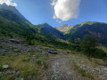
Splendid view of the mountain cirque culminating at the Roche de la Muzelle. Walk through the cool woods before arriving at a gallery of peaks in the Écrins. You will follow the Torrent du Béranger for two-thirds of the hike.
The Désert en Vajouffrey via the Col de Côte Belle
 6.61 mi
+3,458 ft
-3,547 ft
6h 05
Difficult
Departure from Valjouffrey (Isère)
When you’re in the Valbonnais region, as you move from one valley to another, this walk allows you to gain a little altitude and discover the many peaks in this part of the Écrins massif. These peaks overlook both Valsenestre (suggested starting point) and the Désert in Valjouffrey (finish). Of course, you’ll need the weather to be on your side!
Tête de Rame (or Tête des Chétives) via Lac de Labarre
 9.51 mi
+4,823 ft
-4,846 ft
10 hrs
 Very difficult
Departure from Valjouffrey (Isère)
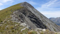
To enjoy an unbroken panorama stretching from the Pic de Bure to Mont Aiguille, taking in all the peaks of the Vercors as well as the Trièves plateau, and on the other side the Taillefer and several peaks of the Écrins.
You’ll also pass by the turquoise-green Lac Labarre, at the foot of the Lauvitel signal.
Ridges around La Salette: from Le Gargas to La Croix de Rougny
 7.01 mi
+2,625 ft
-2,635 ft
5h 30
Difficult
Departure from La Salette-Fallavaux (Isère)
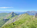
This is a magnificent ridge walk around the Sanctuary of La Salette, a circular route offering stunning views all along the way. First, you climb the Gargas, crossing from the Col d’Huretières to the Col de l’Éterpat, then ascend to Le Chamoux to follow the long ridge via the Tête de la Pale Traversière and then the Croix du Rougny, before descending for a mid-slope traverse back to the Sanctuary.
Please read the practical information carefully before setting out on this route.
La Croix de Rougny, return via the ridges
 Association / Club / Walk leader
 4.82 mi
+1,860 ft
-1,827 ft
5 hrs
Very difficult
Departure from La Salette-Fallavaux (Isère)
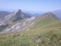
From the forecourt of the Basilica of Notre-Dame de la Salette, there is a view of the entire hike. An exceptional panorama. With the optional Gargas, it's nothing but happiness.
Valsenestre - Refuge de la Muzelle
 6.07 mi
+4,541 ft
-1,886 ft
6h 45
Difficult
Departure from Valjouffrey (Isère)
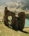
A short 10 km stage but with 1,400 m of elevation gain, featuring the very technical and rocky ascent of the Col de la Muzelle. It requires the utmost caution, especially with a heavy rucksack. A narrow passage between two magnificent mountains, the Roche de La Muzelle and the Pic du Clapier du Peyron. Throughout the ascent, you are surrounded by mountain ranges over 3,000 m high. From the pass, there is a splendid view of the rest of the Glacier de la Muzelle, the lake and the corridor leading down to Valsenestre.
Notre-Dame de la Salette: from the Col de l’Homme to the summit of the Gargas
 4.85 mi
+1,880 ft
-1,854 ft
3h 50
Moderate
Departure from La Salette-Fallavaux (Isère)
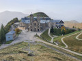
The Sanctuary of La Salette is set amidst lush greenery and steep mountains. The suggested route will take you to the summit of Gargas (2,208 m), where an orientation board will help you identify the Dévoluy, the Obiou and the peaks of the Barre des Écrins, amongst dozens of other peaks. The view in fine weather is superb.
Please note: the 600-metre climb is covered over the first four kilometres. This hike is best suited to experienced walkers.
Font Turbat refuge at the foot of Olan
 12.56 mi
+4,081 ft
-4,085 ft
9h 20
Difficult
Departure from Valjouffrey (Isère)
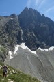
Magnificent view of the north face of Olan (3,563 m), accessed via a typical trough-shaped glacial valley. First, you pass the Pisse waterfall, then you enter this valley deeply carved out by glaciers before reaching the only refuge in the valley. You are facing the Olan with its 1,000-metre vertical wall, but there are still 300 metres to climb to reach the Col des Lauvets with its viewpoints.
La Pisse Waterfall and the Basse Pisse Valley
 6.82 mi
+1,870 ft
-1,870 ft
4h 45
Moderate
Departure from Valjouffrey (Isère)
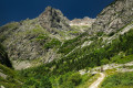
A hike to discover a magnificent, fairly well-known and easily accessible waterfall. Then, and above all, a short hanging valley, shaped like a glacial cirque, much more secluded and rather wild.
Lac Labarre - Lac du Vallon
 6.06 mi
+3,192 ft
-2,828 ft
5h 35
Difficult
Departure from Valjouffrey (Isère)
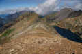
From Lac Labarre, the route follows part of the GR®54B. You will cross the Col de la Romeïou, the Cabane de la Selle, then the Col du Paletas. From there, a wild hike along the ridges, passing by the Neyrard at an altitude of 2,796 m, will take you to Lac du Vallon.
Le Désert-en-Valjouffrey - Valsenestre
 7.01 mi
+3,330 ft
-3,278 ft
6h 05
Difficult
Departure from Valjouffrey (Isère)
Ethird stage involving the ascent of a pass with no major technical difficulty, though the gradient is steep in places and differs slightly from the route shown on the IGN map. From the top of the pass, there is a splendid view of the Col de la Muzelle, the Roche de la Muzelle and the Pic du Clapier du Peyron on either side, promising a beautiful stage for the following day. During the descent, you pass through a maze of large, intertwined slabs of slate clinging to the mountainside.
Le Lauvet - Lac Labarre
 11.84 mi
+4,869 ft
-3,711 ft
9h 40
Difficult
Departure from Valjouffrey (Isère)
From Le Lauvet, descend to La Chapelle-en-Valjouffrey. Then take the Sentier du Facteur trail, cross the Haute Vallée du Béranger nature reserve in Valsenestre, and finish on the GR®54B trail to Lac Labarre.
More walks in Valjouffrey
Select a point of interest below: