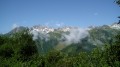
Col de Riondet and Col du Mottet

At the foot of the Pointes du Niélard, facing the Pic du Cheval Noir, this hike to two passes presents no technical difficulty and remains accessible to any fit walker, as it follows only wide alpine tracks.

Details

n°316224
Creation:
Last update:
Last review:
  • Walking
    Activity: Walking
  • ↔
    Distance: 8.50 mi
  • ◔
    Average duration: 5h 55 
  • ▲
    Difficulty: Moderate

  • ⚐
    Back to start: Yes
  • ↗
    Ascent: + 2,313 ft
  • ↘
    Descent: - 2,303 ft

  • ▲
    Highest point: 7,858 ft
  • ▼
    Lowest point: 6,017 ft

Photos

Description of the walk

Start from the top station of the Pierrafort cable car (see timetables and fares in the practical information section).

The walk leads to two passes, with a long section common to both routes up to an unnamed small pass (6). The description below lists these two passes in a particular order, but it is of course possible to do them in the reverse order or to visit just one of them.

Ascent to the small pass

(S/E) With your back to the cable car’s arrival station, head towards a small chalet; leave this chalet on your right, take a footbridge and cross a torrent. Then follow a track heading north-east, which climbs gently in a zigzag pattern up to the Col du Gollet.

(1) At the pass, the track turns sharply right (south-south-west) towards the Col du Mottet (signposted). Continue along the track (the path shown in purple on the 1:25,000 map, which is supposed to pass at elevation 2131, does not exist).

(2) At the junction at a place called La Montagne du Gollet (signposted), continue along the track (ignore a path branching off to the left which is not shown on the 1:25,000 map but is visible if you zoom in further). Pass at the foot of the Pointe du Grand Niélard (boulders), and take two hairpin bends, first to the right then to the left, to climb a grassy ridge.

(3) Descend amongst boulders, then climb a short, steep section. Continue west-south-west and pass beneath the Mottet chairlift line.

(4) Continue along the gently ascending track, heading south-west then west (the junction marked here is only for an alternative descent route).

(5) Ignore a trail starting on the left and stay on the same trail, which becomes steeper. After a few hairpin bends, reach a small pass (unnamed on the map) directly below a large ski trail signpost.

Route to the Col de Riondet

(6) With the signpost on your left, follow the path on the right which begins to descend. At the next Fork in the road, take the left-hand track which climbs steeply up the slope. The climb then becomes less steep until you reach the pass.

(7) From the Col de Riondet, the return to the small pass is via the same path.

Route to the Col du Mottet

(6) With the signpost on your left, follow the path on the left, which climbs and passes level with the signpost. Follow a few hairpin bends, then continue up a gentle slope to the pass.

(8) From the Col du Mottet, the return to the small pass is via the same path.

Descent to the cable car from the unnamed small pass

(6) Follow the same path as on the ascent but in the opposite direction to return to the Pierrafort cable car top station (S/E).

Waypoints

  1. S/E : mi 0 - alt. 6,017 ft - Pierrafort cable car top station - Valmorel
  2. 1 : mi 0.93 - alt. 6,496 ft - Col du Gollet
  3. 2 : mi 1.51 - alt. 6,831 ft - Montagne du Gollet
  4. 3 : mi 2.11 - alt. 7,087 ft - Summit of a ridge
  5. 4 : mi 2.76 - alt. 7,178 ft - Junction near a chairlift line
  6. 5 : mi 3.13 - alt. 7,306 ft - End of the slight incline
  7. 6 : mi 3.52 - alt. 7,598 ft - Unnamed small pass
  8. 7 : mi 3.96 - alt. 7,851 ft - Col de Riondet
  9. 8 : mi 4.69 - alt. 7,799 ft - Col du Mottet
  10. S/E : mi 8.5 - alt. 6,017 ft - Pierrafort cable car top station - Valmorel

Notes

Hiking boots are essential. There may be a small snowfield directly below the Col de Riondet (this was the case in late July 2016). Bring warm clothing and rainwear, as well as sun protection.

No source of drinking water was spotted along the route: bring your own supplies. A 1:25,000 map is required (at the very least, the one accompanying this description).

In summer 2016, the cable car operated from 08:30 to 16:45 on Sundays, Mondays, Tuesdays and Fridays. A return ticket for pedestrians cost €9.10 per person (as did a single ticket, for that matter).

Alternatives for experienced walkers:

Additional option: ascent of the Pointe du Mottet – From the Col du Mottet (8), follow a path westwards that stays on the main ridge or slightly below it on the southern slope. Pass a secondary summit (2,482 m), continue westwards then veer south-west to reach the summit (2,592 m). Descend via the same route. Allow for an additional 220 m of elevation gain and approximately one hour for the round trip.

Alternative descent route – At the fork (4), just before the chairlift line, leave the track and head into a narrow grassy valley flanked on the left by a grassy outcrop. Take care, as the path is poorly marked and the start is inconspicuous. Keep to the right to stay on the track. You’ll come to a marked path that turns left and crosses the gully, making a hairpin bend to the right beneath the chairlift line. Continue along the path at some distance from the line on your left. Approach the line again and turn sharply right towards a wide grassy gully. The gully is bordered on the left by safety nets (for skiers). On the right-hand side, a track hurtles down this very steep valley, but there’s nothing to stop you carving your own zigzag route. At the exit of the valley, veer left onto rockier terrain. Cross a stream, leaving the small chalet you spotted on the way up on your right, and head back to the clearly visible cable car.
I would not recommend this route for the ascent, given the steepness of the slopes and the nature of the terrain. Please note that, at the exit of the cable car’s top station, the sign indicating the ascent to the pass via this route points in the wrong direction.

Hike completed by the author on 26 July 2016.

Worth a visit

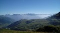
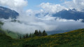
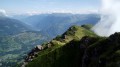
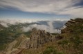
Beautiful and nearby views of the Pointes du Niélard, the Pointe du Mottet and the Pic du Cheval Noir. Panoramic views of the Savoie mountain ranges.

The Col du Mottet offers a more expansive panorama, whilst the Col de Riondet is less busy and is set in a wilder landscape.

Reviews and comments

5 / 5
Based on 1 review

Reliability of the description
5 / 5
Ease of following the route
5 / 5
Route interest
5 / 5
saiph
saiph
• Edited:

Overall rating : 5 / 5

Date of your route : Jun 27, 2023
Reliability of the description : ★★★★★ Very good
Ease of following the route : ★★★★★ Very good
Route interest : ★★★★★ Very good
Very busy route : No

A lovely walk with no real difficulties apart from the climb to the Col du Mottet. We didn’t go via the Col du Riondet as the path was still covered in snow. The walk took 5 hours. There were a few patches of snow on the path. And we spotted vultures and four marmots within camera range!!

Machine-translated

Other walks in the area

For more walks, use our search engine .

The GPS track and description are the property of this route's author. Please do not copy them without permission.