Crève-Tête and the pastoral surroundings of Valmorel

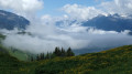
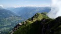
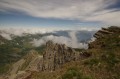
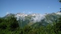
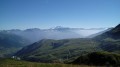
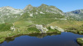
A route offering panoramic views, allowing you to explore this high-altitude ridge known as the ‘Vultures’ Ridge’ (views of Mont Blanc, the Ecrins, the Vanoise, etc.).

Details

17765317
Creation:
Last update:
Last review:
  • Walking
    Activity: Walking
  • ↔
    Distance: 8.66 mi
  • ◔
    Average duration: 6h 45 
  • ▲
    Difficulty: Difficult

  • ⚐
    Back to start: Yes
  • ↗
    Ascent: + 3,176 ft
  • ↘
    Descent: - 3,192 ft

  • ▲
    Highest point: 7,657 ft
  • ▼
    Lowest point: 4,505 ft

Description of the walk

Start in the resort of Valmorel, at the lower station of the Pierrafort cable car.

(S/E) Head south, following the ski lift track past the holiday apartments to reach the track suitable for vehicles. Continue straight ahead, turning onto a path through the woodland.

(1) Carry on due south along an alpine track. Before crossing the Morel, keep to the right and follow the stream on your left until you reach the track at a sharp bend.

(2) Then leave the track and take a path on the left that leads into the forest. Cross the Ruisseau de Plancham and reach a footbridge.

(3) Cross the footbridge over the Morel to reach the Prariond ski lift (the second path shown on the map is no longer visible on the ground). Take care: mountain bikers may cross paths with walkers in the woodland section. Pass the chalet and rejoin the alpine track.

(4) Follow the track to the right and pass the base of the Prariond ski lift. After about 150 m, leave the track and take a path on the left. The path winds its way uphill through a landscape that is half forest, half mountain pasture. Keep to the left of the ski lift.

(5) After climbing a flight of steps, directly below the ski lift line, turn right and follow a path along the hillside (south-south-west) to reach an altitude of 1,760 m in the heart of a beautiful mountain pasture. The signpost at this point indicates “Plan Salin”.

(6) Turn sharply left and follow a wide alpine track to the top station of the Pierrafort gondola lift.

(7) After passing the top station of the cable car, continue straight on along the track to reach the Col du Gollet.

(8) Leave the track and follow a path on the left towards the top station of a ski lift. Shortly after this, take a path on the right. Cross a rocky area to begin the final ascent to Crève-Tête.

(9) Head north-north-east and descend along the Crève-Tête ridge. The path soon passes through a narrow gap, which is a bit tricky to navigate. The path then alternates between a moderate slope and a steep descent.

(10) At a place called Longecha, carry on straight ahead (north-north-east) along the ridge path. Then head into the forest, veering to the left. Continue downwards, keeping straight on along the descending path. Join a track suitable for vehicles and follow it downwards to reach Pierre Larron’s chalet. This track bends just above the refuge. Once past the refuge, the track splits into two branches: follow the left-hand branch and continue the descent.

(11) Leave the track by taking a path on the right. Ignore a path coming from the right and head down (west-south-west) to the Chalet des Bachals.

(12) Cross a track and continue along the path towards Valmorel, still descending, through woodland and clearings.

(13) Back on a track, directly below a ski lift and above the resort, turn right. After about 75 m, turn left to enter the resort. At the roundabout which you’ll soon come to, keep left. At the foot of the lower cable car station, veer left to reach the car park (S/E).

Waypoints

  1. S/E : mi 0 - alt. 4,547 ft - Lower station of the Pierrafort cable car - Valmorel
  2. 1 : mi 0.12 - alt. 4,606 ft - Track – Le Mottet hamlet
  3. 2 : mi 0.42 - alt. 4,829 ft - Hairpin bend – Entrance to the forest
  4. 3 : mi 0.48 - alt. 4,879 ft - Footbridge at the - Morel (rivière)
  5. 4 : mi 0.71 - alt. 5,203 ft - Prariond ski lift
  6. 5 : mi 1.13 - alt. 5,577 ft - Stair steps
  7. 6 : mi 1.63 - alt. 5,791 ft - Salin map
  8. 7 : mi 2.15 - alt. 6,024 ft - Upper station of the Pierrafort cable car
  9. 8 : mi 3.06 - alt. 6,496 ft - Leave the track
  10. 9 : mi 3.98 - alt. 7,648 ft - Summit of - Crève-Tête
  11. 10 : mi 5.08 - alt. 6,804 ft - Longecha
  12. 11 : mi 6.07 - alt. 5,732 ft - Start of the trail
  13. 12 : mi 6.67 - alt. 5,351 ft - Chalet des Bachals
  14. 13 : mi 8.22 - alt. 4,606 ft - Vehicle track – Ski lift line
  15. S/E : mi 8.66 - alt. 4,544 ft - Lower station of the Pierrafort cable car

Notes

Alternative starting point:
You can take the Pierrafort cable car to start the walk at its top station (7). This reduces the elevation gain by around 450 m and shortens the walk by an hour and a half.

There is a difficult section in the final part of the ascent to Crève-Tête, and occasional exposed sections on the descent from the summit of Crève-Tête.

Take care, as mountain bikers may cross paths with walkers in the woodland section.

Worth a visit

(9) Panoramic view from the summit of Crève-Tête (2,342 m), where a cross overlooks a landscape offering a 360° view: Mont Blanc, the Vanoise, Lauzière, the Belleville Valley…

Reviews and comments

4.8 / 5
Based on 2 reviews

Reliability of the description
4.5 / 5
Ease of following the route
5 / 5
Route interest
5 / 5
User 9408346
• Edited:

Overall rating : 5 / 5

Date of your route : Aug 18, 2026
Reliability of the description : ★★★★★ Very good
Ease of following the route : ★★★★★ Very good
Route interest : ★★★★★ Very good
Very busy route : No

A lovely walk with no real technical difficulties – just set off early in the morning so you can climb whilst it’s still in the shade and avoid the crowds on the path. A superb ridge walk with a stunning view.

Machine-translated

LUC.BOURGUIGNON26@GMAIL.COM

Overall rating : 4.7 / 5

Date of your route : Aug 04, 2026
Reliability of the description : ★★★★☆ Good
Ease of following the route : ★★★★★ Very good
Route interest : ★★★★★ Very good
Very busy route : No

A magnificent hike with 1,000 metres of elevation gain.
No trouble at all with two pre-teens!!!
Spotted about twenty griffon vultures on the way down 🤩
Make sure to do the walk in the direction indicated: south then north.

Machine-translated

Other walks in the area

For more walks, use our search engine .

The GPS track and description are the property of this route's author. Please do not copy them without permission.