The schoolchildren’s path in Montvalezan

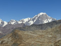
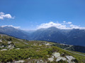
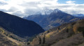
In the past, there were four schools in the commune and schoolchildren from each village would walk along these paths to get there. Today, this circular walk takes you on a journey through the most beautiful villages, with their chapels, ponds and houses built entirely of timber and exposed stone.

Details

n°3693494
Creation:
Last update:
Last review:
  • Walking
    Activity: Walking
  • ↔
    Distance: 3.64 mi
  • ◔
    Average duration: 2h 55 
  • ▲
    Difficulty: Moderate

  • ⚐
    Back to start: Yes
  • ↗
    Ascent: + 1,467 ft
  • ↘
    Descent: - 1,467 ft

  • ▲
    Highest point: 5,138 ft
  • ▼
    Lowest point: 3,770 ft

Description of the walk

(S/E) From the former school in Le Châtelard, head towards Le Villaret by taking the path leading to the climbing site, situated below the Chapelle Saint-Michel. Cross the D84 and make your way to the Chapelle Notre-Dame de Liesse

(1) Continue north-west, then turn south-west and cut across the bends of the D84 to reach Montvalezan.

(2) In Montvalezan, be sure to visit the Church of Saint-Jean-Baptiste and its vicarage gardens, a Baroque gem. Continue along the D84, then turn onto the first path on the right to reach Le Solliet.

(3) In Le Solliet, walk between the houses and the chapel. Climb up to the road, turn right and, 70 metres further on, take the path on the left, heading uphill through the woodland, to reach Les Laix

(4) Walk through the village of Les Laix, then turn right as you leave, heading towards Le Pré du Four. Walk through the village of Le Pré du Four, cross a road and continue towards Hauteville.

(5) In Hauteville, turn right after the chapel to rejoin the path, which winds downwards along a balcony-like route towards La Combaz. At La Combaz, follow the street until you come out onto the road.

(6) Cross the junction and take the path opposite, which will take you back to Le Châtelard. You will then arrive in the village of Le Châtelard; take the time to climb up to the Chapelle Saint Michel to admire the view over the Haute Tarentaise valley, then head back down to the starting point (S/E).

Waypoints

  1. S/E : mi 0 - alt. 4,879 ft - Ancienne école (Le Châtelard)
  2. 1 : mi 0.49 - alt. 4,354 ft - Chapelle Notre-Dame de Liesse (Montvalezan)
  3. 2 : mi 1.23 - alt. 3,789 ft - Église Saint-Jean-Baptiste (Montvalezan)
  4. 3 : mi 1.86 - alt. 4,124 ft - The village of Solliet
  5. 4 : mi 2.3 - alt. 4,701 ft - The village of Les Laix
  6. 5 : mi 2.79 - alt. 5,079 ft - The village of Hauteville
  7. 6 : mi 3.12 - alt. 5,003 ft - Crossing the road
  8. S/E : mi 3.64 - alt. 4,879 ft - Ancienne école (Le Châtelard)

Worth a visit

Reviews and comments

4.7 / 5
Based on 1 review

Reliability of the description
5 / 5
Ease of following the route
4 / 5
Route interest
5 / 5
BG30
BG30

Overall rating : 4.7 / 5

Date of your route : Aug 04, 2023
Reliability of the description : ★★★★★ Very good
Ease of following the route : ★★★★☆ Good
Route interest : ★★★★★ Very good
Very busy route : No

An interesting route for exploring the hamlets and chapels (we must commend the work of the chapel preservation society, which has helped to preserve this heritage). You can admire some magnificent chalets that have been restored or built in keeping with local building traditions.

Machine-translated

Other walks in the area

For more walks, use our search engine .

The GPS track and description are the property of this route's author. Please do not copy them without permission.