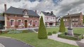
The Chemin de la Forge Subtile in Fresne-Cauverville

This easy route is typical of the Pays d’Auge, with its sunken paths and damp grasslands; it is mostly shaded and offers an intimate atmosphere between the forest and traditional hedgerow countryside: ideal for recharging your batteries.

Details

101656415
Creation:
Last update:
Last review:
  • Walking
    Activity: Walking
  • ↔
    Distance: 3.25 mi
  • ◔
    Average duration: 1h 40 
  • ▲
    Difficulty: Easy

  • ⚐
    Back to start: Yes
  • ↗
    Ascent: + 151 ft
  • ↘
    Descent: - 151 ft

  • ▲
    Highest point: 545 ft
  • ▼
    Lowest point: 394 ft

Description of the walk

Park in the car park opposite the bar-grocery shop in Fresne-Cauverville.

Blue-marked route.

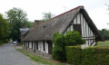
(S/E) As you leave the car park, take the road on the right to pass through a hamlet of half-timbered houses, and continue until you reach a junction with Rue de l’Église.

(1) Turn right, continue for 50 metres, then veer left and head down towards the valley on the left along Rue de la Source. You’ll reach the Ruisseau de l’Abbesse.

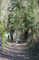
(2) Turn right at the water pumping station, taking the path that runs alongside the valley, and continue along this valley and the Ruisseau de l’Abbesse through a sunken path (which can be wet in winter), until you reach a small tarmac road.

(3) Turn right onto a short tarmac road which becomes a track, and head uphill through the woods, passing an old quarry.

(4) Turn right at the top, at the crossroads. Walk along the open fields, dominated by a water tower, and carry on to the end of the path.

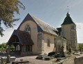
(5) Follow the small road to the left, which takes you straight back to the church in the village of Fresne-Cauverville.

(6) Turn right at the Stop sign, near the town hall, and follow Rue du Village to return to the car park (S/E).

Waypoints

  1. S/E : mi 0 - alt. 545 ft - Car park by the bar and grocery shop
  2. 1 : mi 0.32 - alt. 512 ft - Rue de l’Église
  3. 2 : mi 0.48 - alt. 459 ft - Water pumping station
  4. 3 : mi 1.51 - alt. 394 ft - Junction on the road - Abbesse (ruisseau) - Affluent de la Calonne
  5. 4 : mi 1.83 - alt. 515 ft - Junction of paths on the right
  6. 5 : mi 2.86 - alt. 518 ft - Rue de l’Église
  7. 6 : mi 3.17 - alt. 545 ft - Rue du Village
  8. S/E : mi 3.25 - alt. 545 ft - Car park by the bar and grocery shop

Notes

Please note: the path can be wet in winter.

Blue-marked route.

Worth a visit

The Romanesque Church of Notre-Dame, which houses statues of Saints Cosmas and Damian.

Old retting pits which were once used for retting flax.

Other walks in the area

For more walks, use our search engine .

The GPS track and description are the property of this route's author. Please do not copy them without permission.