Country:
 City:
City:


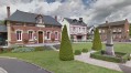
Parking is available in the car park at Fumichon Town Hall.
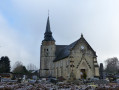
(S/E) Walk past the church and turn left towards Piencourt. At the next Fork in the road, turn right and continue for about 1 km.
(1) Take a dirt track on the right through the fields. Pass through the hamlet of Fiquetterie, ignoring the various turn-offs on the left, and further on, join the D143a.
(2) Cross with care, then continue straight ahead along the track which curves left further on and leads to the hamlet of La Bruyère.
(3) Turn right onto Route de la Vatine and carry on straight ahead until you reach the edge of a wood. Turn right at the edge of the wood, walk past a large building on your right, then turn left to head down to the Paquine; cross it to reach the D262. Cross the road with care and carry on straight ahead.
(4) At the top of the hill, at Bosc Cally, turn right onto a path overlooking the Paquine valley and following it along the ridge. Head towards the silos at La Lande and join the road leading there, not far from the Ouilly-du-Houley cider house.
(5) Turn right, then left, and follow the road for about 600 metres, skirting the orchards.
(6) Turn right onto a track. Pass the hamlet of Le Pommerai and continue down to the bottom of the valley, joining the D262 (Route de l’Hôtellerie).
(7) Turn right onto the road, then, after 100 m, turn left and cross the Paquine again. The path then makes a wide circular loop, bordered by a marsh, alongside a rocky outcrop. After crossing a ravine, go through the woods and then head back up to the hamlet of Pouplin. Pass the first road on the right and join a tarmac road (Route de Pouplin).
(8) Follow it to the right for about 1 km, then turn left towards La Loucharderie and continue for about a hundred metres.
(9) Turn right onto Impasse de la Loucharderie via a grassy track which joins the D143a.
(10) Cross with care and turn immediately right onto the small road called Chemin de la Barberie, which becomes a track running alongside a field. At the next road, turn left then right (Chemin de la Lande) before the power line. Join the Route de la Calonière, opposite a tennis court, and turn right again at this point to rejoin the D143a.
(11) Follow it to the left to reach the car park at Fumichon Town Hall (S/E).

 Visorando Member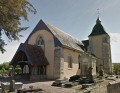

 Easy
Easy  Difficult