Country:

 City:



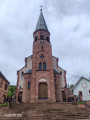
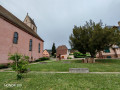
Park in the car park on Rue de la Source, next to the Orschwihr playground.
Green Ring signposting
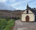
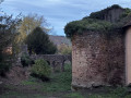
(S/E) Walk along Rue de la Source towards Rue de Soultzmatt, with the park on your left. Just before this road, turn left into the park, walk past the old wine press, then cross the park straight ahead to Rue du Paradis. Continue straight on along Rue du Paradis, then take the small road opposite which runs to the left of Saint-Wolfgang Chapel.
(1) Walk past the Saint-Wolfgang Chapel and immediately turn left onto Rue du Vignoble, which climbs amongst the vineyards. At the fork in the road, keep left: the street continues as a grassy path alongside a low stone wall. At the end of this path, turn right onto the Dorfmattenweg, which enters the forest (towards ‘Les carrières d’Orschwihr’). It emerges onto Rue du Val du Pâtre after crossing the Quirenbach: cross the road carefully, then take the path opposite (slightly to the right) which climbs towards Stettenberg Castle. Punctuated by a few steps, it leads to the ruins.
(2) Walk past the foot of the Stettenberg Castle ruins and continue along the path until you reach a wide track, the Chemin du Château.
Green Ring signposting
Follow the Chemin du Château to the left – which is also part of the Way of St James – until you reach the junction with the Chemin du Schimberg, marked by two posts.
Take a sharp right-hand bend onto the Chemin du Schimberg, heading towards the Orschwihr quarries.
(3) At the ‘Erlenweg’ signpost, turn left onto the wide track. At the junction of tracks, continue straight on, then, at the T-junction about 400 m further on, turn right. Continue until you reach a sign pointing to the Orschwihr Quarries.
(4) At the sign for the Orschwihr Quarries (375 m, via an unmarked path), carry on straight ahead; then, a few dozen metres further on, at the junction, turn right. Just before a wide track, the Hautelsteinweg, leave the Green Ring, which veers sharply to the left, and carry on straight ahead for about ten metres until you reach the track.
Red Ring signposting
(5) Turn left onto the Hautelsteinweg track, then leave it, about fifteen metres further on, via the small path that descends to the left. At the Fork in the road, keep to the right. Further down, cross a track and continue straight on, towards Bergholtz-Zell and the Oelberg, until you reach a junction of paths.
(6) At the junction, turn right and follow the path uphill for a few metres, then take a hairpin bend to the left onto the small path with two parallel tracks, and continue along the one on the right. Go through a gate, then carry on straight ahead along the path, which then becomes tarmac.
(7) At the three-way junction, continue left onto the path that leads downhill. Join a road and follow it to the right for a few metres, then immediately turn left onto the path that descends between the vineyards. At the next junction, turn right and stay on this path – which becomes the Hohlgass – until you reach a rest area.
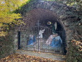
(8) Below the rest area, take the sharp left-hand bend onto the small, inconspicuous path, which winds down in small zigzags, with a few steps. At the next junction, ignore the path that continues straight on, as it has become impassable: take the sharp right-hand bend onto the small, clear and signposted path. It winds down in zigzags to the Fontaine de la Samaritaine, behind the large Calvary chapel.
(9) At the Fontaine de la Samaritaine, climb the small, signposted staircase on the right, with the large chapel on your left. The Stations of the Cross are followed in reverse here: descend, from station to station, along the small intersecting paths, until you reach a small stone porch covered in ivy. Pass under the porch and continue to the top of the steps leading to the Calvary, which descend towards Rue des Suisses. There, first take a detour to the left via the small flight of steps leading up to the Chapel of the Cenacle, then retrace your steps and go down the steps to the street.
Follow Rue des Suisses to the left, past the town hall and then the school, until you reach a fountain. Go to the right of the fountain, head straight up the small street and cross Rue de l’Église.
Carry on straight ahead to the foot of Saint-Benoît Church.
End of signposted route
(10) At the foot of Saint-Benoît Church, turn right onto Rue du Bois.
Green Cross signposting
At the end of the street, turn left onto Rue de Bergholtz-Zell, which crosses the Banngraben and then enters Orschwihr. At the junction with traffic lights, cross Rue de Bergholtz-Zell via the pedestrian crossing, then cross the Grand’Rue.
Red Diamond Signposting
Head down Grand’Rue to the right and take thefirst left onto Rue du Centre.
End of signposting
(11) Walk past Orschwihr Castle on your right and continue to the end of Rue du Centre. Turn left onto Rue de l’Église, then turn right onto Rue de Soultzmatt. Follow this road and cross the Quirenbach again.
Green Ring signposting
At the playground, cross Rue de Soultzmatt at the pedestrian crossing and follow Rue de la Source opposite, alongside the park, to return to the car park (S/E).
 Tourist office
 Easy

 Visorando Member