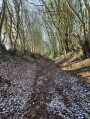
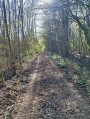
Frazé Castle

Wash down your meal with a glass of Foussarde wine and, surrounded by wooded hills, the village of Frazé boasts a remarkably well-preserved centre and a countryside rich in architectural heritage.

Details

n°22869339
Creation:
Last update:
Last review:
  • Walking
    Activity: Walking
  • ↔
    Distance: 7.59 mi
  • ◔
    Average duration: 3h 35 
  • ▲
    Difficulty: Moderate

  • ⚐
    Back to start: Yes
  • ↗
    Ascent: + 135 ft
  • ↘
    Descent: - 131 ft

  • ▲
    Highest point: 682 ft
  • ▼
    Lowest point: 577 ft
  • ⚐ Country: France
  • ⚐
    Area: Perche
  • ⚐ City: Frazé (28160)
  • ⚑
    Start/End: N 48.262373° / E 1.09751°
  • ❏
    IGN map(s): Ref. 1917SB, 1918SB, 2017SB, 2018SB
  • Hour-by-hour weather

Description of the walk

You can park in the town hall car park.

(S/E) Opposite the château (municipal sign, church below), turn right.

At the crossroads, take the D360-1 towards La Leu and pass the cemetery.

(1) At the Huvetière junction, follow the road to the right towards Le Dézert. At the Fork in the road, turn left and continue along the dirt track between the fields.

(2) At the junction, take the path on the left for 600 m.

(3) Take the path on the right. It leads straight on to the edge of the forest.

(4) Then follow the path to the right. It skirts the woodland to the west and then to the south, staying along the edge.

(5) Take the D124-3 on the right, then head down the path on the left to cross the Foussarde, then head back up the opposite side and pass through the hamlet of Les Phayes.
Turn right twice and you’ll come out onto the D124.

(6) Turn left onto the D124. A little further on, take the track on the right and you’ll come out onto a road.

(7) Follow the road to the left. After about 600 m, head down the dead-end track on the right.

(8) After the Haras des Frettes, take the track on the left to enter the woods. Take the D15 on the right (take care) and cross the bridge.

(9) At the bend, leave the road, ignore the track on the left and continue along the small path opposite. Cross the Route du Mesnil and carry on along the small road opposite towards the woods.

(10) Turn right onto Allée du Petit-Essard. The path runs alongside woodland and farmland and passes close to the Manoir du Chatellier. Take the road on the right, then the D15 on the left, and head towards the château (S/E).

Waypoints

  1. S/E : mi 0 - alt. 623 ft - Frazé Town Hall - Château de Frazé
  2. 1 : mi 0.72 - alt. 679 ft - La Huvetière
  3. 2 : mi 1.34 - alt. 656 ft - T-junction
  4. 3 : mi 1.73 - alt. 676 ft - T-junction
  5. 4 : mi 2.51 - alt. 640 ft - Junction
  6. 5 : mi 3.96 - alt. 577 ft - Route D124-3. Towards the - Foussarde (rivière) - Affluent du Loir
  7. 6 : mi 4.71 - alt. 643 ft - D124
  8. 7 : mi 5.26 - alt. 614 ft - Small road
  9. 8 : mi 5.84 - alt. 653 ft - Crossroads
  10. 9 : mi 6.37 - alt. 650 ft - Junction
  11. 10 : mi 6.78 - alt. 673 ft - Le Petit-Essard
  12. S/E : mi 7.59 - alt. 623 ft - Frazé Town Hall - Église Notre-Dame (Frazé)

Worth a visit

Eating out
L'Étape des Saveurs

Reviews and comments

5 / 5
Based on 1 review

Reliability of the description
5 / 5
Ease of following the route
5 / 5
Route interest
5 / 5
User 21737197

Overall rating : 5 / 5

Date of your route : May 19, 2026
Reliability of the description : ★★★★★ Very good
Ease of following the route : ★★★★★ Very good
Route interest : ★★★★★ Very good
Very busy route : Yes

Yes, largely.

Machine-translated

Other walks in the area

For more walks, use our search engine .

The GPS track and description are the property of this route's author. Please do not copy them without permission.