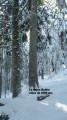
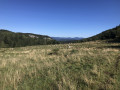
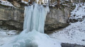
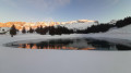
The Châlet de Chalimont

Explore the Herbouilly Forest with access to the Pas du Fouillet.

Details

465231
Creation:
Last update:
Last review:
  • Snowshoeing
    Activity: Snowshoeing
  • ↔
    Distance: 6.78 mi
  • ◔
    Duration according to the author: 6 hrs 
  • ▲
    Difficulty: Moderate

  • ⚐
    Back to start: Yes
  • ↗
    Ascent: + 1,129 ft
  • ↘
    Descent: - 1,132 ft

  • ▲
    Highest point: 4,121 ft
  • ▼
    Lowest point: 3,615 ft

Description of the walk

Park at the side of the road and in a staggered formation at the end of the road leading to the Bois Barbu Nordic centre.

(S/E) Walk past the Auberge de la Glisse in Bois Barbu. Take snowshoe trail no. 2 to the Carrefour des Sables.

(1) Turn right onto trail no. 5 towards Valchevrière. Begin a steep but short climb to reach the road which, in winter, serves as the cross-country ski trail.

(2) Turn right, begin a short descent before climbing again and rejoining the road at Bénitier du Merlon. Continue along the track (shared with skiers, so keep well to the right of the road). Reach the Valchevrière viewpoint.

(3) Carry on for a few metres along the road, then leave it to take the forest track (PF) on the right. Then leave the heritage route on your right and continue along the PF. You’ll reach the junction leading to the ruined village of Valchevrière.

(4) Turn right to reach the ruined village.

(5) Return to the crossroads.

(4) Continue westwards along the track. Turn left off the track to begin a steep climb and reach the Goutarou lodge.

(6) Carry on along the road and, after a few steps, you’ll reach the Châlet de Chalimont.

(7) Return via the same route to reach the Auberge de la Glisse (S/E).

Waypoints

  1. S/E : mi 0 - alt. 3,724 ft - Auberge de la Glisse
  2. 1 : mi 0.38 - alt. 3,642 ft - Carrefour des Sables
  3. 2 : mi 1.13 - alt. 3,825 ft - Route
  4. 3 : mi 1.96 - alt. 3,822 ft - Valchevrière viewpoint
  5. 4 : mi 2.38 - alt. 3,717 ft - Junction
  6. 5 : mi 2.52 - alt. 3,658 ft - Valchevrière
  7. 6 : mi 3.34 - alt. 4,081 ft - Lodge du Goutarou
  8. 7 : mi 3.52 - alt. 4,121 ft - Châlet de Chalimont
  9. S/E : mi 6.78 - alt. 3,724 ft - Auberge de la Glisse

Notes

Important information: On the Vercors plateau, a specific signposting system has been introduced for snowshoe trails. These signs consist of a mauve-coloured plaque featuring a white snowshoe. Each sign features a green, blue, red or black band at the bottom indicating the difficulty of the route. This indicates the difficulty level, as is the case with ski runs. Furthermore, this band shows the name of the route and its number. Finally, all these routes are marked on the resort maps, which are available at the various ticket offices.
Refreshments are available at the Gîte du Goutarou.
A function room is available at the Châlet de Chalimont.

(7) It is possible to continue on to the Col d’Herbouilly by staying parallel to the cross-country ski trail. Alternatively, you can take the forest road to the right to reach the Brèche de Chalimont.

Worth a visit

Reviews and comments

4.2 / 5
Based on 3 reviews

Reliability of the description
4 / 5
Ease of following the route
4.3 / 5
Route interest
4.3 / 5
User 13076217

Hello
I did the Rencurel to Romeyer hike with the club – a lovely hike
but there was a bit of confusion at the viewpoint as some signs aren’t always visible
There’s no space in front of the town hall; it’s better to park near Rencurel church. The place names are no longer signposted (Château, Pourrois, La Font, etc.). The yellow and green markings are more reliable, as is the GPS
Note the lovely Emile Pirelli hut at the viewpoint in case of rain

Machine-translated

Deuxpattes
Deuxpattes

Overall rating : 3.7 / 5

Date of your route : Feb 05, 2023
Reliability of the description : ★★★☆☆ Average
Ease of following the route : ★★★★☆ Good
Route interest : ★★★★☆ Good
Very busy route : Yes

We rated the description as ‘average’ because, for example, at one point the description mentions snowshoe route 5, even though it doesn’t exist...
For us, however, this wasn’t a problem as we used the GPS to find our way.
The snow was quite icy that day on the climbs (which were short...) and that led to some funny moments!!!
Thanks for this post

Machine-translated

titine morel
titine morel

Go to the Malaterre chalet instead
as there’s no snowshoe sign at the Carrefour des Sables

Machine-translated

Claude R3.
Claude R3.

If you continue on to the Chalimont Pass via the Chalimont forest track (about half an hour’s easy walk), you’ll be rewarded with some exceptional scenery.

Machine-translated

Claude R3.
Claude R3.

Overall rating : 4 / 5

Date of your route : Oct 05, 2020
Reliability of the description : ★★★★☆ Good
Ease of following the route : ★★★★☆ Good
Route interest : ★★★★☆ Good
Very busy route : Yes

The route is lovely, but it’s a real shame to stop at the Chalimont chalet, when carrying on for about half an hour along the Chalimont forest track (which starts just to the left of the Chalimont chalet and is clearly signposted) allows you to reach the Chalimont Pass (1,402 metres) with no difficulty at all. Exceptional scenery with views of the Bourne Gorges, Rencurel and the Col de Romeyere

Machine-translated

venturini
venturini

Overall rating : 5 / 5

Date of your route : Nov 04, 2019
Reliability of the description : ★★★★★ Very good
Ease of following the route : ★★★★★ Very good
Route interest : ★★★★★ Very good

A lovely hike full of emotion in Valchevrière

Machine-translated

Other walks in the area

For more walks, use our search engine .

The GPS track and description are the property of this route's author. Please do not copy them without permission.