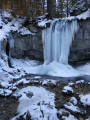
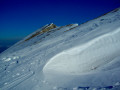
Corrençon circular loop

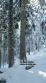
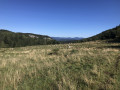
From Bois Barbu to Corrençon, then back via the Baraque de Malaterre. The route runs mainly through woodland, except for the final stretch and the section through Corrençon.

Details

471379
Creation:
Last update:
Last review:
  • Snowshoeing
    Activity: Snowshoeing
  • ↔
    Distance: 8.22 mi
  • ◔
    Duration according to the author: 6 hrs 
  • ▲
    Difficulty: Moderate

  • ⚐
    Back to start: Yes
  • ↗
    Ascent: + 1,175 ft
  • ↘
    Descent: - 1,184 ft

  • ▲
    Highest point: 4,193 ft
  • ▼
    Lowest point: 3,589 ft

Description of the walk

Park in the car park by the roadside at the end of the road leading to the Bois Barbu Nordic stadium.

(S/E) Walk past the Auberge de la Glisse and take snowshoe trail no. 2. You’ll soon reach the Sables crossroads; turn left onto the snowshoe trail to reach the Galmiche crossroads.

(1) Cross the ski run and turn left onto snowshoe trail no. 2. Walk through the forest until you reach the Col de Liorin crossroads.

(2) Turn left onto trail no. 11 and continue until you reach the picnic area. Cut across the road and head right through the fields to rejoin the road just before the hamlet of the peatland.

(3) Then take the road on the right to reach the village of Corrençon.

(4) At the junction with the D215, turn right, cross the village and head for the Corrençon sports centre.

(5) Immediately after the centre, take snowshoe trail no. 11, heading generally north then north-west, until you reach the Glacière crossroads.

(6) Carry on straight ahead and rejoin snowshoe trail no. 2 to reach the Malaterre hut.

(7) Stay on trail no. 2, signposted ‘Bois Barbu’, alternating between descents and short climbs, until you reach the Galmiche crossroads.

(1) Follow the same route as on the way out to return to the Auberge de la Glisse (S/E).

Waypoints

  1. S/E : mi 0 - alt. 3,727 ft - Auberge de la Glisse
  2. 1 : mi 0.73 - alt. 3,793 ft - Galmiche
  3. 2 : mi 1.37 - alt. 4,065 ft - Liorin junction
  4. 3 : mi 2.17 - alt. 3,822 ft - Peatland crossroads
  5. 4 : mi 3.15 - alt. 3,606 ft - Junction with the D215
  6. 5 : mi 4.04 - alt. 3,766 ft - Corrençon multi-sports hall
  7. 6 : mi 5.36 - alt. 4,042 ft - Carrefour Glacière
  8. 7 : mi 6.03 - alt. 4,183 ft - Baraque de Malaterre
  9. S/E : mi 8.22 - alt. 3,717 ft - Auberge de la Glisse

Notes

Important information: On the Vercors plateau, a dedicated signposting system has been introduced for snowshoe trails. These signs consist of a mauve-coloured plaque featuring a white snowshoe. Each sign has a green, blue, red or black band at the bottom indicating the route’s difficulty level. This indicates the route’s difficulty, in the same way as for ski runs. Furthermore, this band shows the route’s name and number. Finally, all these routes are marked on the resort maps, which are available at the various ticket offices.

This route cannot be walked outside the snow season as it crosses cultivated fields.

An interesting stop at the Baraque de Malaterre.
Salle Hors Sac in Corrençon.

Worth a visit

All the villages and towns on the Vercors plateau are well worth a visit: Autrans, Corrençon, Lans-en-Vercors, Méaudre, Villard-de-Lans and Saint-Nizier-du-Moucherotte.

Reviews and comments

4 / 5
Based on 3 reviews

Reliability of the description
4 / 5
Ease of following the route
4 / 5
Route interest
4 / 5
bernardino
bernardino ★

Hello, and thank you for your comment on this very enjoyable route.
Thank you for letting us know that it is currently possible to do this route without snowshoes.
Have a lovely rest of the day.

Machine-translated

gabomination
gabomination

Overall rating : 4 / 5

Date of your route : Feb 05, 2022
Reliability of the description : ★★★★☆ Good
Ease of following the route : ★★★★☆ Good
Route interest : ★★★★☆ Good
Very busy route : Yes

We did this walk in walking boots without snowshoes. Most of the time, that was enough, but in some places, snowshoes would have been useful. We felt the estimated walking time was slightly overestimated (the walk was circular and we completed it in 4 hours 30 minutes).
A lovely walk, mainly through the forest, not very difficult.
The directions are fairly precise, especially with the GPS track.
Thanks to whoever posted this!

Machine-translated

Richard1329
Richard1329

Overall rating : 4 / 5

Date of your route : Mar 13, 2018
Reliability of the description : ★★★★☆ Good
Ease of following the route : ★★★★☆ Good
Route interest : ★★★★☆ Good

A walk done in snow boots without snowshoes (quite a lot of snow, but well-trodden).
A lovely walk through the woods, with plenty of short ascents and descents.
The stop at the Malaterre refuge halfway through was very pleasant: make sure you have cash or a chequebook if you want to buy anything!

Machine-translated

randomarche42
randomarche42

Overall rating : 4 / 5

Date of your route : May 01, 2017
Reliability of the description : Not used / Not applicable
Ease of following the route : Not used / Not applicable
Route interest : ★★★★☆ Good

All the Corrençon walks that have been downloaded are planned for the Ascension weekend at the end of May

Machine-translated

Other walks in the area

For more walks, use our search engine .

The GPS track and description are the property of this route's author. Please do not copy them without permission.