Country:
 City:


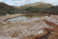
The starting point for this walk is on the small road just past junction 210 on the motorway. The car park faces the Salinetes Fountain, which you can see below, at its foot.
(S/E) Retrace your steps to rejoin the small road you’ve just driven along. Follow it to the left until you reach the junction with the motorway exit slip road. Carry on straight ahead at the signposts, cross the small bridge and watch the stream flow: you are now above the Barranc de les Salinetes. Leave the road and take the path on the right just after the bridge (sign saying ‘no littering’).
(1) At the first junction, turn left, then right at the second. Head towards the stream and turn left without actually joining it.
(2) At this junction, you can choose either the left-hand or right-hand path as they both lead to the same point. Head left (the route chosen), come out onto a wide track and follow it, turning left. Keep right at the three-way junction and head towards a small concrete structure surrounded by wire fencing, which is used for water treatment.
(3) Carry on straight ahead, to the left of this small structure, then pass between the two stone retaining walls supporting a water supply pipe. You will then come across a very narrow, well-marked path, which is also quite steep.
(4) A few metres before reaching the first summit, look out for a path on the left, on the other side of the hill, which descends and leads to a very wide track; follow this track as it heads to the right.
(5) Leave the wide track and turn sharply left: make sure you spot the cairn and the small path on the left. You’ll reach a pass.
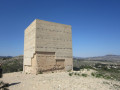
(6) Head off to the right to begin the ascent of Montagut or El Montaüt. Please note: this climb is only suitable for experienced mountaineers, as there is no marked path; you will need to make your own way either over scree or across large boulders. Ideally, follow the route between the two lines shown on the map. The 90° changes indicate sharp changes in direction which must be followed to stay in relatively safe areas where climbing is easier. Reach the summit after a short climb from an unnamed pass which you must cross.
(7) Descend back to the pass via the same route as on the ascent.
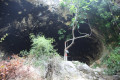
(6) Head straight along the path, following the ridges: admire the many caves as you go.
(8) At the junction, head straight on towards the ponds, walk alongside them and reach the junction with a small tarmac road opposite a group of houses.
(9) Turn left, then left again at the junction, and you’ll come within sight of a very short section of the path you took on the way there. Turn right.
(1) Carry on straight ahead for a few metres, in the opposite direction to the outward journey, until you reach the road you took on the way out. Cross it by turning right then left, and continue along the path opposite until you reach the three-way junction.
(10) Head left towards the stream and follow it. When you reach the solar farm, take the sharp left-hand bend to reach the Fontaine de Salinetes, where you can have a refreshing drink if you like.
(11) Head for the steps and climb the hill to return to the car park (S/E).
 Visorando Member
 Moderate

 Easy