Cabeço d’Or Circular Route

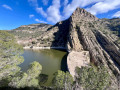
A beautiful walk in a wild setting, surrounded by vertical cliffs, featuring the ascent to one of the legendary peaks of the Alicante region: the Cabeço d’Or.

Details

n°17892679
Creation:
Last update:
Last review:
  • Walking
    Activity: Walking
  • ↔
    Distance: 6.14 mi
  • ◔
    Average duration: 5h 10 
  • ▲
    Difficulty: Moderate

  • ⚐
    Back to start: Yes
  • ↗
    Ascent: + 2,664 ft
  • ↘
    Descent: - 2,644 ft

  • ▲
    Highest point: 3,904 ft
  • ▼
    Lowest point: 1,483 ft

Photos

Description of the walk

By car, from Alicante city centre, take the A31 motorway (from Calle México) towards Madrid and take exit 236A towards Valencia shortly afterwards. Continue on the A70 motorway for about twenty kilometres. After the long tunnel, take exit 1 marked Mutxamel/Xixona and follow the CV800 towards Xixona, then the CV773 towards Busot. After that, simply follow the signs for the Canelobre Caves (signs marked ‘Coves de Canelobre’ or ‘Cuevas de Canelobre’). Before reaching the caves, just after the ‘km 2’ sign, you’ll see a large car park on the left as you round a bend: park there. In total, you’ll have driven about 35 km from the start.

(S/E) From the car park (the place is called Pla de la Gralla), head towards the information board and follow the path markedPR®-CV2 Cabeço d’Or. It is a very wide path. A little further on, you’ll pass a house on the left – the Casa de Gorges – and continue keeping to the right until you reach another house with a boat in front of it at Raco de Seva.

(1) Leave the track and turn right onto a narrow mountain path (there is a signpost). From this point, the path climbs much more steeply, winding its way up, but it is easy to follow and marked with white and yellow paint marks.

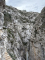
(2) At the signpost indicating the direction of the summit, turn left to complete the round trip. The path starts very close to the vertical rock faces. It presents two challenges: a short section where you have to climb up ladders, and then, as you head towards the pass, a short stretch over rocky ground where you’ll need to use your hands to steady yourself.

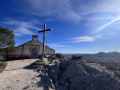
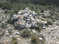
You’ll pass close to a ruin which is well worth a visit, as part of this house has been carved out of the rock. Continue on to the summit, marked by a large cylinder.

(3) Descend via the same route.

(2) Head straight on along the path leading downhill.
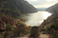
This path is very well marked and offers superb views of other mountains and the Alicante coastline. What’s more, it’s a much wilder and far less crowded area than the other part of the route.
After a series of hairpin bends, pass under a very tall electricity pylon and reach a junction.

(4) Turn right and you’ll come to a wire fence surrounding a house.

(5) Take the path on the left and you’ll soon reach a sign marked ‘Cuevas de Canelobre’.

(6) Follow the sign by turning right.

(7) Start a steep climb to the right, rising from 450 m to 580 m in a very short time. Pass in front of the Canelobre Caves, which you can visit (entrance fee applies), then head down the tarmac road to reach the car park very quickly (S/E).

Waypoints

  1. S/E : mi 0 - alt. 1,699 ft - Pla de la Gralla.
  2. 1 : mi 1.37 - alt. 2,192 ft - Raco de Seva, on the right
  3. 2 : mi 2.21 - alt. 3,140 ft - Junction leading to the summit
  4. 3 : mi 2.75 - alt. 3,904 ft - Cabeço d’Or
  5. 4 : mi 4.87 - alt. 1,670 ft - Junction: turn right.
  6. 5 : mi 5.11 - alt. 1,581 ft - Fence, on the left.
  7. 6 : mi 5.2 - alt. 1,512 ft - Signpost for the caves, on the right
  8. 7 : mi 5.44 - alt. 1,483 ft - Start of the climb to the cave.
  9. S/E : mi 6.14 - alt. 1,706 ft - Return to the car park.

Notes

(2) When descending from Cabeço d’Or, if you start to feel tired, it is advisable to head back down the same way, i.e. turn right.

The Comunitat Valenciana – which can be translated as the regional government – emphasises certain rules regarding respect for nature. In particular, it asks that you stick to the marked paths. In practice, therefore, you should avoid taking shortcuts.

This is also an area at high risk of wildfires, so, in particular, you must not smoke, and under no circumstances should you throw your cigarette out of your car window.

Worth a visit

Right from the start of the walk, you’ll find yourself near vertical cliffs, often dotted with caves.

I found a map of the walk on the Busot town hall website. Whilst out in the field, I used this map to create a file for Visorando. The route to follow is calledPR®-CV2.PR® stands for ‘Petite Randonnée’ (short hike) and CV represents the Valence region. It is an organisation responsible for managing the mountains that approves and marks these routes. Such a route is always namedPR®-CV followed by a number. The markers are white and yellow.

To give an indication of the hike’s difficulty, I use the rating system developed by the FFR (French Hiking Federation). This system is based on three criteria: effort (E), which indicates physical difficulty; technical difficulty (T), which indicates the presence of obstacles of varying degrees of difficulty; and risk (R), which indicates the severity of a fall.
Each of these criteria is rated from 1 (easy) to 5 (difficult).
The effort is calculated automatically by a programme, which produces an effort index (IBP) based on the route’s track. Here, the IBP is 84, which indicates a fairly difficult level.
This hike would therefore be classified as: E4 T3 R3.

As you begin the descent, you pass close to a large stone well which was used to store snow and ice. There was a thriving trade in transporting this ice to the towns. During the descent, you can see stone walls which are the remains of terraced farming.

Finally, the name Cabeço d’Or is said to derive from the fact that, during the Al-Andalus period, the Arabs called this region ‘Ur’, meaning ‘water’. However, a mistranslation of the word’s phonetics resulted in ‘or’ in Valencian and subsequently ‘oro’ in Spanish. This name attracted many people who dug mines here, but to no avail. No, the true wealth of this place is indeed the water that flows through it.

Just above the entrance building to the Canelobre Caves, you can see a mountain with a huge hole piercing right through it.

Always be cautious and plan ahead when you're outdoors. Visorando and the author of this route cannot be held responsible for any accidents occurring on this route.

The GR® and PR® markings are the intellectual property of the Fédération Française de Randonnée Pédestre.

Reviews and comments

4.7 / 5
Based on 1 review

Reliability of the description
4 / 5
Ease of following the route
5 / 5
Route interest
5 / 5
Didll
Didll

Overall rating : 4.7 / 5

Date of your route : Feb 23, 2026
Reliability of the description : ★★★★☆ Good
Ease of following the route : ★★★★★ Very good
Route interest : ★★★★★ Very good
Very busy route : Yes

A beautiful hike that is quite difficult and technical for people who are not very fit. The distance is 12 km, advertised as 9.8 km.

Machine-translated

Other walks in the area

For more walks, use our search engine .

The GPS track and description are the property of this route's author. Please do not copy them without permission.