Pou del Rentonar in Torremanzana

From the 17th century right up until almost the middle of the 20th century, harvesting snow and turning it into ice was a very important livelihood for the mountain dwellers. However, with the invention of the fridge, this source of income dried up.
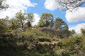
The walk described here is both easy and short, and offers the chance to admire a superb snow well.

Details

n°42680661
Creation:
Last update:
Last review:
  • Walking
    Activity: Walking
  • ↔
    Distance: 2.97 mi
  • ◔
    Average duration: 1h 50 
  • ▲
    Difficulty: Easy

  • ⚐
    Back to start: Yes
  • ↗
    Ascent: + 512 ft
  • ↘
    Descent: - 515 ft

  • ▲
    Highest point: 3,829 ft
  • ▼
    Lowest point: 3,314 ft

Photos

Description of the walk

The starting point for this walk is at Port de Benifallim, near the village of Torre de les Maçanes (or Torremanzanas). To reach this starting point by car, see the ‘Practical Information’ section below.

(S/E) From the car park, cross the road carefully(as it is very busy with motorbikes) and head along the path on the left.

(1) At the junction, carry on straight ahead. Ignore the side paths.

(2) Take the small path that goes uphill.

(3) At the signpost, carry on straight ahead.

(4) At the signpost, follow the sign for “els Plans”.

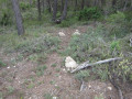
(5) Snow pit, known as “Pou del Rentonar”.
Then retrace your steps and follow the path back to the car park (S/E).

Waypoints

  1. S/E : mi 0 - alt. 3,317 ft - Port de Benifallim car park
  2. 1 : mi 0.31 - alt. 3,415 ft - Crossroads
  3. 2 : mi 0.82 - alt. 3,570 ft - Path
  4. 3 : mi 1.24 - alt. 3,727 ft - Signpost
  5. 4 : mi 1.33 - alt. 3,763 ft - Signpost
  6. 5 : mi 1.49 - alt. 3,829 ft - The snow well. Pou del Rentonar
  7. S/E : mi 2.97 - alt. 3,314 ft - Port de Benifallim car park

Notes

Driving directions to ELS PLANS

From Alicante city centre, take the A31 motorway (from Calle México) towards Madrid and, shortly afterwards, take exit 236A towards Benidorm and Valencia.

Continue on the A70.
Take exit 5 towards the CV800 / Mutxamel / Xixona
At the various roundabouts, always follow signs for the CV-800 (Xixona / Alcoï).
As you approach Xixona, there is an exit on the right towards Xixona; do not take this, but carry on straight ahead.

Further on, at the roundabout, take thefirst exit towards the CV-780 La Torre de les Maçanes (you must therefore leave the CV-800 heading towards Alcoï, which continues straight ahead). There is then a 13-kilometre stretch of very winding road ahead. This means you won’t be travelling very fast.

You’ll enter La Torre de les Maçanes and carry on along the CV-780.
After kilometre 17, you’ll see a sign for Port / Puerto de Benifallim (1,015 m) and, about 200 metres after that, park on the right in a clear, open area.

Worth a visit

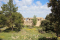
El Pou del Rontonar: it dates from the 18th century, has a diameter of about 10 metres and a depth of about 13 metres. However, it is difficult to appreciate these dimensions due to the darkness.
Snow wells are circular holes dug into the ground and lined with stones all around the rim. They are built at high altitudes and generally date from the 17th century. Snow from the surrounding area was thrown down through the top opening and packed down to form ice. At night, the ice was cut into ‘blocks’, protected in jute sacks, removed through a hole at the bottom and loaded onto mules for delivery down to the valley before sunrise. It was a very important trade, and around 320 snow pits have been recorded in the Valencian Community.

Reviews and comments

5 / 5
Based on 1 review

Reliability of the description
5 / 5
Ease of following the route
5 / 5
Route interest
5 / 5
aicragellebasi
aicragellebasi

Overall rating : 5 / 5

Date of your route : Dec 16, 2025
Reliability of the description : ★★★★★ Very good
Ease of following the route : ★★★★★ Very good
Route interest : ★★★★★ Very good
Very busy route : No

An easy and superb walk. The well doesn't look like much from the outside, but when you get closer and look inside, you can appreciate its importance and the amount of ice it must have been able to hold. It's a monumental work.

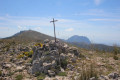
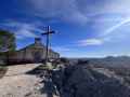
For the more adventurous, it's worth continuing past the well, turning immediately right and following the signs for "Cim del Plans" for a short climb (0.5 km) to the summit (1,300 m above sea level), which offers breathtaking 360-degree views. This is a 6.6 km round trip with a 292 m elevation gain.

Machine-translated

Other walks in the area

For more walks, use our search engine .

The GPS track and description are the property of this route's author. Please do not copy them without permission.