The Bois du Manoir

A walk through the villages and countryside of the Cauchoise region.

Details

10054303
Creation:
Last update:
Last review:
  • Walking
    Activity: Walking
  • ↔
    Distance: 9.67 mi
  • ◔
    Average duration: 4h 55 
  • ▲
    Difficulty: Moderate

  • ⚐
    Back to start: Yes
  • ↗
    Ascent: + 509 ft
  • ↘
    Descent: - 512 ft

  • ▲
    Highest point: 427 ft
  • ▼
    Lowest point: 89 ft
  • ⚐ Country: France
  • ⚐ City: Toussaint (76400)
  • ⚑
    Start/End: N 49.739392° / E 0.42347°
  • ❏
    IGN map(s): Ref. 1809OT
  • Hour-by-hour weather

Photos

Description of the walk

Parking and starting point: the town hall car park, Rue de Rouen.

(S/E) Opposite the town hall, turn right until you reach the first street on the left.

(1) Turn left onto Rue de l’Épinay. Walk for approximately 1,600 metres until you reach the sign for the village of Colleville. Continue to the hamlet of Le Petit Moulin, then take the first road on the right.

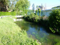
(2) Turn right, passing the sewage treatment works on your left. Continue along the path to reach Impasse des Ajoncs. Take the first left and head downhill to the junction where the River La Valmont is located.

(3) Turn right onto Rue Cauchoise. Pass the vegetable gardens on your right until you reach an X-junction. Turn right onto Route de Contremoulins (D 68), then take the first left towards the Étangs Collevillais and continue for 38 metres until you reach the first right.

(4) Turn right onto Route d’Orval and, at the end of the road, continue along the path opposite. Carry on along this track until you reach the water outlet, which is 1 m high. Continue along the path signposted ‘chemin de propriété privée’ and keep going straight on, following the barbed-wire fence, until you reach the road, Route de Bec de Mortagne (D 69).

(5) Turn right, go up the hill and continue to the T-junction with the RN 926. Cross the road carefully and continue straight ahead towards Bec de Mortagne, Route de Valmont D 69. Walk for approximately 365 metres and turn right onto Rue de Paris or Rue de la Roussie. Carry on straight ahead until you reach the T-junction 420 m further on.

(6) Turn left onto Rue de la Chénaie, ignore the turnings on the left and continue to the T-junction 1,100 metres ahead, at elevation 109. Turn right onto Chemin des Arts and continue to the T-junction.

(7) Turn right onto Route de Caudecoste to reach the village of Contremoulins. At the crossroads, turn right to head towards the church, then retrace your steps back to the same crossroads.

(8) Carry on straight ahead along Route de la Gillotière (D 68) and head downhill to the T-junction; watch out for traffic. Turn right towards Toussaint, go up the hill and, once you reach level ground, carry on straight ahead until you reach the church on Rue de l’Église.

(9) At the church, turn left onto Rue du Stade. Follow this road to the end – going against the one-way flow – until you reach the T-junction. Cross the RN 926, turn right and return to the starting point at the town hall car park (S/E).


Waypoints

  1. S/E : mi 0 - alt. 354 ft - Rue de Rouen, town hall car park
  2. 1 : mi 0.08 - alt. 358 ft - Rue de l’Epinay
  3. 2 : mi 1.09 - alt. 89 ft - Rue du Petit Moulin
  4. 3 : mi 1.77 - alt. 92 ft - Rue Cauchoise - Valmont (fleuve)
  5. 4 : mi 2.27 - alt. 125 ft - Route de Gredolle
  6. 5 : mi 4.39 - alt. 236 ft - Route du Bec de Mortagne, D 69
  7. 6 : mi 5.8 - alt. 420 ft - Rue de la Chénaie
  8. 7 : mi 7.15 - alt. 397 ft - Route de Caudecoste
  9. 8 : mi 7.72 - alt. 364 ft - Route de la Gillotière
  10. 9 : mi 9.38 - alt. 344 ft - Rue du Stade
  11. S/E : mi 9.67 - alt. 354 ft - Rue de Rouen, town hall car park

Notes

The walk follows mainly country roads, with a very shaded section – the path at the end of the Route d’Orval leading to the Route de Bec de Mortagne (D 69).

From point (8) to the junction at the bottom of the hill, take great care with traffic.

Reviews and comments

3.9 / 5
Based on 4 reviews

Reliability of the description
4 / 5
Ease of following the route
4 / 5
Route interest
3.8 / 5
baboune57
baboune57

Overall rating : 5 / 5

Date of your route : Sep 04, 2024
Reliability of the description : ★★★★★ Very good
Ease of following the route : ★★★★★ Very good
Route interest : ★★★★★ Very good
Very busy route : No

Route completed on 1 September. Very enjoyable.
The description is very accurate and, with the GPS track, it’s impossible to get lost.
Thanks to the route creator.

Machine-translated

Chloe.paton
Chloe.paton

Overall rating : 4 / 5

Date of your route : Apr 20, 2024
Reliability of the description : ★★★★☆ Good
Ease of following the route : ★★★★☆ Good
Route interest : ★★★★☆ Good
Very busy route : Yes

A very concise route

Machine-translated

Ferdinandbzv
Ferdinandbzv

Overall rating : 4.7 / 5

Date of your route : Sep 18, 2022
Reliability of the description : ★★★★★ Very good
Ease of following the route : ★★★★★ Very good
Route interest : ★★★★☆ Good
Very busy route : No

An interesting walk offering the chance to explore the countryside of the Pays de Caux. Some sections are very shady, whilst others wind their way through fields, which is why it’s best to do this walk in summer when the crops haven’t yet been harvested. There are plenty of roads, but fortunately there’s very little traffic. Many thanks to the creator of this rather long walk.

Machine-translated

benoitrando
benoitrando

As for road names, all too often – and on many routes – the road names are unfortunately located at the other end of the road; the name is therefore provided for guidance only, and you can find your way by looking at the map.
The route does mainly follow roads, it’s true, but you just need to read the route description carefully before setting off; this is indicated in the practical information section. What’s more, if you’d prefer to stick to walks with plenty of points of interest, I’d advise you to head up to Paris. For me, a walk is about appreciating the natural surroundings whilst you’re out walking.
Kind regards

Machine-translated

jrig
jrig

Overall rating : 2 / 5

Date of your route : Sep 01, 2022
Reliability of the description : ★★☆☆☆ Disappointing
Ease of following the route : ★★☆☆☆ Disappointing
Route interest : ★★☆☆☆ Disappointing
Very busy route : No

Poorly written directions, with road names sometimes not visible when you’re supposed to turn off. For example, the Route de Bec de Mortagne. I missed it and then got lost. I eventually found my way back onto it. A T-junction means three roads. If there’s a dead-end road opposite, it’s no longer a T-junction. The route is of little interest, apart from the local scenery.
Lots of tarmac, with gravel on the Route de la Gillotière.

Machine-translated

Other walks in the area

For more walks, use our search engine .

The GPS track and description are the property of this route's author. Please do not copy them without permission.