Country:
 City:
City:


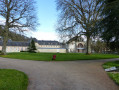
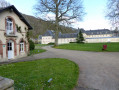
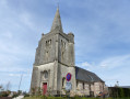
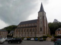
Parking and starting point at Place du Docteur Robert Gréverie, in front of the town hall and the church.
(S/E) Climb the steps leading to the Church of Saint-Nicolas-Saint-Martin and continue straight ahead, turning right onto Rue du Donjon. At the T-junction, turn left onto Rue Guy de Maupassant and follow it to the next T-junction opposite the Eugène Delacroix secondary school.
(1) Turn left onto Route de Valmont and follow it uphill for about 800 metres: be careful not to miss the turn-off onto the path.
(2) Turn left onto the first grassy track which leads into a field and runs alongside the road for about 30 metres before veering away from it; the track then turns left towards the woods. In the middle of the fields, this track turns right; continue straight on for over a kilometre until you reach a road.
(3) Turn left twice and carry on until you reach a T-junction. Turn left onto Rue du Marquet and carry on to the next junction.
(4) Cross the road and carry on straight ahead along Rue du Chêne Saint-Martin until you reach the car park of the Church of Saint-Martin-Saint-Éloi in Thiétreville. Turn slightly right to walk round the church and the cemetery. Cross the car park, turn right and, at the fork in the road just after, turn left onto Rue Émile Beus, following signs for the community hall. At the start of Rue Bernard Decaen, turn left onto Rue de la Plaine.
(5) Turn right onto Rue de la Forge, passing the community centre on your left. At the following X-junction, continue straight ahead onto Route de Bois-Mare, which you should follow straight on for about 2 km until you reach the T-junction at the bottom of the hill.
(6) Turn left onto Route de l’Europe and take the first right onto Chemin d’Arentot. At the next junction, turn left and follow the Vélo-Route du Lin to the next X-junction.
(7) Leave the Vélo-Route du Lin, which continues straight ahead, and turn left onto Chemin de la Carrière. At the junction, cross carefully at the pedestrian crossing and continue straight ahead onto Chemin du Vivier. Follow the road to the forest gate at a place called Le Vivier, with a pumping station on your left.
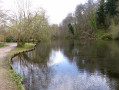
(8) After the forest gate, take the first path on the right. Cross the two small bridges that follow, pass the car park to reach a T-junction.
(9) Turn right onto Rue Charles de Gaulle, then immediately left onto the Vélo-Route du Lin. Next, take the first right and then immediately left onto Rue Raoul Auvray, heading towards Notre-Dame du Pré Abbey, which is a little further on the right.
(10) After passing the abbey entrance, head right until you reach the junction.
(11) Take the first left onto Place de la Gare and continue to the junction with Rue Jules Crochemore. Turn left and go straight on to the starting point (S/E).


 Visorando Member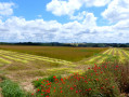

 Association / Club / Walk leader