The Plaine de la Mare aux Saules

A lovely little route through the Cauchois countryside.

Details

21590382
Creation:
Last update:
Last review:
  • Walking
    Activity: Walking
  • ↔
    Distance: 7.17 mi
  • ◔
    Average duration: 3h 40 
  • ▲
    Difficulty: Moderate

  • ⚐
    Back to start: Yes
  • ↗
    Ascent: + 440 ft
  • ↘
    Descent: - 469 ft

  • ▲
    Highest point: 410 ft
  • ▼
    Lowest point: 79 ft
  • ⚐ Country: France
  • ⚐ City: Colleville (76400)
  • ⚑
    Start/End: N 49.748759° / E 0.449309°
  • ❏
    IGN map(s): Ref. 1809OT
  • Hour-by-hour weather

Photos

Description of the walk

Park in the car park on Rue de l’Église.

(S/E) Leave the car park, cross the road and head towards the town hall. Continue on the left-hand side of the town hall to take the steps behind the building (blue markings). Follow the path and climb up to the first junction in the woods.

(1) Turn right and follow the fitness trail, ignoring the path furthest to the right. Carry on until you reach the edge of the woods, at the gate and the road.

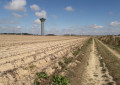
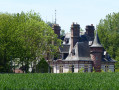
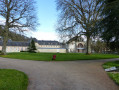
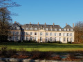
(2) Turn left onto Route de Hougerville, walk for about 1.8 km, passing the Château de Hougerville on your right, heading towards the water tower.

(3) Turn left onto the first path leading across the fields, just before the water tower. At the T-junction, turn right and ignore the path continuing on the right-hand side. Take the first path on the left just before reaching the road and follow it to the end until you reach the tarmac.

(4) Carry on straight ahead along Rue de Bondeville, through the hamlet of Hâbleville, until you reach the T-junction. Turn left onto Rue du Marquais, then turn left again at the first road, Route de Colleville.

(5) A little further on, about 180 metres, the road turns left at a 90° angle; ignore this and carry on along the path straight ahead. Follow this path, which becomes a narrow track leading downhill (be careful, as in places it narrows due to rainwater runoff). At the bottom, at the junction opposite the house, veer left and, a few metres further on, join the tarmac road at the hamlet known as “les Waats”.

(6) Turn left onto Chemin du Thorp. Follow this road uphill to the T-junction at the hamlet known as Le Torp.

(7) Turn right onto Route du Torp and follow this road downhill to the crossroads.

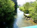
(8) Cross the Route de Fécamp – watch out for traffic – and continue straight ahead along Rue du Petit Moulin. Cross over the River Valmont, pass the X-junction on the cycle route at the hamlet known as Le Petit Moulin and take the first left. Pass the sewage treatment works, continue along the track until you reach the tarmac road, Impasse des Ajoncs. Turn left at the first junction onto Rue du Renard and head downhill to the X-junction by the river.

(9) Carry on to the right along Rue Cauchoise, with the river on your left, until you reach the next T-junction. Turn left onto Rue de la Gare, cross the bridge over the Valmont and continue until the first left-hand turn.

(10) Turn left and continue to the end of the cul-de-sac, where you’ll find a large boules court. Opposite the entrance to the boules court, veer slightly to the right and follow the straight, grassy and stony path of the old railway line straight ahead. Walk past the entrance to the sugar factory on your left and carry on until you reach the tarmac road opposite the greenway or cycle path.

(11) Turn right onto Rue Cauchoise towards the housing estate and continue until you reach an X-junction. Cross the road at the pedestrian crossing in front of the post office and return to the starting car park on Rue de l’Église (S/E).


Waypoints

  1. S/E : mi 0 - alt. 128 ft - Car park on Rue de l’Église
  2. 1 : mi 0.11 - alt. 174 ft - Crossroads
  3. 2 : mi 0.29 - alt. 240 ft - Route d’Hougerville
  4. 3 : mi 1.42 - alt. 387 ft - Route d’Hougerville, water tower
  5. 4 : mi 2.75 - alt. 358 ft - Rue de Bondeville
  6. 5 : mi 3.12 - alt. 354 ft - Route de Colleville
  7. 6 : mi 3.81 - alt. 217 ft - Chemin du Torp, a hamlet known as “Les Waats”
  8. 7 : mi 4.42 - alt. 387 ft - Route du Torp
  9. 8 : mi 5.25 - alt. 105 ft - Route de Fécamp
  10. 9 : mi 6.16 - alt. 92 ft - Rue Cauchoise, at river level - Valmont (fleuve)
  11. 10 : mi 6.57 - alt. 102 ft - Rue de la Gare
  12. 11 : mi 7.03 - alt. 92 ft - Rue Cauchoise, at the level of the greenway. Near the - Valmont (fleuve)
  13. S/E : mi 7.17 - alt. 128 ft - Car park on Rue de l’Église

Notes

Parking is available in the car park on Rue de l’Église, opposite the town hall, on the right-hand side as you go up the street.

Worth a visit

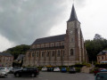
Saint-Martin’s Church was built between 1860 and 1862. The former 11th-century church was built in a small valley near the river, where its foundations can still be seen.
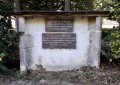
The war memorial.
An abandoned sugar factory.
The local council owns a statuette known as ‘the Ivory Virgin’, which is housed at the Conservatoire des Musées in Caen.
The old railway station and the ‘Vélo Route du Lin’ cycle path, a greenway.

Reviews and comments

4.7 / 5
Based on 2 reviews

Reliability of the description
5 / 5
Ease of following the route
5 / 5
Route interest
4 / 5
noelja
noelja

Overall rating : 4.3 / 5

Date of your route : Oct 01, 2022
Reliability of the description : ★★★★★ Very good
Ease of following the route : ★★★★★ Very good
Route interest : ★★★☆☆ Average
Very busy route : No

A fairly varied route, with just a tad too much tarmac but virtually no cars.

Machine-translated

Claude41
Claude41

Overall rating : 5 / 5

Date of your route : Aug 26, 2022
Reliability of the description : ★★★★★ Very good
Ease of following the route : ★★★★★ Very good
Route interest : ★★★★★ Very good
Very busy route : No

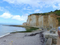
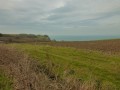
We didn’t come across any other walkers on this Friday afternoon. A pleasant and varied route that alternates between the plains of the Pays de Caux, stretches through woodland and even offers a view of the sea at Bondeville. There are a few beautiful country houses along the way, as well as Hougerville Castle. Lots of tractors were spreading manure during those last few days of August: watch out for dust and strong smells. An easy walk with the added bonus of being able to round it off with a drink in Fécamp (5 km from Coleville) on a terrace overlooking the sea.

Machine-translated

Other walks in the area

For more walks, use our search engine .

The GPS track and description are the property of this route's author. Please do not copy them without permission.