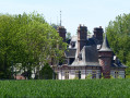
The Gredolle ponds

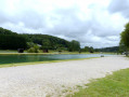
The route passes by a unique wayside shrine known as the “Tour-Lanterne” in the hamlet of Ypreville and by the Colleville fishing ponds, running alongside the River Valmont.

Details

3156841
Creation:
Last update:
Last review:
  • Walking
    Activity: Walking
  • ↔
    Distance: 10.64 mi
  • ◔
    Average duration: 5h 15 
  • ▲
    Difficulty: Moderate

  • ⚐
    Back to start: Yes
  • ↗
    Ascent: + 371 ft
  • ↘
    Descent: - 348 ft

  • ▲
    Highest point: 410 ft
  • ▼
    Lowest point: 92 ft

Photos

Description of the walk

Park in the car park on Route de l’Église in Angerville-la-Martel.

(S/E) Leave the car park and turn right. Pass the town hall junction, ignore the road on the left and carry on straight ahead along Route d’Ypreville towards the hamlet of Ypreville.

(1) At the T-junction in the hamlet of Ypreville, turn right and follow the bend to the left. At the Tour Lanterne wayside shrine (“Lanterne des Morts” on the map), turn left and then left again onto Impasse des Celliers. Continue along the track until you reach the T-junction, turn right and rejoin the road.

(2) At the road, turn left onto Rue de la Campagne. At the next junction, turn right onto Rue du Calvaire. Ignore the turn-offs on the left until you reach a star-shaped junction.

(3) Cross the D68A road and take the left-hand branch opposite, Impasse des Hauts d’Orival. Take the first path on your right, follow this along a track not shown on IGN maps (caution: the path is heavily overgrown with tall grass and stinging nettles) and rejoin the road at the foot of an electricity substation, with the water tower on your right.

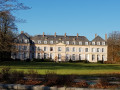
(4) Turn left onto Route d’Hougerville, passing the farm-shop and Hougerville Castle (private) on your left. Continue down this road until you reach a large wooden gate on your right, 50 metres before the Colleville sign.

(5) Turn right to enter the Colleville woods via the pedestrian entrance situated directly opposite the sign for the fitness routes. Once in the woods, follow the green markings closely for approximately 260 m. Leave the path on the left and follow the steep path with steps to reach the rear of the town hall; go down the final steps and head round the front of the town hall to the road.

(6) At the road, Rue de l’Église, turn left towards Saint-Martin’s Church. Then retrace your steps to the junction with Route de Fécamp. Cross the road and take Rue Cauchoise opposite.

(7) At the cycle path, turn left and head towards the old railway station. Turn right onto Rue de la Gare, pass an X-junction whilst continuing up the street, and take the first left onto Route de Gredolle.

(8) Follow this road, passing the football ground and the fishing ponds on your left, until you reach a T-junction, approximately 1,400 metres further on.

(9) Turn right onto Route du Bec au Cauchois and, at the T-junction, carry on straight ahead. Continue straight on.

(10) Cross the bridge over the River Valmont, cross the cycle path and carry on straight ahead onto Chemin des Hates.

(11) Go up the path (tarmac) and the Route des Hates (slightly uphill). Follow the bend to the left, go past the right-hand bend, ignoring the turn-off to the left. Turn left onto the grassy path ahead, follow it past the rear of the château on your right and rejoin the road.

(12) Turn right onto Rue du Vassouy. At the next junction, ignore the road on the left and carry on straight ahead. Take the first road on the right just after the Miquetot sign, Route des Hêtres, and continue to the T-junction.

(13) Turn left onto Route des Hates and, at the next junction, continue straight ahead onto Impasse de la Linerie. Leave the tarmac and follow the path that leads through the cultivated fields. At the crossroads, turn left until you reach the tarmac.

(14) On Chemin de la Passée, go straight on, passing Angerville Castle on your right and the village sign. At the T-junction, turn right and head for the car park on Route de l’Église (S/E).

Waypoints

  1. S/E : mi 0 - alt. 384 ft - Car park on Route de l’Église
  2. 1 : mi 0.91 - alt. 374 ft - The hamlet of Ypreville
  3. 2 : mi 1.9 - alt. 387 ft - Rue de la Campagne
  4. 3 : mi 2.64 - alt. 364 ft - Route d’Orival D68A
  5. 4 : mi 3.38 - alt. 384 ft - Route d’Hougerville
  6. 5 : mi 4.53 - alt. 240 ft - Route d’Hougerville (wooden barrier)
  7. 6 : mi 4.78 - alt. 125 ft - Rue de l’Eglise
  8. 7 : mi 5.36 - alt. 92 ft - Cycle route
  9. 8 : mi 5.99 - alt. 128 ft - Route de Grédolle
  10. 9 : mi 7.26 - alt. 151 ft - Route du Bec au Cauchois
  11. 10 : mi 7.73 - alt. 138 ft - The - Valmont (fleuve)
  12. 11 : mi 7.88 - alt. 154 ft - Chemin des Hates
  13. 12 : mi 8.92 - alt. 374 ft - Rue du Vassouy
  14. 13 : mi 9.55 - alt. 387 ft - Route des Hates
  15. 14 : mi 10.27 - alt. 381 ft - Chemin de la Passée
  16. S/E : mi 10.64 - alt. 384 ft - Car park on Route de l’Église

Notes

At the Colleville ponds, on Rue de Grédolle, you can stop for a picnic. The area has tables with benches and shelters, provided they are not being used by anglers. Ask the staff at the snack bar for permission; in principle, there’s no problem as long as the area is kept clean (bins are provided).

Worth a visit

Angerville-la-Martel:
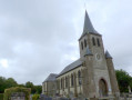
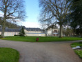
A pleasant site comprising Saint-Martin’s Church, the 16th-century vicarage, the beech grove and the grassy square.
Saint-Martin’s Church was extended in the 16th century. The bell tower was rebuilt in 1772 after being struck by lightning; it was struck by lightning again and rebuilt in 1837.
The war memorial.
The lantern tower in Ypreville dates from 1936 and was built by Father Maurice in memory of the (now vanished) lepers’ cemetery. A purple light can be seen at dusk.
The Calvary, inscribed with the words ‘Look upon this Christ and keep the faith’, on the Chemin d’Angerville in Daubeuf.

Colleville:
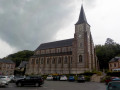
Saint-Martin’s Church was built between 1860 and 1862. The former 11th-century church was built in a small valley near the river, where its foundations can still be seen.
The war memorial.
An abandoned sugar factory.
The local council owns a statuette known as ‘the ivory Virgin’, which is housed at the Conservatoire des Musées in Caen.
The old railway station and the ‘Véloroute du Lin’ cycle route, a greenway.

Reviews and comments

4.8 / 5
Based on 2 reviews

Reliability of the description
5 / 5
Ease of following the route
5 / 5
Route interest
4.5 / 5
baboune57
baboune57

Overall rating : 5 / 5

Date of your route : Sep 06, 2024
Reliability of the description : ★★★★★ Very good
Ease of following the route : ★★★★★ Very good
Route interest : ★★★★★ Very good
Very busy route : No

A lovely and interesting walk today, following a day of heavy rain yesterday.
I’d recommend taking a walking stick – it comes in handy, particularly after point 3 on the path where the grass is tall.

Machine-translated

orchide29
orchide29

Overall rating : 4.7 / 5

Date of your route : Aug 29, 2024
Reliability of the description : ★★★★★ Very good
Ease of following the route : ★★★★★ Very good
Route interest : ★★★★☆ Good
Very busy route : No

A pleasant walk, with just one steep climb in the second half; otherwise, it’s an easy route.
There’s a snack bar by the ponds roughly halfway along the route, where it’s lovely to stop for a bite to eat, a coffee and a toilet break!!! That’s no small thing. The owner of the snack bar is very friendly
I’d recommend this lovely walk
Just so you know, there’s a vending machine selling fresh baguettes in the car park at the start, in case you don’t have any bread for your snack!!!
Enjoy the walk
And thank you.

Machine-translated

Other walks in the area

For more walks, use our search engine .

The GPS track and description are the property of this route's author. Please do not copy them without permission.