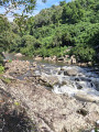
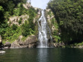
The Bassin de la Mer and the Bassin des Aigrettes

The east of Réunion Island is teeming with remarkable pools and waterfalls. Among these are the Mer and Aigrettes pools. They are amongst the best known on the island. This region is also notable for the surrounding vegetation, which remains green almost all year round. The walk is flat to begin with before becoming more challenging as you approach the Bassin des Aigrettes.

Details

n°30061436
Creation:
Last update:
Last review:
  • Walking
    Activity: Walking
  • ↔
    Distance: 3.81 mi
  • ◔
    Average duration: 2h 20 
  • ▲
    Difficulty: Moderate

  • ⚐
    Back to start: Yes
  • ↗
    Ascent: + 682 ft
  • ↘
    Descent: - 676 ft

  • ▲
    Highest point: 883 ft
  • ▼
    Lowest point: 436 ft

Description of the walk

Access to the starting point:
- From Saint-Denis: head towards Saint-André via the N2 and take exit 21 towards Salazie. Then continue straight on along the D48. At the next two roundabouts, take the second exit. Then cross the Rivière du Mât via the first bridge on the left. Just after the bridge, turn right at the first junction. Keep right at every junction until you reach the car park.
- From Saint-Benoît: head towards Saint-Denis via the N2. Take exit 22 towards the Rivière du Mât. Then turn left onto the N2002 to cross over the four-lane road. Stay on the same road until you reach the village of Rivière du Mât. Drive through the village to the bridge, but do not cross it. Instead, at the bridge, take the path on the left towards the Parc des Berges de la Rivière du Mât. Keep right at every junction until you reach the car park. (S/E)

(S/E) From the park, take the path that runs alongside the car park, following the Rivière du Mât. The path is flat and pleasant at first and passes close to longan trees, whose fruit is a welcome treat when in season.

(1) You’ll soon come across a path coming from the left: ignore it and head right to stay along the river. Walk past a few private properties and cross two streams via footbridges. Just before the next junction, begin a short but steep climb.

(2) At the next fork, turn right towards the Bassin de la Mer. Some sections feature steep gradients, both uphill and downhill. Allow five minutes’ walk to reach the Bassin de la Mer.

(3) Take your time to admire the view, then return via the same route.

(2) Turn right towards the Bassin des Aigrettes and, after another climb, you’ll reach a track.

(4) Follow it to the right. Then take the first path on the left. This path crosses several ravines and includes steep climbs with steps. After a descent that’s a little longer than the others, cross a ravine and you’ll reach a junction: head right towards the Bassin des Aigrettes.

(6) Take your time to admire the Bassin des Aigrettes, then follow the same route as on the way out to return to the starting point (S/E).

Waypoints

  1. S/E : mi 0 - alt. 436 ft - Parc des Berges de la Rivière du Mât
  2. 1 : mi 0.21 - alt. 456 ft - Path junction
  3. 2 : mi 1.2 - alt. 620 ft - Junction towards Bassin de la Mer
  4. 3 : mi 1.33 - alt. 561 ft - Bassin de la Mer
  5. 4 : mi 1.66 - alt. 725 ft - Track
  6. 5 : mi 1.99 - alt. 758 ft - Junction with the Bassin des Aigrettes path
  7. 6 : mi 2.04 - alt. 725 ft - Bassin des Aigrettes (Bras des Lianes)
  8. S/E : mi 3.81 - alt. 436 ft - Parc des Berges de la Rivière du Mât

Notes

This walk is strongly advised against in wet weather.
Swimming is possible but not recommended due to strong currents.
Picnic area at the start of the walk (S/E).
A short walk, but with steep slopes towards the end.

Worth a visit

Bassin de la Mer (3).
Bassin des Aigrettes (6).

Reviews and comments

4.3 / 5
Based on 2 reviews

Reliability of the description
4 / 5
Ease of following the route
4.5 / 5
Route interest
4.5 / 5
réulyonnais
réulyonnais

Overall rating : 4.7 / 5

Date of your route : Apr 11, 2026
Reliability of the description : ★★★★★ Very good
Ease of following the route : ★★★★★ Very good
Route interest : ★★★★☆ Good
Very busy route : Yes

It’s fairly easy to get to the lagoon. The second part, leading to the Bassin des Aigrettes, is a bit trickier, but overall it’s a good walk. With three teenagers.

Machine-translated

Billoutte974
Billoutte974

Overall rating : 4 / 5

Date of your route : Jul 17, 2023
Reliability of the description : ★★★☆☆ Average
Ease of following the route : ★★★★☆ Good
Route interest : ★★★★★ Very good
Very busy route : Yes

For walkers, I’d recommend walking shoes if possible.

Machine-translated

Other walks in the area

For more walks, use our search engine .

The GPS track and description are the property of this route's author. Please do not copy them without permission.