Country:
 City:
City:


Access:
Head towards Rivière des Pluies and, at the Desbassyns Bridge, follow signs for La Confiance and L’Éspérance. Follow this road, pass a petrol station, then count two large bends and continue straight on along Rue Luc Donat at the third bend. Cross a ravine, and at the junction with Chemin Bras Sec, keep to the right. Follow the road until you reach Rue Ravine Rose on the left. Park at this junction.
(S/E) Set off along Rue Ravine Rose. It starts near fields of dream flowers, banana trees and chouchou trees and crosses a stream. Then leave Rue Ravine Rose, which continues uphill to the right, and take the lane that starts on the left. Ignore the first lane on the right and take the second lane, still on the right. It ends quite quickly. Continue along the Sentier de l’Échelle, which follows on from this path, winding its way between the wire fences. The descent begins almost immediately: the very steep gradient sets the tone! The steps are quite high in places. The descent takes you through guava trees, river ferns, lizard’s feet, fanjans, small nattes and camphor trees, as well as other remarkable species. It takes just ten minutes to reach the Ravine Sèche, which is overrun with Japanese knotweed along this stretch. The path then climbs up the other side, still on a steep gradient. It passes close to a few ‘change-écorce’ trees.
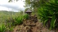
(1) At the first junction, turn right. The path then quickly reaches the ridge, offering magnificent views to the north. Follow this path as it heads south through umbrella ferns, casuarinas, rampart trees and galaberts. A few benches have been provided to enjoy the views. The path then branches off to the east and crosses the Ravine Mère Canal past a wooden table, a pond and an arch.
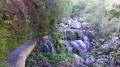
(2) Continue along the path on the right-hand bank, then keep left at the junction. Follow a drainage pipe along a downhill path made up of steps, which can be slippery if it has rained. When you reach the road, keep left, go round two bends, and follow the road to postbox number 161, which is on the left-hand side of the road.
(3) Take the Sentier de l’Échelle, which starts to the left of the letterbox. It descends steeply, crosses the Ravine Mère Canal, and climbs back up an equally steep slope.
Return to the start of the circular loop.
(1) Keep to the right and then follow, in the opposite direction, the same path you took on the way out until you reach the car park (S/E).

 Visorando Member

 Easy
Easy 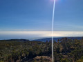
 Difficult