Country:

 City:
City:


Access: From the N2, take exit 11 and follow the D62 towards La Ressource and Piton Plaine des Fougères. Follow the road until you reach the next church on the left. Continue along the road for a few metres, then at the sign for Piton Plaine des Fougères, turn left in the direction indicated by the sign. Then follow the track to its end.
(S/E) From the car park, take the track that starts at the far right-hand end of the car park. The track is wide and ideal for warming up or mountain biking. It is also regularly used by vehicles as a few residents live a little further up the hill. The track winds its way through a series of hairpin bends amidst the swaying trees and, unfortunately, invasive weeds. But it’s lovely to watch the sunrise as the light plays across the vegetation.
(1) Leave the first path on the right for later and continue along the track. Further up, pass a few picnic tables and enter the Sainte-Marie Regional Forest, where a few clearings stretch as far as the Morne du Bras des Lianes. Lovers of guava trees and begonias will find plenty here to satisfy their passion for foraging.
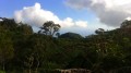
(2) Take the next path on the left, which starts just before the end of the track, right by a ravine. From here, enjoy the spectacle of Mother Nature! This unspoilt forest is home to fanjans, ‘langues de bœuf’, Elaphoglossum macropodium and, above all, magnificent highland tamarinds. The path, which climbs gently, can, however, be muddy during the rainy season! It is also a haven for epiphytic plants. Clearings are extremely rare, but the beautiful highland tamarins more than make up for this. Some are very imposing, and you’ll need to duck to get past them.
(3) At the next junction, keep to the left. Cross the Grand Bras Sec, passing just above a small pool. The rampart is not far away. You’ll know you’ve reached it when you see a wayside shrine.
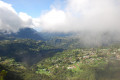
(4) After the wayside shrine, turn right at the junction and enjoy your first view of the Cirque de Salazie and the island’s highest peaks. The path runs alongside the rampart, but views are few and far between. On the other hand, some of the tamarind trees are truly magnificent giants! The path occasionally winds its way through the calumets.
(5) Stop off once more at the viewpoint overlooking Salazie before continuing along the path. An orientation board is available to help you find your way.
(6) You’ll reach another junction; leave the path on the right for later. Here, too, you’re treated to a sweeping view of the cirque. You can take one last break before tackling the final stretch towards Piton Plaine des Fougères. The path is narrower and features a few wooden duckboards and planks to avoid muddy sections. The next view of the Mare à Martin signals that the summit is just ahead.
(7) The end of the path marks your arrival at the summit, which offers breathtaking views of Salazie, the Bélouve Forest, Piton des Neiges, Roche Écrite and even the volcano in the distance. However, the Rivière des Pluies is rather difficult to see. For better views, it is advisable to head down the ridge by following what resembles a path to the right (from the summit): but watch out for uneven ground!
After taking in the view, return to the previous junction via the same route.
(6) Turn left to re-enter the realm of Mother Nature, which, under certain conditions, may remind you of J.R.R. Tolkien’s forest in *The Lord of the Rings*.
(8) Then ignore the first path on the right and carry on straight ahead.
(9) About ten minutes after the previous junction, you’ll reach the viewpoint overlooking the Rivière des Pluies. Carry on. The path then veers due east. This section features several information boards. A series of ups and downs then begins as you cross the ravines.
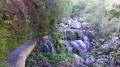
(10) Turn left at the next junction. After a fairly long descent, you’ll reach a footbridge spanning the Ravine Mère Canal. Here you’ll find a small pool fed by a small waterfall and spanned by a small arch. You’ll soon rejoin the track you took on the way there.
(1) Once on the track, follow it to the left until you reach the car park (S/E)

 The GPX track was spot on; we had no trouble finding our way, especially as the ONF has marked and signposted the various trails, distances and times very clearly.
 Visorando Member
 Difficult
 Easy
Easy