Country:
 City:
City:


Access: Head towards Bagatelle via the D51. Follow this road until you reach the sign for Bassin Bœuf. Once you reach Bagatelle (on the left if coming from Sainte-Suzanne and on the right if coming from Sainte-Marie), follow the path indicated by the sign until you reach the sign on the left pointing to Bassin Bœuf. Continue along the track to the left of the sign until you reach the car park.
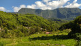
(S/E) Follow the track for about forty metres and take the first path on the left. This path can be a proper stream if it has rained. You can hear the sound of the water from the very first few metres, and it never stops – a real treat for the ears. To the right, you can see the wind farms. You’ll reach the River Sainte-Suzanne in no time. When the water level is high enough, you can reach Bassin Racine by walking upstream.
When you reach the basin, you cannot miss the magnificent arch-tunnel through which the Sainte-Suzanne River flows. In front of this arch lies the Bassin Canne. Go round the Bassin Canne on the left and cross the ravine. The water is diverted through the arch, so this section of the river is completely dry. You simply need to hop from rock to rock. Then look out for the continuation of the path on the right bank (marked by cairns) and follow it. Next, ignore the first path on the right before crossing over the arch and reaching the next junction. Keep to the left and begin a slippery descent into the river. Once you reach the river, walk upstream for a few metres. Caution: the rocks are slippery.
(1) You will then come to a break in the rock and a small waterfall. But what really catches the eye is the arch and its waterfall, fed by the upstream pool and by resurgences. Return to the previous junction via the same route and turn left. The path runs through the woodland and passes close to some beautiful trees. You can see the entrance to the arch on the right. Some sections will be narrower than others. A short climb follows. Keep to the right at the next junction. Then take the first path on the right. You’ll soon reach Bassin Nicole after a slippery descent.
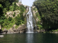
(2) What is most impressive is its extraordinary and magnificent waterfall. You can swim there. By following the river downstream, you can reach the top of Bassin Racine. Return to the junction via the same route and turn right. The path follows the contour line as closely as possible, offering views of the beautiful Bassin Nicole waterfall. Then cross a ravine, passing just above a small cascade, and keep left at the first junction by a pipe.
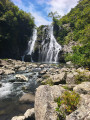
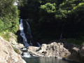
(3) The path arrives at the lovely Bassin Bœuf. It is very popular with young swimmers. The waterfall is stunning: part of the water rushes into a hole in a rock and emerges on the other side. Then return to the previous junction via the same route and descend into the ravine. Head for the old water intake opposite, on the other side of the river. The water intake gives rise to some lovely little waterfalls.
Follow the track for a few metres and turn left onto the first path, which is marked with orange signs. The slope is quite steep. There is a rather tricky section that requires caution, but it is aided by branches and cables. After this climb, keep left at the junction. The path follows the contour line for a very short while before alternating between ascents and descents, some of which are slippery and technical. It is also quite narrow.
Then turn right at the next junction. Follow the path for about a hundred metres and don’t miss the inconspicuous path on the left that leads to the Bassin Grondin. Some sections require caution as the steps are rotten and the path is somewhat overgrown. A fallen tree in the middle of the path confirms this, but it is still passable.
(4) You’ll soon reach the large Bassin Grondin with its waterfall. Then return to the previous junction and turn left to cross a stream near a waterfall. Do make sure not to miss the next junction, however, where you should head down to the left into the river.
(5) You’ll reach the Bassin Bois, which is the least interesting part of the route. Then return to the previous junction and turn left onto a path that is at times very steep. When you reach the top of the embankment, head towards the sugarcane fields and cross a track, following it to the left for a short while. Turn off again onto the first path on the left, just after the bend. Follow the path until you reach a pipe emerging from the ground.
Then turn left onto a faint track. The first few metres are fairly flat, then the slope becomes steep very suddenly with some technical sections, though there are plenty of trees to hold on to and prevent you from slipping. From there on, the sound of the river will never cease! You’ll reach the Sainte-Suzanne River quite quickly, however, after stepping over numerous trees.
(6) Follow the river upstream over very slippery pebbles to the Grande Cascade, which you’ll reach fairly quickly. It’s majestic when the river is in full flow. Waterfall enthusiasts will be in their element here. It’s the largest on the route. The Bassin de Bois is very beautiful, but it’s the waterfall that steals the show.
Return to the previous junction via the same route and turn left. The path is flat and narrow. It winds its way under a canopy of vegetation on the left bank to skirt around the Bassin de Bois. Just beyond this waterfall lies the Bassin Ravine Creuse, but access to it is very discreet and was not found during this hike. Soon, in addition to the guava trees, sabre palms begin to appear, followed by tabacs bœuf. The two ravines are crossed via a narrow, secure footbridge, though this may be daunting for those prone to vertigo.
After passing the second footbridge, take the first path on the left, which leads to the ravine right at the foot of the stunning Bassin Carosse waterfall.
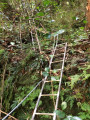
(7) Take your time to admire the beautiful waterfall, then return to the previous junction via the same path and turn left once more. At the junction, continue straight on. Then climb the vertical, vertiginous ladder leading to the top of the Bassin Carosse. Once at the top, follow the pipeline as closely as possible, either along a path or over smooth, slippery rocks.
(8) After about 3 to 4 hours’ climb, you’ll reach the Bassin Pilon and its three waterfalls. Swimming is strongly discouraged here. This is the last waterfall on the route. Continue along the path which climbs up the left bank via two fairly steep ladders. At the junction, keep to the right, then take the left at the next junction, before keeping to the right again at the third to reach the top of the escarpment. Walk through the guava trees on a gentle descent.
(9) At the track, continue to the left. The track climbs initially before descending again and crossing several ravines. At the end of the track, turn right onto the road and follow it to the Bassin Boeuf car park (S/E).

 Visorando Member
 Moderate
 Easy
Easy