


Refine your search for walks in Lahaymeix
Lahaymeix walks


 Shortcut
 Visorando Member
 1.58 mi
 +62 ft
 -62 ft
 0h 45
0h 45
 Easy
Easy
 Departure from Lahaymeix (Meuse)
Near the village of Lahaymeix, this 3 km Vent des Forêts walk takes you on a journey to discover various works by artists in the heart of the Meuse forest.
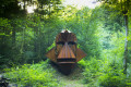
Route of the three fountains in the Marcaulieu National Forest
 4.81 mi
+446 ft
-453 ft
2h 35
Easy
Departure from Dompcevrin (Meuse)
4.81 mi
+446 ft
-453 ft
2h 35
Easy
Departure from Dompcevrin (Meuse)
Close to the village of Dompcevrin, this Vent des Forêts hike takes you on a journey of discovery through the works of various artists in the heart of the Meuse forest.
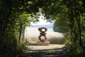
The Gros Charme route in the Pierrefitte Forest
 6.05 mi
+331 ft
-335 ft
3h 05
Easy
Departure from Pierrefitte-sur-Aire (Meuse)
6.05 mi
+331 ft
-335 ft
3h 05
Easy
Departure from Pierrefitte-sur-Aire (Meuse)
Near the village of Pierrefitte-sur-Aire, this 10 km Vent des Forêts walk takes you on a journey to discover various works by artists in the heart of the Meuse forest.
Route de la Croix Camonin
 8.38 mi
+623 ft
-600 ft
4h 25
8.38 mi
+623 ft
-600 ft
4h 25
 Moderate
Departure from Fresnes-au-Mont (Meuse)
Moderate
Departure from Fresnes-au-Mont (Meuse)
Starting from the village of Fresnes-au-Mont, this ‘Vent des Forêts’ walk takes you on a journey to discover various works by artists in the heart of the Meuse forest.
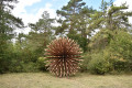
Gros Caillou Route
 7.47 mi
+512 ft
-531 ft
3h 55
Moderate
Departure from Dompcevrin (Meuse)
7.47 mi
+512 ft
-531 ft
3h 55
Moderate
Departure from Dompcevrin (Meuse)
Near the village of Dompcevrin, this 12 km Vent des Forêts hike takes you on a journey of discovery through the Meuse forest, where you can admire various works of art.
Above the Ruisseau de Marsoupe
 5.91 mi
+446 ft
-436 ft
3h 05
Easy
Departure from Saint-Mihiel (Meuse)
5.91 mi
+446 ft
-436 ft
3h 05
Easy
Departure from Saint-Mihiel (Meuse)
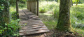
A beautiful walk near Saint-Mihiel on small paths where you can see orchids, a menhir and animals.
Savonnières - Woinville route
 9.61 mi
+938 ft
-925 ft
5h 15
Moderate
Departure from Valbois (Meuse)
9.61 mi
+938 ft
-925 ft
5h 15
Moderate
Departure from Valbois (Meuse)
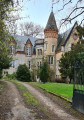
A route combining rural forest landscapes and some interesting monuments from the Great War. There is also a lovely view of the Woëvre plain, Montsec and Lake Madine.
The Crête des Éparges
 4.99 mi
+574 ft
-571 ft
2h 50
Moderate
Departure from Les Éparges (Meuse)
4.99 mi
+574 ft
-571 ft
2h 50
Moderate
Departure from Les Éparges (Meuse)
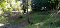
A memorial hike on a site where very deadly battles took place between February and April 1915, considered by some historians to be a prelude to the Battle of Verdun (nearby), which was triggered a year later. Several monuments and numerous remains mark the route, including impressive craters left by huge explosions.
 Tour of Lake Madine from Montsec
 14.76 mi
+233 ft
-253 ft
3 hrs
Moderate
Departure from Montsec (Meuse)
14.76 mi
+233 ft
-253 ft
3 hrs
Moderate
Departure from Montsec (Meuse)
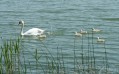
This lake is a reserve with sensitive natural environments, home to a diverse range of flora and fauna.It is a wild environment except on its northern shore, where there are leisure centres that are very pleasant during the summer months, but don't be put off by the crowds and don't hesitate to pay for parking.
Resson Plateau
 5.34 mi
+515 ft
-512 ft
2h 55
Easy
Departure from Bar-le-Duc (Meuse)
5.34 mi
+515 ft
-512 ft
2h 55
Easy
Departure from Bar-le-Duc (Meuse)
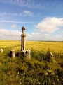
A short route that will take you to the Plateau de Resson. You can enjoy a full 360° panorama.
Old forts, springs, crosses and a chapel on the route from Gironville
 10.93 mi
+1,237 ft
-1,227 ft
6h 05
Moderate
Departure from Geville (Meuse)
10.93 mi
+1,237 ft
-1,227 ft
6h 05
Moderate
Departure from Geville (Meuse)
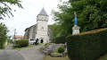
A landscape of woodland and farmland, springs and fountains, old forts, as well as a view of the Euville quarry.
A short sensory trail has been added along the path at point 10
A rest area, as idyllic as you could wish for, near the Gévaux chapel, or in the tranquillity of the Noblanvau valley: lovely picnic areas at both these points.
Please note: We will not be following any permanent signposting. Please follow this description carefully.
Belvédère de Tannois circular
 5.58 mi
+623 ft
-594 ft
3h 05
Easy
Departure from Tannois (Meuse)
5.58 mi
+623 ft
-594 ft
3h 05
Easy
Departure from Tannois (Meuse)
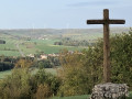
This 9km circular takes you to the Belvédère de Tannois and offers exceptional views over the Ornain valley.
Forêt de la Reine - Lorraine region
 10.16 mi
+52 ft
-52 ft
1.5 hrs
Easy
Departure from Broussey-Raulecourt (Meuse)
10.16 mi
+52 ft
-52 ft
1.5 hrs
Easy
Departure from Broussey-Raulecourt (Meuse)
A beautiful bike ride in the Lorraine Regional Nature Park and, more specifically, the superb Forêt Domaniale de la Reine, which straddles the departments of Meurthe-et-Moselle and Meuse.It is a so-called "wet" forest, containing more than a dozen natural ponds.
Froideterre Fortification, Douaumont Ossuary and Zigzag Trench
 Association / Club / Walk leader
 7.22 mi
+768 ft
-755 ft
4h 00
Moderate
Departure from Bras-sur-Meuse (Meuse)
7.22 mi
+768 ft
-755 ft
4h 00
Moderate
Departure from Bras-sur-Meuse (Meuse)
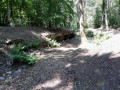
This history-filled route allows you to discover structures, shelters, command posts, entrenchments and an intermediate ammunition shelter still in good condition, as well as some remains of trenches and isolated combat posts.
From the Verdun Memorial to Bezonvaux via Fort Douaumont
 10.83 mi
+840 ft
-833 ft
5h 45
Moderate
Departure from Fleury-devant-Douaumont (Meuse)
10.83 mi
+840 ft
-833 ft
5h 45
Moderate
Departure from Fleury-devant-Douaumont (Meuse)
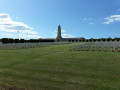
This walk takes you past many ruined structures, a destroyed village, monuments, memorial stones and recently restored trenches. It passes by Fort Douaumont and the Douaumont Cemetery. Look carefully at the ground – you’ll still find plenty of shell fragments and sometimes even whole shells.
Around Douaumont
7.61 mi
+840 ft
-866 ft
4h 15
Moderate
Departure from Fleury-devant-Douaumont (Meuse)
A route steeped in the history of the Great War.This route offers a chance to explore the woods replanted following the 1914–1918 war between France and Germany.There are several historical remains to explore, such as bunkers, shelters and buildings including the Douaumont Ossuary and Fort Douaumont.
Verdun battlefields
5.63 mi
+449 ft
-463 ft
3h 00
Easy
Departure from Fleury-devant-Douaumont (Meuse)
Connect, in 9 km, the memorial, the destroyed village of Fleury, the ossuary, the Zigzag Trench and Fort Douaumont.
Circular of the Côtes from Bazincourt-sur-Saulx
 14.63 mi
+1,227 ft
-1,240 ft
7h 50
14.63 mi
+1,227 ft
-1,240 ft
7h 50
 Difficult
Departure from Bazincourt-sur-Saulx (Meuse)
Difficult
Departure from Bazincourt-sur-Saulx (Meuse)
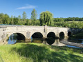
This 24 km circular is quite difficult with an elevation gain of 400 m, hence its name.
Picnic tables are available in all the villages along the route.
The route takes 6 hours (including a picnic). 40% of the route is shaded.
In Stainville, visit the 16th-century Saint-Mathieu Church with its baldachin altar, oil paintings of Christ, the Château de Choiseul and the 19th-century stone fountain.
In the Meuse Argonne, starting from Neuvilly-en-Argonne
 6.79 mi
+328 ft
-344 ft
3h 25
Moderate
Departure from Neuvilly-en-Argonne (Meuse)
6.79 mi
+328 ft
-344 ft
3h 25
Moderate
Departure from Neuvilly-en-Argonne (Meuse)
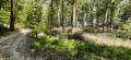
You will discover the Étang des Bercettes, classified as a sensitive natural area, and walk along the Argonais massif.
TheGR®14climbs to reach the Haute Chevauchée. During this hike, you will explore part of the nature trail where you will find all manner of trees, including black walnut and silver fir.
A circular walk starting from Pagny-sur-Meuse
 8.92 mi
+341 ft
-348 ft
4h 25
Moderate
Departure from Pagny-sur-Meuse (Meuse)
8.92 mi
+341 ft
-348 ft
4h 25
Moderate
Departure from Pagny-sur-Meuse (Meuse)
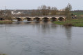
A peaceful walk around the Meuse and Troussey, with the added bonus of crossing the Mazagran Canal Bridge.
The Butte de Vauquois and the Mont des Allieux
3.65 mi
+404 ft
-394 ft
2h 00
Easy
Departure from Vauquois (Meuse)
A historical walk exploring the Butte de Vauquois and the National Necropolis of La Maize. The Battle of Vauquois took place during the First World War. The village was built on the hill of the same name, making it a strategic location. Vauquois is a key site associated with trench warfare, a tactic involving the digging of deep tunnels and the burial of tonnes of explosives within them to cause significant damage on the surface before launching an assault.