Panoramic views of the Côtes de Meuse from Buxerulles

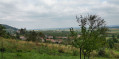
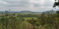
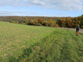
This route takes in the villages of Buxerulles, Buxières-sous-les-Côtes and Woinville. It passes through vineyards, orchards and woodland. It can be regarded as the ‘balcony of the Côtes’, overlooking Lake Madine. There are lovely views over the plain, the Côtes de Meuse and the Montsec hill.

Details

44644341
Creation:
Last update:
Last review:
  • Walking
    Activity: Walking
  • ↔
    Distance: 4.21 mi
  • ◔
    Average duration: 2h 25 
  • ▲
    Difficulty: Easy

  • ⚐
    Back to start: Yes
  • ↗
    Ascent: + 522 ft
  • ↘
    Descent: - 522 ft

  • ▲
    Highest point: 1,283 ft
  • ▼
    Lowest point: 876 ft

Photos

Description of the walk

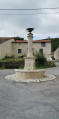
Parking: Round fountain in the centre of the village of Buxerulles, near the church and the town hall.

Signposting: Yellow Rectangle/orange rectangle

(S/E) From the fountain, head west-north-west and walk up the street to join the D908.

(1) Cross the road and follow it to the right for 50 metres, then turn left onto the Chemin des Morts, a pleasant scenic path between woodland and orchards leading towards Buxières-sous-les-Côtes. All along this path, there are lovely views of the Montsec hill to your right. Apple trees and mirabelle plum trees dominate the landscape.

(2) At the entrance to Buxières-sous-les-Côtes, turn left onto Rue de Saint-Mihiel, which soon bends left and ends in a gravel track that climbs the slope.

(3) Follow it to the right; it enters the forest, passes a hairpin bend and joins the Route Stratégique.

(4) Alternative route: At the junction with the Route Stratégique, the orange rectangular sign suggests taking the small path on the left which winds through the forest to rejoin the route a little further on.

Continue along the Strategic Road for about 200 metres.

(5) Turn left into the woodland. After 2 km across the plateau and a few detours (marked with orange rectangles), the path joins a sunken track above the village of Woinville.

(6) Head down to the left along the path, which is sometimes rutted, to reach the village of Woinville.

(7) Just before passing the drinking fountain and the Morinvaux refuge, there is the option of taking a short 300-metre round trip to the right along the small road for a lovely view of the village, the vast plain and, once again, the Montsec hill.
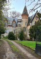
Carry on straight ahead to the central crossroads in the village of Woinville, passing a castle on the way.

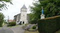
(8) At the junction (with the church opposite on the left), turn left onto the D908 and follow it for about a hundred metres. Turn left between the castle and the town hall and follow the Chemin de la Valotte to the right through the orchards, then along the edge of the forest.

(9) Above Buxerulles, head down to the right to reach the village centre.

(1) Cross the D908 and continue straight on to the fountain and the starting point (S/E).

Waypoints

  1. S/E : mi 0 - alt. 876 ft - Round Fountain
  2. 1 : mi 0.07 - alt. 909 ft - Junction of the circular route – D908 road
  3. 2 : mi 0.7 - alt. 942 ft - Crossroads – Buxières-sous-les-Côtes
  4. 3 : mi 0.89 - alt. 1,030 ft - Junction leading to the forest
  5. 4 : mi 1.35 - alt. 1,253 ft - Strategic Route
  6. 5 : mi 1.53 - alt. 1,257 ft - Junction with a forest track
  7. 6 : mi 2.56 - alt. 1,214 ft - Junction towards Woinville
  8. 7 : mi 3.03 - alt. 919 ft - Fountain in Woinville
  9. 8 : mi 3.12 - alt. 892 ft - D908 road – Saint-Pierre Church (Woinville)
  10. 9 : mi 4.04 - alt. 991 ft - Junction towards Buxerulles
  11. S/E : mi 4.21 - alt. 876 ft - Round Fountain

Notes

Fountain and picnic table in Buxerulles at (S/E)
Fountain and picnic table in Woinville at (7)

Reviews and comments

4.8 / 5
Based on 3 reviews

Reliability of the description
5 / 5
Ease of following the route
5 / 5
Route interest
4.3 / 5
sdenis90
sdenis90

Overall rating : 5 / 5

Date of your route : Jul 20, 2026
Reliability of the description : ★★★★★ Very good
Ease of following the route : ★★★★★ Very good
Route interest : ★★★★★ Very good
Very busy route : No

We started the circular route in Woinville (car park opposite the ‘museum’ area).
There are ‘shortcuts’ available to avoid heading back down into the villages and to stay at the same level as the vineyards
Plenty of points of interest (signs pointing out old military structures, panoramic views, etc.)
We had an IGN map but didn’t need to use it as the path was so well signposted.

Machine-translated

Randonneur lorrain
Randonneur lorrain

Overall rating : 4.7 / 5

Date of your route : Aug 24, 2025
Reliability of the description : ★★★★★ Very good
Ease of following the route : ★★★★★ Very good
Route interest : ★★★★☆ Good
Very busy route : No

A beautiful hike with views of Montsec and the Meuse hills at the start and end, otherwise you are in the forest most of the time.
The path is well marked, with possible detours to see some remains from the First World War (field altar, command post, etc.), with additional signage.

Machine-translated

potamo
potamo

Overall rating : 4.7 / 5

Date of your route : Mar 12, 2025
Reliability of the description : ★★★★★ Very good
Ease of following the route : ★★★★★ Very good
Route interest : ★★★★☆ Good
Very busy route : No

a pleasant, easy walk

Machine-translated

Other walks in the area

For more walks, use our search engine .

The GPS track and description are the property of this route's author. Please do not copy them without permission.