


Refine your search for walks in Lac du Pontet
Lac du Pontet walks


 The Pontet Lake
 Association / Club / Walk leader
 2.34 mi
 +778 ft
 -778 ft
 1h 45
 Easy
 Departure from Villar-d'Arêne (Hautes-Alpes)
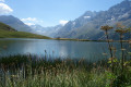
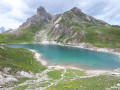
Le Pontet is a magnificent turquoise lake above the hamlet of Les Cours, near Villar d'Arêne. You can get close to it by car, but the walk from Les Cours is very pleasant and, depending on the season, you may see edelweiss and marmots.
Le Pied du Col - Lac du Pontet - L'Aiguillon
 Visorando Member
 7.66 mi
+1,834 ft
-1,824 ft
5h 05
 Moderate
Departure from Villar-d'Arêne (Hautes-Alpes)
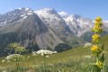
This hike is accessible to all without any particular difficulty and allows you to walk with the magnificent panorama of the Meije glaciers as a backdrop.
What's more, the remarkable exposure of the circuit and its relatively modest altitude mean that this loop can be completed as soon as the snow melts.
Moderator's note added on 26/07/2021: please note that part of this circuit is no longer passable. See reviews for an alternative route
Lac du Pontet and Aiguillon
 3.74 mi
+735 ft
-761 ft
2h 20
Easy
Departure from Villar-d'Arêne (Hautes-Alpes)
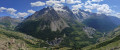
This route is more of a "stroll" than a "hike": first a beautiful little mountain lake that is easy to access, then a small peak with a magnificent view of the Meije massif to the south and the Goléon to the north.
This is the shortest and easiest route to discover these two tourist attractions.
Walks near Lac du Pontet
La Grave – Goléon Mountain Hut
4.72 mi
+3,271 ft
-108 ft
5h 00
 Difficult
Departure from La Grave (Hautes-Alpes)
The idea behind this three-day self-supported trek is to link the Goléon massif to the Grandes Rousses massif via the ridges to the north of the Plateau d’Emparis.
It’s a wild hike requiring not only good physical fitness but also the ability to read maps and the terrain.
Thefirst day is just a warm-up.
From Goléon to Les Grandes Rousses: La Grave / Clavans
86.50 mi
+29,537 ft
-26,375 ft
3 days
 Very difficult
Departure from La Grave (Hautes-Alpes)
From the Goléon massif to the Grandes Rousses massif, via the ridges between Emparis and Arves.A multi-day hike, with a bivouac, along the ridges between Emparis and Arves.
La Grave - Alpe de Villar-d'Arêne mountain hut
 6.87 mi
+2,618 ft
-669 ft
5h 25
Difficult
Departure from La Grave (Hautes-Alpes)
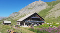
After a rest day in La Grave, set off on this8th stage, which presents no technical difficulties and involves no significant elevation gain. A route that circles La Meije, initially following the Romanche torrent. You will pass close to Villar d'Arène. Thesecond section, starting from Pont d'Arsine, is slightly more challenging and much wilder, taking in the Pas d'Anna Falque and the Plan d'Alpe before reaching the Refuge de l'Alpe de Villar-d'Arêne, which offers breathtaking views of the surrounding mountains.
From the Col du Lautaret to the Alpe de Villard d'Arène
 3.99 mi
+463 ft
-315 ft
2h 15
Moderate
Departure from Villar-d'Arêne (Hautes-Alpes)
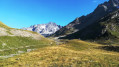
Stage1 of the Tour du Combeynot: From the Col du Lautaret to the Alpe de Villar-d'Arêne refuge via the schistose crevasse trail overlooking the Romanche valley. Unique view of the Écrins and Meije peaks.
The Combeynot Circuit in 4 stages
 24.21 mi
+5,413 ft
-5,344 ft
4 days
Moderate
Departure from Villar-d'Arêne (Hautes-Alpes)
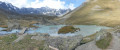
Set against a backdrop of rocks and glaciers, beneath the peaks of the Agneaux, Pic Gaspard and La Meije (3,983 m), the route winds its way through mountain pastures, larch forests and mountain hamlets. Whether along the Romanche or the banks of the Guisane, biodiversity unfolds with every step. With breathtaking views, the trail takes you on a journey through tradition and the high mountains.
From Alpe de Villard-d'Arène to Monêtier-les-Bains
9.74 mi
+1,289 ft
-3,261 ft
5h 35
Moderate
Departure from Villar-d'Arêne (Hautes-Alpes)
Stage2 of the Tour du Combeynot: From the Romanche to the Guisane Valley via the Col d'Arsine, this stage takes place at the foot of the Agneaux
Alpe de Villar d'Arêne Mountain Hut - Monêtier-les-Bains
 9.66 mi
+1,266 ft
-3,271 ft
5h 35
Difficult
Departure from Villar-d'Arêne (Hautes-Alpes)
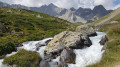
Stage9 of this route links the Refuge de l’Alpe de Villar-d’Arêne to Monêtier-les-Bains, taking a short detour to the Lac du Glacier d’Arsine, surrounded by the Pics de Chamoissière, d’Arsine, de Neige Cordier, the Pointe Cézanne and the Montagne des Agneaux. Unfortunately, the Arsine Glacier is suffering from global warming. The section starting from the pass along the Petit Tabuc stream in the valley, known as the Réou d'Arsine, is magnificent and very wild.
Lac de la Ponsonnière – Refuge des Drayères
 5.88 mi
+640 ft
-1,909 ft
3h 15
Moderate
Departure from Le Monêtier-les-Bains (Hautes-Alpes)
This second, slightly easier stage takes us past four magnificent lakes: Lac des Cerces, Lac du Grand Ban, Lac Rond and Lac de la Clarée
From Le Lauzet to the Col du Lautaret
4.19 mi
+1,325 ft
-26 ft
3h 05
Moderate
Departure from Le Monêtier-les-Bains (Hautes-Alpes)
Stage4 of the Tour du Combeynot: from the Guisane Valley to the Col du Lautaret
Lac des Cerces - Lacs de la Madeleine via Pointe des Cerces
 7.84 mi
+3,963 ft
-3,261 ft
8 hrs
Very difficult
Departure from Valloire (Savoie)
Day 2 in the Clarée Valley: ascent of Pointe des Cerces (unmarked mountain route), passage to Lac and Source de la Clarée and climb to the second bivouac at Lacs de la Madeleine (off-trail on the final section).
As with the other parts of this circular, this route is intended for experienced hikers who are accustomed to high mountains.