


Refine your search for walks in Lac de Roburent
Lac de Roburent walks


 Lake Roburent
 Visorando Member
 8.29 mi
 +2,195 ft
 -2,198 ft
 5h 45
 Moderate
 Departure from Larche (Alpes-de-Haute-Provence)
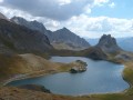
One of the most beautiful lakes in Haute-Ubaye. An easy hike with a slightly steep start, but it can be shortened if necessary.
Monte Scaletta via the Roburent lakes
 10.08 mi
+3,550 ft
-3,543 ft
7h 45
 Difficult
Departure from Larche (Alpes-de-Haute-Provence)
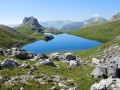
A magnificent and very varied hike, offering superb panoramic views of numerous peaks and lakes.
Numerous military remains bear witness to the strategic importance of this summit (bunkers, shelters, tunnels, cable car with the wheel still in place).
The return route, equipped with chains and handrails on a fairly short section, then follows a splendid balcony path in a dolomitic landscape.
This is an aerial route, so you must not be prone to vertigo.
Lake Roburent via the Feuillas and Scaletta passes
 13.34 mi
+5,312 ft
-5,302 ft
8 hrs
 Very difficult
Departure from Larche (Alpes-de-Haute-Provence)
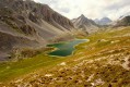
A beautiful, long hike combining mountain passes (Feuillas and Scaletta), lakes (Orrenaye and Roburent) and fortifications straddling the border between France and Italy.
Walks near Lac de Roburent
Col de Larche – Rifugio della Gardetta
 10.06 mi
+4,019 ft
-2,877 ft
8h 10
Difficult
Departure from Larche (Alpes-de-Haute-Provence)
On this fourth day, you’ll head briefly back into France to walk through the Orrenaye valley with its magnificent lake. You’ll return to Italy at the Col du Ruburent, then enjoy the beauty of Lake Ruburent as you walk around it. You’ll cross the very rocky Passo della Scaletta, which contrasts with the mountain pastures as you climb to the Passo della Gardetta.
Gardetta Mountain Hut – Marmora
 11.77 mi
+1,906 ft
-5,551 ft
7h 05
Difficult
Departure from Canosio (Cuneo)
On this sixth day, you’ll walk alongside Rocca la Meja, then cross two magnificent passes (Ancoccia and del Mulo). Along the way, you’ll come across many more structures from the Vallo Alpino. The long descent into the valley offers a chance to relax by the shores of Lake Resile. You’ll then need to pass through the many small hamlets that make up Marmora before arriving at the Locanda Ceaglio.
Bacchi Rossi Refuge - Vens Lakes Refuge
 4.60 mi
+2,359 ft
-807 ft
4h 10
Moderate
Departure from Argentera (Cuneo)
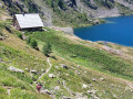
On thissecond day of the Tour of Mount Aiga from the Ferrere Refuge, you will pass through Plan de Belvédère, where there is a tin shelter overlooking the Rio Forneris valley and a fountain. You will also pass below Lake Emma, Monte Peiron at 2,796 m and Pointe Testa di Garbe at 2,749 m, to arrive, after a few hairpin bends, at Col de Fer at 2,584 m. You will then head towards Small Pass of Tortisse and the Vens Refuge, the end of this stage.
Larche - Saint-Dalmas-le-Selvage
17.35 mi
+5,102 ft
-5,633 ft
12h 25
Difficult
Departure from Larche (Alpes-de-Haute-Provence)
Étape de la traversée des Alpes par le GR®5 de Larche à Saint Dalmas le Selvage. Passage dans le Parc National du Mercantour sauvage et authentique puis transition entre la Haute Tinée et le Vallon de Jalorgues avec un passage sur la plus haute route d'Europe vers le Col de la Bonnette.
Larche – Chiappera
 Association / Club / Walk leader
 10.20 mi
+3,369 ft
-3,494 ft
7h 35
Difficult
Departure from Larche (Alpes-de-Haute-Provence)
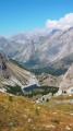
This stage will take you to the pretty Vallon de la Montagnette, then on to the Col des Monges, which offers a stunning view of the Southern Alps.
Campo Base mountain hut – Saint-Ours
 10.65 mi
+3,799 ft
-3,412 ft
7 hrs
Very difficult
Departure from Acceglio (Cuneo)
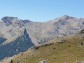
A lovely walk that begins with a steep, winding climb followed by a descent offering remarkable views.
Trek around Chambeyron Mountain Range (5) Refuge Campo Base - Larche
9.01 mi
+3,560 ft
-3,451 ft
7h 15
Very difficult
Departure from Acceglio (Cuneo)
Last stage of this trek around Chambeyron mountain range, taking you back to France through Col de Sautron. You'll find yourself in superb wildlife setting when arriving at the pass.
Chiappera - Chambeyron Refuge
 7.10 mi
+4,344 ft
-1,145 ft
6 hrs
Very difficult
Departure from Acceglio (Cuneo)
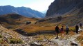
A lovely stage featuring a beautiful climb to the Stroppia Waterfall and the Lac des Neuf Couleurs.
Ussolo - Chialvetta
 8.68 mi
+3,747 ft
-3,199 ft
7h 15
Difficult
Departure from Prazzo (Cuneo)
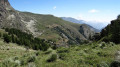
On this fourth day, you will continue along the left bank of the Maira. At Punta Culour, the highest point on this bank, a magnificent view to the west over the peaks on the border with France awaits you. You will then descend back down to the Maira river at Acceglio to cross over to the other bank. You will climb up the Unerzio valley to reach Chialvetta.
Small pass of Tortisse – Cime du Fer – Saint-Étienne-de-Tinée
 9.23 mi
+1,955 ft
-6,621 ft
5h 55
Difficult
Departure from Saint-Étienne-de-Tinée (Alpes-Maritimes)
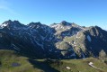
Before descending back to Saint-Etienne-de-Tinée, you climb to the Cime du Fer (2,700 m), which offers a superb 360° view, notably of the Tête de Moïse (3,104 m) and the magnificent Mont Viso (3,841 m).
Then we descend alongside the Tortisse torrent before heading back towards the Lacs de Vens and climbing up to the Lac des Babarottes.
We continue along a section of the Chemin de l’Énergie until we catch sight of Mont Ténibre.
We then finish with a long descent (-1,200 m) down to the village.