Country:

 City:


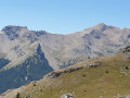
(S) Leave the refuge, take the tarmac road running alongside the campsite, pass through the village of Chiappera, then head down towards the forest.
(1) Leave the tarmac road, turn right and enter the forest, following the sign for the Col de Sautron.
(2) Follow the path through the woodland, taking care when crossing the small bridges to avoid the wet areas. The path then climbs gently in a series of hairpin bends.
(3) Carry on straight ahead, ignoring the path on the left which leads back down. You’ll come to a spring.
(4) Set off along a series of gentle hairpin bends, cross a cow pasture, and remember to close the gate behind you.
(5) Reach the top of the path, head straight ahead (marked by a tree stump on a rock), then continue to a water source.
(6) Continue straight ahead and, after a climb, reach the spring known as Sorgente del Baciasse.
(7) Carry on along the path, which becomes even steeper; pass a bivouac on your left.
(8) Continue up the steep climb, passing an engraved stone with text in Italian. Complete the ascent at the Col du Sautron, the Franco-Italian border pass.
(9) Descend towards Larche; you’ll soon reach the junction marked ‘Sous le col’.
(10) Keep to the left of theGRP®, passing the signposts for ‘l’Isalette’ and then ‘Pré La Font’.
(11) Turn right, follow the Ruisseau de Rouchouse and reach the hamlet of L’Ausse Blanche.
(12) Carry on, passing close to a blockhouse at the ‘Point d’appui 2018’ marker. Continue and turn right at the next junction to reach the ‘Plateau de Mallemort’ marker.
(13) Continue downhill along an easy path through the grass, but without trees, to reach the Plateau de Mallemort.
(14) Cross the ravine, then continue along theGRP® trail, following its yellow and red markings. You will come to the junction marked ‘Pré du Jas’.
(15) Then turn right onto the route from Day1 and head for Fort de Saint-Ours.
(16) Continue along theGRP® to reach the car park at the Gite-Auberge de Saint-Ours (E), marking the end of this 3-day tour.
The description must end with a reference to the finishing point: (E) for a point-to-point walk, (S/E) for a circular route.

 Visorando Member
 Association / Club / Walk leader
 Difficult