Refine your search for walks in Lac de Castillon
Lac de Castillon walks


 The Barre du Pidanoux starting from Saint-Julien-du-Verdon
 Visorando Member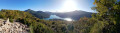
 4.30 mi
 +1,017 ft
 -1,017 ft
 2h 50
2h 50
 Moderate
 Departure from Saint-Julien-du-Verdon (Alpes-de-Haute-Provence)
The Barre du Pidanoux hike overlooks Lake Castillon and the village of Saint-Julien-du-Verdon. It offers exceptional panoramic views.
Note: The entire hike is marked with yellow lines.
The Pic de Chamatte, starting from Vergons
 8.95 mi
+2,815 ft
-2,815 ft
6h 35
8.95 mi
+2,815 ft
-2,815 ft
6h 35
 Difficult
Departure from Vergons (Alpes-de-Haute-Provence)
Difficult
Departure from Vergons (Alpes-de-Haute-Provence)
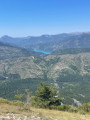
A very lovely walk leading to the Pic de Chamatte at an altitude of 1,879 metres. This walk may prove challenging due to the elevation gain for inexperienced walkers. However, there are no technical sections. Only the descent requires a sense of direction. The path, although marked on the map, is barely visible in places. From the summit, a magnificent 360° view awaits you, taking in the Mercantour, the Verdon massifs and Lac du Castillon.
Issole Forest Circular Route
 6.79 mi
+994 ft
-1,010 ft
4h 00
Moderate
Departure from Saint-André-les-Alpes (Alpes-de-Haute-Provence)
6.79 mi
+994 ft
-1,010 ft
4h 00
Moderate
Departure from Saint-André-les-Alpes (Alpes-de-Haute-Provence)
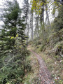
A lovely walk through the Issole State Forest, planted with magnificent pine trees.Throughout the walk, the gradient is gentle, on a path that’s very easy on the joints and which occasionally alternates with a forest track; both are always very well signposted.
Walks near Lac de Castillon
Castellane - Senez
 11.17 mi
+2,454 ft
-2,270 ft
7h 15
Difficult
Departure from Castellane (Alpes-de-Haute-Provence)
11.17 mi
+2,454 ft
-2,270 ft
7h 15
Difficult
Departure from Castellane (Alpes-de-Haute-Provence)
Route Napoléon via theGR®® 406 – Stage 4/6: Castellane – Senez
Senez - La Clappe
11.85 mi
+2,703 ft
-1,837 ft
7h 50
Difficult
Departure from Senez (Alpes-de-Haute-Provence)
Route Napoléon via theGR®® 406 - Stage 5/6: Senez - La Clappe.
From Allons station to Fugeret station
 8.90 mi
+1,975 ft
-2,349 ft
5h 50
Moderate
Departure from Allons (Alpes-de-Haute-Provence)
8.90 mi
+1,975 ft
-2,349 ft
5h 50
Moderate
Departure from Allons (Alpes-de-Haute-Provence)
This allows you to use the ‘Train des Pignes’ as a means of exploring the area whilst hiking, by changing valleys. The route runs partly through former farmland and partly through mixed woodland (with remarkable trees during the descent towards Fugeret).
Three sections, three landscapes:1/ from the station to the village of Allons,2/ from the village to La Basse d’Annot,3/ from the ridge to Fugeret station.
From Blieux to the Mont Chiran Observatory via the Mourre de Chanier
 10.30 mi
+4,626 ft
-1,542 ft
8h 45
10.30 mi
+4,626 ft
-1,542 ft
8h 45
 Very difficult
Departure from Blieux (Alpes-de-Haute-Provence)
Very difficult
Departure from Blieux (Alpes-de-Haute-Provence)
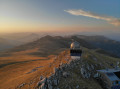
First stage of the circular route from the village of Blieux to the Mont Chiran Observatory. You’ll climb gradually towards the ridges to tackle the day’s peaks: the Mourre de Chanier (1,930 m), the highest point of the stage, the Petit Mourre (1,873 m) and the Grand Mourre (1,898 m), before reaching the Mont Chiran Observatory (1,905 m). The panoramic views stretch out over Lake Sainte-Croix, the Verdon and the surrounding mountain ranges, including the Mercantour. Arrival at the observatory marks the end of this first day, with a welcome water source for the campsite.
The village of Peyresq
 10.25 mi
+2,674 ft
-2,582 ft
7h 00
Difficult
Departure from Thorame-Haute (Alpes-de-Haute-Provence)
10.25 mi
+2,674 ft
-2,582 ft
7h 00
Difficult
Departure from Thorame-Haute (Alpes-de-Haute-Provence)
A journey on the Train des Pignes. An acrobatic river crossing and the magnificent village of Peyresq with its sweeping views.
Saint-Auban - Le Mas
 8.61 mi
+1,444 ft
-1,827 ft
5h 15
Moderate
Departure from Saint-Auban (Alpes-Maritimes)
8.61 mi
+1,444 ft
-1,827 ft
5h 15
Moderate
Departure from Saint-Auban (Alpes-Maritimes)
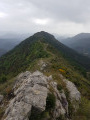
The final stage of the hike in the Haut-Estéron region; this route mainly follows tracks through the woodland before reaching the ridge of Mount Charamel, which is well worth the detour in its own right: the view is sublime. You then descend gently back down to the village of Le Mas.
From the Mont Chiran Observatory to Blieux
 8.28 mi
+636 ft
-3,711 ft
4h 20
Moderate
Departure from Blieux (Alpes-de-Haute-Provence)
8.28 mi
+636 ft
-3,711 ft
4h 20
Moderate
Departure from Blieux (Alpes-de-Haute-Provence)
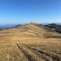
Second stage of the circular route from Blieux to Mont Chiran. You leave the Mont Chiran Observatory and follow the ridges northwards towards L’Hauteur (1,777 m), the day’s highest point. After taking in the views of the Mercantour and the Observatory, you’ll gradually descend towards the Col de Reibert (1,464 m) and then follow the long stony track back to the village of Blieux. A day with a gentler elevation gain, but still very open and offering a change of scenery, which brings this tour of the Verdon peaks to a magnificent close.
Gueydan Bridge – Entrevaux via the summit of La Lette
 10.68 mi
+3,665 ft
-3,845 ft
8h 05
Difficult
Departure from Saint-Benoît (Alpes-de-Haute-Provence) (Alpes-de-Haute-Provence)
10.68 mi
+3,665 ft
-3,845 ft
8h 05
Difficult
Departure from Saint-Benoît (Alpes-de-Haute-Provence) (Alpes-de-Haute-Provence)
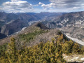
A beautiful, challenging route that keeps you on the ridgelines. The C-shaped configuration of the Var means that throughout this ascent you can admire the river’s banks on both the north and south sides. At the end of the hike, wander through the narrow streets lined with old walls in this magnificent village.