Chiran Observatory

Explore the Chiran Observatory, setting off from Majastre, the least populated commune in the Provence-Alpes-Côte d’Azur region, with just 5 year-round residents.

Details

n°2064889
Creation:
Last update:
Last review:
  • Walking
    Activity: Walking
  • ↔
    Distance: 8.39 mi
  • ◔
    Average duration: 6h 45 
  • ▲
    Difficulty: Difficult

  • ⚐
    Back to start: No
  • ↗
    Ascent: + 3,340 ft
  • ↘
    Descent: - 3,284 ft

  • ▲
    Highest point: 6,191 ft
  • ▼
    Lowest point: 3,720 ft
  • ⚐ Country: France
  • ⚐
    Area: Alps
  • ⚐ City: Majastres (04270)
  • ⚑
    Start: N 43.912699° / E 6.289239°
  • ⚑
    End: N 43.913904° / E 6.289153°
  • ❏
    IGN map(s): Ref. 3441OT, 3442OT, 3442OTR
  • Hour-by-hour weather

Photos

Description of the walk

This route may be a first of its kind, as there are no markings along the entire route. Most of the paths do not even appear on the IGN map. Park at the exit of the village of Majastres (5 to 6 spaces).
Warning! This walk is not signposted and requires you to be able to find your way when there is no obvious path.

(S/E) Set off due south along the forest track.

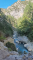
(1) A first waterfall below catches your eye. Continue along the track, which climbs steadily until you reach a brand-new hut on the left.

(2) Then head due east up the slope, which rises steeply through the heath and pine trees until you come to a black pipe; follow this until it branches off due south.
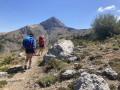
From there, continue the ascent, which will be very difficult over the scree, navigating by sight with your eyes fixed on a pass that emerges along the Crête du Chiran (elevation 1,729).

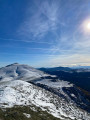
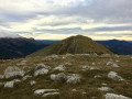
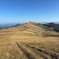
(3) The rest of the walk will be more gentle along the ridge, with a superb panorama from the summit of Chiran (1,825 metres).

(4) Descend through the mountain pastures, keeping the observatory – which is already visible – in your sights.

(5) We pass by a reservoir, then face another gradual climb which ends with our arrival at the observatory.

(6) We are welcomed by the refuge warden (an astronomy enthusiast) who gives us a tour of the 360° view, a visit to the observatory and a chance to view the sun through a telescope.
We head back down, passing by the orientation table, heading due north with the Peire Naisse hut in our sights.

(7) From there, continue north-north-east. The route is well marked, with a few cairns here and there.

(8) When you reach a crossroads (elevation 1233), head due south, following the yellow markings to Majastres (S/E).

Waypoints

  1. S : mi 0 - alt. 3,720 ft - Majastres
  2. 1 : mi 0.85 - alt. 3,930 ft - Waterfall
  3. 2 : mi 1.65 - alt. 4,131 ft - Mountain hut
  4. 3 : mi 2.56 - alt. 5,653 ft - Crête du Chiran
  5. 4 : mi 2.92 - alt. 5,971 ft - Summit of Chiran
  6. 5 : mi 3.54 - alt. 5,574 ft - Reservoir
  7. 6 : mi 4.31 - alt. 6,191 ft - Observatory - Le Chiran (1905 m)
  8. 7 : mi 5.37 - alt. 5,052 ft - Peire Naisse Hut
  9. 8 : mi 8.15 - alt. 4,042 ft - Crossroads
  10. E : mi 8.39 - alt. 3,776 ft - Majastres

Notes

No special equipment is required for this hike; there are a few streams.

Please note! Some paths may be difficult to follow. The Visorando app, or a hiking GPS, may be useful.
Part of the route is available on the OSM (world) base map

Worth a visit

Listening to the refuge warden talk – you never tire of it… According to him, from the observatory, you can see a quarter of France!!!
360° view
Lake Sainte-Croix

Reviews and comments

3.3 / 5
Based on 4 reviews

Reliability of the description
2.8 / 5
Ease of following the route
2.7 / 5
Route interest
4.5 / 5
User 16894976

Overall rating : 4 / 5

Date of your route : Nov 24, 2025
Reliability of the description : ★★★☆☆ Average
Ease of following the route : Not used / Not applicable
Route interest : ★★★★★ Very good
Very busy route : No

A splendid but very difficult hike.

Regarding point 1: don't bother, just follow the road to the hut without going through the heath.
The climb is arduous but not dangerous. The scree is tiring but if you take your time, you can climb it.
Once you reach the top, the view is simply exceptional.
However, bear in mind that the return journey is just as difficult as the ascent, but downhill and with tired legs from the climb. The signs are quite difficult to follow, especially as there was snow everywhere when we were there, making it impossible to find your way without GPS. If, like us, you are on the side of a cliff, turn your back to the cliff and climb up to the left for 40 metres: you will be on the path.

Machine-translated

philkikou
philkikou

Overall rating : 4 / 5

Date of your route : Aug 15, 2023
Reliability of the description : ★★★★☆ Good
Ease of following the route : ★★★★☆ Good
Route interest : ★★★★☆ Good
Very busy route : No

I did the route in the opposite direction, up to point 4. I spotted some chamois early in the morning whilst following the ridges. The herd was further away and had been warned off by the shepherdess. A fairly peaceful and pleasant 5 km round trip starting from the Mont-Chiran refuge.

Machine-translated

henri57
henri57 ★
• Edited:

Hello,

Thank you for taking the time to share your feedback.

It’s true that there’s no marked path from the hut to point no. 2. We followed the directions to climb through the forest, past the broom and over the scree slopes up to the ridge. This section is more like ‘scrambling’ than a proper hike.

It’s stated clearly in the route description; see the copy below

The route for this walk may be a first of its kind, as there are no markings along the entire route. Most of the paths do not even appear on the IGN map. Park at the exit of the village of Majastres (5 to 6 spaces).
Warning! This walk is not signposted and requires you to be able to find your way when there is no obvious path.

===========================

It is best to start in the opposite direction to the route and, if necessary, head up towards the ridge between points 8 and 7 across the pastures to reach point 3

This is just a suggestion; it may well be a good alternative.

==========================
Please note:

Reliability of the description: Very disappointing
Reliability of the route on the map: Disappointing

Weren’t you being a bit harsh?

See you soon

Machine-translated

PASCALOU27
PASCALOU27
• Edited:

Overall rating : 2.3 / 5

Date of your route : Aug 20, 2019
Reliability of the description : ★☆☆☆☆ Very disappointing
Ease of following the route : ★★☆☆☆ Disappointing
Route interest : ★★★★☆ Good

This walk is not recommended for the outward leg. In fact, there is no marked path from the hut to point no. 2. We followed the signposts to climb through the forest, over the broom bushes and across the scree slopes up to the ridge. This section is more like ‘trudging’ than a proper hike. As a result, the fatigue caused by this climb prevents us from fully enjoying the scenery upon reaching the ridge. It is better to start the walk in the opposite direction to the route and, if necessary, climb up to the ridge between points 8 and 7 through the pastures to reach point 3. Also, watch out for sheepdogs (Patous and others) guarding the flock around the reservoir. Despite our wide, precautionary detour, the dogs rushed towards us and we had to follow the instructions provided to reassure them (stand still, sit down if necessary, place your walking poles on the ground, ignore the dogs and wait for them to move away).
We received a warm welcome at the observatory refuge, but we were unable to enjoy the view due to a sudden storm.
The descent followed the planned route, heading towards the sheepfold and following the few cairns along the path. We spotted a few chamois on the way back.

Machine-translated

doudou04180
doudou04180
• Edited:

Overall rating : 3.3 / 5

Date of your route : Jul 12, 2019
Reliability of the description : ★★★☆☆ Average
Ease of following the route : ★★☆☆☆ Disappointing
Route interest : ★★★★★ Very good

Hike completed on 11/0/19
The route back to Majastre is really very complicated – the trail must have been made by a wild boar
I wouldn’t recommend this route
Regards

Machine-translated

Other walks in the area

For more walks, use our search engine .

The GPS track and description are the property of this route's author. Please do not copy them without permission.