Castellane - Senez

Route Napoléon via theGR®® 406 – Stage 4/6: Castellane – Senez

This walk is part of a multi-day hike: Route Napoléon de Grasse à Digne-les-Bains

Details

n°4015074
Creation:
Last update:
Last review:
–
  • Walking
    Activity: Walking
  • ↔
    Distance: 11.17 mi
  • ◔
    Average duration: 7h 15 
  • ▲
    Difficulty: Difficult

  • ⚐
    Back to start: No
  • ↗
    Ascent: + 2,454 ft
  • ↘
    Descent: - 2,270 ft

  • ▲
    Highest point: 4,052 ft
  • ▼
    Lowest point: 2,333 ft
  • ⚐ Country: France
  • ⚐
    Area: Alps
  • ⚐ City: Castellane (04120)
  • ⚑
    Start: N 43.845963° / E 6.512925°
  • ⚑
    End: N 43.914193° / E 6.406109°
  • ❏
    IGN map(s): Ref. 3441OT, 3442OT, 3442OTR, 3542OT
  • Hour-by-hour weather

Photos

Description of the walk

(S) Setting off from the Ma Petite Auberge hotel: on leaving the hotel, turn left, then take a left onto Rue des Aires. Follow the Verdon river to the right to reach the Chemin des Hautes Listes. Continue along this path until you reach the Montée de la Salau junction.

(1) Turn right onto this road; you’ll soon reach the junction with the D952. Turn right off the D952 straight away to take the road leading to the Porte des Gorges du Verdon campsite. Continue on this road, passing a chapel, until you reach the Colle junction.

(2) From here, turn right onto theGR®®406, marked with red and white signs, and begin a steep climb. At a hairpin bend to the right, join the forest track. Further on, you’ll reach another junction near the hamlet of Brayal.

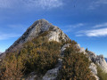
(3) Leave the track on your right and continue left along theGR®®. After a steep climb, you’ll reach the Rocher du Castel du Ruel crossroads.

(4) Carry on straight ahead, still on theGR®®; on this stretch, it shares the route with a yellow-markedPR®®, and, after an easy descent, you’ll reach the Passages junction.

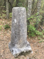
(5) Turn left onto theGR®® for a gentle climb to a new four-way junction marked by a boundary stone.

(6) Turn almost 90° to the right to head downhill. Further down, you’ll reach the hamlet of Les Cirigiers. Continue along theGR®® to reach the archaeological site near Les Jacons (see § During the walk).

(7) Carry on straight ahead along theGR®® to quickly reach the D4085, also known as the Route Napoléon.

(8) Turn left onto it, taking great care, to reach the crossroads at the hamlet of Le Logis.

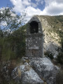
(9) Leave the road here and turn left onto theGR®®, beginning a short climb to cross the hamlet of Le Logis. Continue along the winding path to reach the Oratoire Saint-Pierre, where you can enjoy a superb view (see details in the ‘During the walk’ section).

(10) Pass beneath the mobile phone mast and continue down a long descent, then reach the crossroads at Bois de Saint-Pierre.

(11) Pass the Ancienne Route Napoléon on your left and turn right onto theGR®®. Continue along this path, then take a left-hand bend onto the D21 road to reach the Pont de Blieux.

(12) Cross the Ruisseau de l’Asse de Blieux, then walk very slightly uphill to reach a crossroads just before the hamlet of La Lampie.

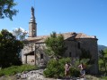
(13) Head straight ahead and stay on theGR®® to reach Senez and the Azimut municipal lodge (E), today’s stop.

Waypoints

  1. S : mi 0 - alt. 2,362 ft - Catellane Hôtel Ma Petite Auberge. Near the - Verdon (rivière)
  2. 1 : mi 0.93 - alt. 2,339 ft - Carrefour Montée de la Salau
  3. 2 : mi 1.55 - alt. 2,474 ft - Carrefour de la Colle
  4. 3 : mi 2.32 - alt. 2,887 ft - Bayral
  5. 4 : mi 3.63 - alt. 4,052 ft - Rocher du Castel du Ruel
  6. 5 : mi 4.25 - alt. 3,740 ft - Les Passages
  7. 6 : mi 4.77 - alt. 3,950 ft - Carrefour - Borne
  8. 7 : mi 5.53 - alt. 3,530 ft - Archaeological excavations
  9. 8 : mi 5.78 - alt. 3,458 ft - D4085
  10. 9 : mi 6.06 - alt. 3,432 ft - Le Logis
  11. 10 : mi 6.77 - alt. 3,740 ft - Oratoire Saint Pierre
  12. 11 : mi 7.46 - alt. 3,360 ft - Bois de Saint Pierre
  13. 12 : mi 8.91 - alt. 2,677 ft - Pont de Blieux
  14. 13 : mi 10.52 - alt. 2,726 ft - Les Aires
  15. E : mi 11.17 - alt. 2,549 ft - Senez Lodge L'Azimut

Notes

Duration: 7 hours 15 minutes

(S) Provisions: Before leaving the village, we bought a packed lunch from the bakery next to the hotel – a good selection of sandwiches, pizzas, quiches, etc. – as we hadn’t spotted any places to stock up along the way.

(E) Accommodation for night 4 in Senez at the Lodge de l’Azimut
Telephone: 04 74 43 67 13.
A community-run lodge managed by friendly and attentive young people. Very high standard: recently renovated, opened in June 2020, high-quality materials, spacious rooms, modern showers and organic products. A special mention for the managers, who opened the lodge for us even though it was their day off. To help us out, they also prepared a delicious cold meal for us in the evening, which we enjoyed on the terrace. Highly recommended, even for a longer stay.

Worth a visit

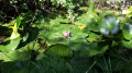
Between points (2) and (3), I didn’t think to note the exact spot at the time, but there is a charming little pond by the side of the track, on the left, containing some beautiful water lilies in bloom when we passed through in September. Not to be missed.
(4) Finally, we arrive at the Rocher du Castel de Ruel, where we rejoin a wide path: thePR®®. It forms a circular route starting from the Col de Lèques on the D 4085. It’s a fairly well-used route.
(5) We pass a small group heading up towards the Col de Lèques and then on to Les Siréniens, a site famous for its fossils – mermaids, according to legend, though our fellow walkers reckon they’re more likely to be manatees. Yes indeed, the sea used to be here a very long time ago!
(7) As we emerge from the woods, in the field to the left, we come across a group of about six or seven people busy with an archaeological dig. Very kindly, the site manager explains the significance of the site to us and shows us some flint tools dating from the Upper Palaeolithic (-30,000 years). Above all, he explained why this site had been chosen for the dig, as to us novices, the location seemed completely unlikely.
Between (8) and (9) Against all expectations – thanks to a minor slip-up by our supplies manager – upon reaching the D 4085 we found a snack bar called Le Bivouac, which we’d unfortunately missed earlier. We were able to eat our sandwiches sitting at a table on the terrace; the owner gave us a very warm welcome. We drank some beers – which we later regretted on the climb – ate ice creams and hot crêpes, and finished off with a good coffee. In fact, it has everything you need for a good meal; do check beforehand as it’s only open in season. So there’s no need to bring your own sandwiches.
(10) From the oratory, there’s a superb view of the Clue de la Roche Percée, a rock with a hole through it through which the Route Napoléon (D 4085) passes below. There’s a magnificent view of the Taulane and Sant Peire gorges on the other side.

Always be cautious and plan ahead when you're outdoors. Visorando and the author of this route cannot be held responsible for any accidents occurring on this route.

The GR® and PR® markings are the intellectual property of the Fédération Française de Randonnée Pédestre.

Other walks in the area

For more walks, use our search engine .

The GPS track and description are the property of this route's author. Please do not copy them without permission.