


 Country:

 City:
City:


Make sure you fill your water bottles before setting off: there are no water sources for much of this stage (none for thefirst 10 km).
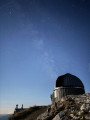
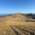
(S) Leave the Mont Chiran Observatory through the entrance gate and immediately take the path on your right, heading north, away from the Blieux gate. The path is poorly marked, consisting mainly of 4x4 tracks leading up towards the ridges and the Bergerie du Chiran hut.
(1) Pass between the Bergerie du Chiran and the water reservoir, then continue below the ridges towards L’Hauteur. The path is almost non-existent, but the terrain is relatively flat, allowing you to cut across the field.
(2) Cross a small ravine without difficulty and rejoin a more clearly marked path. You’ll see a scree slope at the bottom of a gap in the ridge line below L’Hauteur.
(3) As soon as the pass is aligned with the summit of l’Hauteur, leave the path to the right and cut across the field to the summit. The climb is not technically difficult despite the elevation gain: the rocks are stable, so proceed at a steady pace.
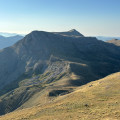
(4) Pass through the gap. Go slightly round the summit to the left to begin the ascent from the rear. Complete the ascent along the ridges to the right. You will reach the summit of the Hauteur (1,777 m).
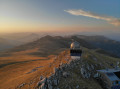
(5) The highest point of the day. Enjoy the view of the Mercantour to the north-east and the Mont Chiran Observatory to the south, which you left this morning. Descend via the same route and head right towards the 4x4 track heading north-east.
(6) Step over the small cattle fence and join the 4x4 track. Follow it downhill until you rejoin the stony track. Once on the stony track, you’ll reach the Col de Reibert (1,464 m).
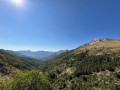
(7) Take the track on the right. You’ll follow the valley all the way, with the peaks you climbed the day before on your right.
(8) Pass the Reibert signpost (1,460 m) indicating that Blieux is 7.5 km away (approximately 2 hours). Continue along this same track until you reach the entrance to the village. You’ll rejoin the tarmac road to Blieux.
(9) Pass the Bas Chaudoul signpost (965 m) indicating Blieux is 40 mins / 2 km away (your car is actually only 1.4 km away). Arrive at the car park at the entrance to the village of Blieux (E).
 Visorando Member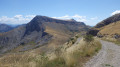
 Very difficult
  Difficult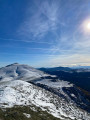
 Easy
Easy 
