Country:
 City:


(S) Leave Coignières station via the car park exit (north-west).
GR® white and red signposting
At the roundabout, turn right, then immediately cross at the pedestrian crossing to follow a path opposite that runs behind the supermarket. Pass under the N10, turn left, then turn right onto Rue des Étangs, which runs past the town hall.
(1) At the junction, turn left onto Allée des Pommiers, following the boundary wall: there is a marker on either side at the start. At the end of the wall, you’ll come to a gate in the wire fence, which can be opened: there’ s a ‘Private Property’ sign, but there is a right of way for the GR®. Follow the signs for ‘public footpath’ and enter the Bois des Hautes Bruyères.
No signposting
(2) Leave the GR®11, turn left and cross the embankment of the Petit Étang, then turn right and walk alongside the Grand Étang. rejoin the GR®11.
GR® markings: white and red
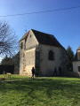
(3) Follow it straight on. Turn left once you reach the edge of the woodland and enter Saint-Rémy-l’Honoré. At the first houses, turn right onto the street leading to the church.
(4) Take the road (D34) on the left, pass the town hall, then take the first right onto Rue Saint-Nicolas, heading towards Les Mesnuls. Continue for about 150 metres, then, after No. 6, turn right onto a path that runs between two fences.
(5) Cross a road at La Lombarderie and take Rue de la Cour aux Pineaux opposite. Once you reach the left-hand bend, head onto the path that branches off to the right. Enter the Bois de la Côte and climb up onto the plateau. You’ll come to a large crossroads.
(6) Turn left, head back down from the plateau and arrive at another crossroads, just before reaching the tarmac road. Take the path on the right and, after 500 metres, turn left, staying on the GR®11. Just under a kilometre further on, you’ll reach a GR® junction.
(7) Follow the one heading left. On the descent, continue along the small road leading to the property to the right of the Rocher Marquant andarrive at the Maison de Jean Monnet: a good spot for a picnic.
End of GR® signposting
(8) Take the street on the left. At the junction, turn left; then, 50 metres further on, at the T-junction, turn right onto Rue de la Buissonnerie. Walk past the Brigitte Bardot Foundation, cross the Pont des Ganche, where the street becomes a farm track. Continue straight on, passing under a high-voltage power line, until you reach the corner of a hedge.
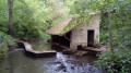
(9) Turn right onto a dirt farm track. When you reach a road, turn left again. At the first junction, at the end of Chemin des Fontenelles, in the village of Les Mesnuls, turn right (Rue de Beauregard), pass a wash house and arrive at a crossroads opposite the town hall.
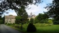
(10) Turn left onto the D191 (Allée des Tilleuls), then turn left again and you’ll reach the church. Leave the road to go round the church on the right, then follow the paths through the park to rejoin the Allée des Tilleuls, opposite the château. Turn left in front of the gate.
(11) Turn immediately right onto Rue du Moulin. Walk alongside a pond on your left until you reach aT-junction at a place called Le Jardin.
(12) Follow the road to the right for about fifty metres, then turn left onto a track running alongside a power line. This dirt track joins a tarmac road; continue straight on along it until you reach a gate.
(13) Take the path that climbs sharply to the left. When you reach a major crossroads, turn left towards the west.
Resume following the GR® markings
(14) Cross a road, then after 100 m, follow the narrow path on the right along the edge of the woods. Take the street on the right before the first house and you’ll reach a star-shaped junction at the entrance to the rugby ground.
No signposting
(15) Continue along the road opposite for 250 m, then take the path on the right to visit the Henry IV Camp Marker. Continue along the path to the crossroads on the edge of the Étang de la Plaine, turn sharply right and return to the star-shaped crossroads.
GR®°°®°° signposting resumes
(15) Follow the Route de Château Gaillard straight ahead (towards the town centre) until you reach Montfort-l’Amaury. At the junction, turn right (Rue de Sancé), then turn left at the next junction. Continue for about thirty metres.
(16) Take the steps on Ruelle Boutet which lead up to the left. Walk past the Maison de Maurice Ravel and continue left along the street of the same name until you reach number 23.
(17) Take the steps on the right, then climb to the top of the hill where Montfort-l’Amaury Castle stands (several routes available): superb 360° views.
Head back down the north side and emerge onto Rue Saint-Laurent.
No signposting
Ignore Rue Maurice Ravel and turn right towards Saint-Pierre Church.
(18) Head down Rue de Paris to the left, then take the second right onto Rue Amaury. Continue until you reach Place Robert Brault with its monument and a large sequoia.
(19) Head left to take the passageway at the far end of the square. When you reach a narrow street (Allée des Sycomores), turn right and join Rue de Ronchamp.Cross the road and head for the bus stop on the other side, 50 metres to the left (E).

 Visorando Member

 Easy
 Difficult