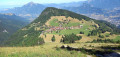
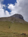
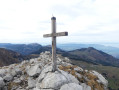
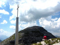
The Pointe d’Areu as seen from Romme

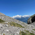
This round-trip route, which is challenging due to its length, will take you to a summit in the Aravis offering exceptional views over the Arve Valley, the Mont Blanc massif and the Pointe Percée.

Details

n°64908176
Creation:
Last update:
Last review:
  • Walking
    Activity: Walking
  • ↔
    Distance: 9.67 mi
  • ◔
    Average duration: 8h 00 
  • ▲
    Difficulty: Very difficult

  • ⚐
    Back to start: Yes
  • ↗
    Ascent: + 4,078 ft
  • ↘
    Descent: - 4,065 ft

  • ▲
    Highest point: 8,005 ft
  • ▼
    Lowest point: 4,226 ft

Photos

Description of the walk

Head to the village of Romme; park in the centre, in a car park on the right as you approach from Cluses.

(S/E) From the car park, walk up the road towards Le Reposoir, then, after 100 m, turn left onto the Chemin de Vormy.

(1) At the bend in the track, take the path signposted “Téléski – grand tour”. It soon branches off to the left towards the ski lift. Climb the hairpin bends, following the ski lift until you reach the Piste de Vormy.
Continue up this track, passing a hairpin bend until you reach a pathhead to the right of the top of the ski lift.

(2) A wooden sign points the way to Vormy. Take the path on the right towards Porzet. After a 200-metre climb, you’ll rejoin the Piste de Vormy.

(3) Follow the track uphill for about 50 m, then turn left onto a barely visible path, which will cross the track a little further up.

(4) Back on the track, follow it to the right: it goes round the Tête de la Sallaz. Further on, the track levels out and begins to descend.

(5) Leave the track to the right, taking a path that is more or less level.

(6) Further on, the path veers to the left; the descent begins with a short, easy rocky section,
then, on level ground, leads to “la Gueule à Vent” (signpost).

(7) Continue towards the Pointe du Château, then on to the Tête du Château.

(8) Pass the Tête du Château and the Col de la Forclaz on your right, then continue climbing.

(9) On a flat section (signpost), take the footpath. Cairns mark the route along the ridge to the summit of the Pointe d’Areu.

(10) The return journey follows the same route as the outward journey. If you still have some energy left, you can, as shown on the map, head to the summit of the Tête du Château (cross) from this point (8), then rejoin the descent path by following the ridge. You can then follow the same route back to Romme (S/E).

Waypoints

  1. S/E : mi 0 - alt. 4,226 ft - Village of Romme – car park on the left in the centre
  2. 1 : mi 0.36 - alt. 4,472 ft - Head towards the Grand Tour ski lift
  3. 2 : mi 0.88 - alt. 5,180 ft - Vormy via Porzet (sign)
  4. 3 : mi 1.19 - alt. 5,840 ft - Turn right at Porzet towards the Pointe d’Areu
  5. 4 : mi 1.36 - alt. 6,083 ft - Back on the track, turn right
  6. 5 : mi 2.11 - alt. 6,526 ft - Leave the Chemin de Vormy – pass beneath La Sallaz
  7. 6 : mi 2.68 - alt. 6,585 ft - Start of a descent
  8. 7 : mi 3.29 - alt. 6,591 ft - Col de - La Gueule à Vent
  9. 8 : mi 4.28 - alt. 7,461 ft - Near the - Tête du Chateau (Aravis)
  10. 9 : mi 4.57 - alt. 7,779 ft - Start of the ridge at the point
  11. 10 : mi 4.75 - alt. 7,995 ft - Summit of the Pointe d’Areu
  12. S/E : mi 9.67 - alt. 4,229 ft - The village of Romme

Notes

No markings, just a few signs and signposts.
Mountain route – ensure you have suitable kit.
No technical difficulties.

This route passes through multiple protected areas, which may be subject to special regulations:

Reviews and comments

5 / 5
Based on 1 review

Reliability of the description
5 / 5
Ease of following the route
5 / 5
Route interest
5 / 5
User 7011941

Overall rating : 5 / 5

Date of your route : Jun 23, 2025
Reliability of the description : ★★★★★ Very good
Ease of following the route : ★★★★★ Very good
Route interest : ★★★★★ Very good
Very busy route : No

A challenging hike with 1,200 metres of elevation gain, though by no means impossible; the view at the top is simply incredible.
I drank 3.5L/4L of water over the course of the day during a heatwave
Just to clarify, the finish is at the Pointe des Ardennes; the Pointe d’Areu is 200 metres further on, following a very narrow ridge covered in loose scree with a 400-metre drop on either side
A very quiet walk

Machine-translated

Other walks in the area

For more walks, use our search engine .

The GPS track and description are the property of this route's author. Please do not copy them without permission.