From Le Reposoir to the Refuge du Doran via the Pointe d’Areu

Set off from Le Reposoir and spend the night at the Refuge du Doran, passing via the Pointe d’Areu (des Arbennes).

This walk is part of a multi-day hike: Les Pointes d'Areu et la Pointe Percée en deux jours

Details

22985178
Creation:
Last update:
Last review:
  • Walking
    Activity: Walking
  • ↔
    Distance: 6.19 mi
  • ◔
    Average duration: 6h 40 
  • ▲
    Difficulty: Difficult

  • ⚐
    Back to start: No
  • ↗
    Ascent: + 4,383 ft
  • ↘
    Descent: - 3,077 ft

  • ▲
    Highest point: 7,992 ft
  • ▼
    Lowest point: 3,602 ft

Photos

Description of the walk

Set off from the Lanche car park at Le Reposoir.

(S) Follow the Petit Foron stream on your right through the Bois de Mery (the path is rather poorly signposted and quite steep). On leaving the woods, head left uphill to the hamlet of Méry.

(1) Continue climbing to La Gueule au Vent.

(2) Turn right and continue to the summit of Champ Fleuri, keeping the Pointe du Château on your right.

(3) Carry on along the ridge on the right to reach the Tête du Château.

(4) Continue the ascent until you reach a fork in the path.

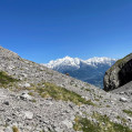
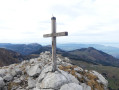
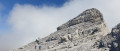
(5) Turn left for a round trip to the Pointe d’Areu (des Arbennes). Impressive 360° views of the Alps.

(6) Return via the same route to the previous fork.

(5) Continue to the left, skirting the cliffs on your left, and reach the Col de la Forclaz.

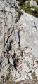
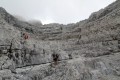
(7) Carry on straight ahead and begin the descent from the Col de la Forclaz towards Doran. This is a very tricky descent, with handrails at the start to help you, though these may still be covered in snow in early summer. The scree slope is quite steep. After this long descent, you’ll reach the Refuge du Doran (E).

Waypoints

  1. S : mi 0 - alt. 3,609 ft - La Lanche car park at Le Reposoir. Follow the - Foron du Reposoir (cours d'eau) - Affluent du Giffre
  2. 1 : mi 2.06 - alt. 5,692 ft - Méry
  3. 2 : mi 2.95 - alt. 6,608 ft - La Gueule à Vent
  4. 3 : mi 3.55 - alt. 7,169 ft - Champ Fleuri
  5. 4 : mi 3.97 - alt. 7,457 ft - Tête du Chateau (Aravis)
  6. 5 : mi 4.25 - alt. 7,789 ft - A/R junction
  7. 6 : mi 4.42 - alt. 7,982 ft - Pointe des Arbennes/Areu
  8. 7 : mi 4.74 - alt. 7,605 ft - Col de la Forclaz (2324m)
  9. E : mi 6.19 - alt. 4,915 ft - Refuge de Doran (1495m)

Notes

(2) It’s possible to climb to the top of the Pointe du Château. Allow an hour for the ascent.

(3) Champ Fleuri is an ideal spot for a bite to eat.

You can stay overnight at the Refuge du Doran, which is brilliant, and have a meal at the Col des Annes on thesecond day.

There’s still snow in early June, which can make certain sections tricky, such as after the Col de la Forclaz.

As for kit, we each had a 50-litre rucksack containing 5 litres of water, our sleeping bags and some snacks.

To ensure your safety at certain points, don’t hesitate to take walking poles and a rope.

Reviews and comments

4.9 / 5
Based on 3 reviews

Reliability of the description
5 / 5
Ease of following the route
4.7 / 5
Route interest
5 / 5
User 13857771

Overall rating : 5 / 5

Date of your route : Jul 21, 2026
Reliability of the description : ★★★★★ Very good
Ease of following the route : ★★★★★ Very good
Route interest : ★★★★★ Very good
Very busy route : Yes

A magnificent but challenging hike, particularly the descent from the Col de la Forclaz towards Doran over unstable scree. Not suitable for children under 10 years of age

Machine-translated

Cyril.la.marmotte.70

Overall rating : 5 / 5

Date of your route : Jul 06, 2026
Reliability of the description : ★★★★★ Very good
Ease of following the route : ★★★★★ Very good
Route interest : ★★★★★ Very good
Very busy route : No

A one-day hike; experienced hikers should take care due to the elevation gain. A superb route offering magnificent scenery

Machine-translated

User 21208654

Overall rating : 4.7 / 5

Date of your route : Jul 17, 2025
Reliability of the description : ★★★★★ Very good
Ease of following the route : ★★★★☆ Good
Route interest : ★★★★★ Very good
Very busy route : No

A magnificent hike through varied landscapes. A long climb through forests, alpine pastures and ridges, followed by a dizzying descent through the Forclaz corridor

Machine-translated

Other walks in the area

For more walks, use our search engine .

The GPS track and description are the property of this route's author. Please do not copy them without permission.