Pointe des Arbennes via the Méry chalets

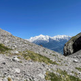
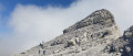
A lovely hike to reach the Pointe des Arbennes. The magnificent 360° panorama is a wonderful reward: the Fiz, Mont Blanc, the Aravis and the Bargy. A route with no technical sections, but one whose length and elevation gain justify its ‘Difficult’ rating. Watch out for snow near the summits at the start of the season.

Details

3902187
Creation:
Last update:
Last review:
  • Walking
    Activity: Walking
  • ↔
    Distance: 9.67 mi
  • ◔
    Average duration: 7h 45 
  • ▲
    Difficulty: Difficult

  • ⚐
    Back to start: Yes
  • ↗
    Ascent: + 3,825 ft
  • ↘
    Descent: - 3,796 ft

  • ▲
    Highest point: 7,995 ft
  • ▼
    Lowest point: 4,219 ft

Photos

Description of the walk

Take the D119 from Cluses and pass through the village of Romme towards Le Reposoir. 1.9 km after leaving the village, park in the car park at the start of the Méry forest track, which is located in a bend on the right.

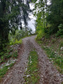
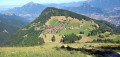
(S/E) Take the forest track leading to the Méry chalets. The climb, which is fairly steady, takes you through a mixed forest of conifers and deciduous trees. You’ll start with a series of tight hairpin bends, followed by a straighter stretch of path to reach the Méry chalets, where you’ll join theGR®96.

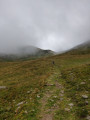
(1) Turn left onto it and continue along thisGR® trail, which starts with a steep climb through the mountain pastures. A gentler slope leads to the Col de la Gueule à Vent.

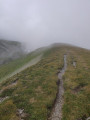
(2) Leave theGR®96here and turn right onto the grassy ridge path, which you follow.

(3) Turn right at the junction with the Champ Fleuri ridges. Further on, you’ll reach the sloping scree slope beneath the Tête du Château.

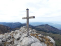
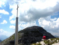
(4) Cross this scree slope and continue on; keep left at the junction, leaving the Col de la Forclaz path on your right. A final steep section through the grass leads you to the top of the Col de la Forclaz. Then begin the final, fairly steep section of the climb, over scree and sharp limestone pavement, following the cairns. This will take you to the
summit of the Pointe des Arbennes, marked by a cross.

(5) Return via the same route to the car park on the Méry forest track (S/E).

Waypoints

  1. S/E : mi 0 - alt. 4,219 ft - Car park on the Méry forest track
  2. 1 : mi 2.51 - alt. 5,689 ft - Chalet de Méry
  3. 2 : mi 3.37 - alt. 6,611 ft - La Gueule à Vent
  4. 3 : mi 3.97 - alt. 7,192 ft - Champ Fleuri
  5. 4 : mi 4.32 - alt. 7,457 ft - Pierrier Tête du Château
  6. 5 : mi 4.85 - alt. 7,986 ft - Pointe des Arbennes
  7. S/E : mi 9.67 - alt. 4,242 ft - Car park on the Méry forest track

Notes

The only water source is at the start of the walk, at the Méry chalets.
Between (S/E) and (1), the forest still bears traces of the 2018 storm in some places.
(2) From the Col de Gueule à Vent, the path follows the ridges, which can be windy and shrouded in cloud. Make sure you pack suitable clothing.
A significant part of the walk is unmarked: it’s advisable to bring a GPS device for accurate positioning, or the Visorando app. As this is a popular walk, you’re unlikely to be on your own.

Worth a visit

With a bit of luck, you’ll spot some wildlife: roe deer in the woods, chamois and ibex near the Col de la Forclaz and the summit. And plenty of cows in the mountain pastures.
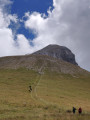
The peaks above the Col de la Forclaz serve as a launch site for paragliders brave enough to make the climb.
(5) Pointe d’Arbennes: from here you can make out the Pointe d’Areu further away, which is not easily accessible and is not recommended for casual walkers.

Always be cautious and plan ahead when you're outdoors. Visorando and the author of this route cannot be held responsible for any accidents occurring on this route.

The GR® and PR® markings are the intellectual property of the Fédération Française de Randonnée Pédestre.

Reviews and comments

5 / 5
Based on 2 reviews

Reliability of the description
5 / 5
Ease of following the route
5 / 5
Route interest
5 / 5
karkad
karkad

Overall rating : 5 / 5

Date of your route : Sep 09, 2023
Reliability of the description : ★★★★★ Very good
Ease of following the route : ★★★★★ Very good
Route interest : Not used / Not applicable
Very busy route : No

A lovely walk with varied scenery, quite rocky in the final section. I made my way back without going down via the pass, but by following the ridge directly along the mountain pasture fence (a faint track), passing by the Pointe du Château; I then joined the path further down whilst still following the ridge, which allowed me to complete a circular route.
Plenty of raspberries in the woodland section – yum!
I didn’t want to try heading to the Pointe d’Areu on my own – the rock looked far too crumbly. Clouds were rising from the summit and disappearing straight away – such a magical atmosphere!

Machine-translated

rdunky
rdunky

Overall rating : 5 / 5

Date of your route : Jul 21, 2022
Reliability of the description : ★★★★★ Very good
Ease of following the route : ★★★★★ Very good
Route interest : ★★★★★ Very good
Very busy route : No

This walk is a wonderful stroll along easy paths.
From the chalets at Mery, the views are magnificent and change as you progress, with the final view being a lovely surprise.
The walking time is around 5½ hours for an average walker.
There are no vertiginous sections.

Machine-translated

Other walks in the area

For more walks, use our search engine .

The GPS track and description are the property of this route's author. Please do not copy them without permission.