Country:

 City:
City:


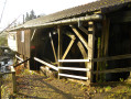
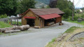
Car park at the municipal sawmill (junction of Quartier de la Gonfle and Rue de Chauveroche).
Red Disc markings
(S/E) Cross the river and pass close to the sawmill. Head straight up the street towards La Planche des Belles Filles. At the end of the street, turn left towards the Col du Querty and continue until you reach the first house.
(1) Follow the track to the right. Pass a second house and keep to the right, through the woodland, on a steeply sloping path. You’ll come to a third building at Les Prés Bourbets.
(2) Carry on straight ahead towards the pass. The slope is still quite steep. The path then branches off to the left and levels out before reaching the Col du Querty.
(3) Turn right. At the next junction, the signposting has been changed: do not take the track to the right, but follow the Red Disc path which branches off to the left. At the fork in the road, continue to the right and follow a hairpin bend until the next junction: head up to the left towards the Chaume du Querty. Keep to the right all the way to the Chaume.
(4) Cross the Chaume du Querty, following a steeply sloping path offering views of the surrounding area. Pass the buildings on your right to re-enter the forest and reach the Roche Fendue crossroads.
Blue Triangle signposting
(5) Turn left towards La Planche des Belles Filles. Then head right towards the summit, where you’ll find a memorial stone, a map post and picnic tables.
No signposting
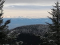
(6) Enjoy the view over part of the Vosges. Then head back down the grassy path (with your back to the orientation table), taking care on the steep slope. This path is used as a ski run in winter. Keep to the left until you reach the mountain refuge.
(7) Walk along the road to the right until you reach the hairpin bend, near a restaurant and a treetop adventure park.
(8) Follow the track that starts between the two and joins a path.
Green Rectangle signposting
Carry on straight ahead twice along the track. After the second junction, it climbs and reaches a barrier: carry on. Keep following it straight ahead until you reach a Green Triangle trail which starts on the right (here too, the markings have changed compared to the IGN maps).
(9) Carry on straight ahead to cross the Ruisseau du Creux des Fougères. Ignore a track on the right to reach a second one.
Blue Saltire signpost
(10) Turn right towards the Refuge de la Grande Goutte.
Yellow Disc markings
(11) There is a hut here with a fireplace and a table. Follow the path starting on the left just after the table. Then follow the track opposite and keep right twice to climb a slope and reach the ridge.
(12) At the Fork in the road, continue to the right towards the ‘Blue Ring’ trail: turn right, then take a left-hand bend (the ‘Blue Ring’ trail shown on the maps as branching off to the right has been diverted). At the end, you’ll reach the Col du Ballon.
Unmarked
(13) There are plenty of places to eat. The summit isn’t far for those who want to enjoy the lovely views. Cross the road carefully and follow it to the right along a path leading to the Auberge du Ballon d’Alsace. At the inn’s car park, head up the track to the left until you reach a hairpin bend.
Red Rectangle markings
(14) Head down through the stubble fields alongside the road until you reach a Fork in the road.
Blue Disc markings
(15) Turn right, cross a car park and follow a track. After a bend, leave the track and turn right into the woods, then left twice to stay alongside the road. You’ll reach the Chaumière ski lift.
(16) Head down to the right towards the road and cross it carefully. Head towards the Étang du Petit Haut, cutting across an abandoned track, then a second one after a hairpin bend. The path becomes increasingly stony as you approach the pond.
(17) Walk along the left-hand side of the pond, then head down to the left along the Savoureuse. The descent is technical but offers views of the waterfalls.
(18) Continue the descent and cut across a track onto a steeply sloping path leading to the Saut de la Truite.
(19) Take in the scenery, then cross the main road again with care to take the path on the left at a bend. This path winds along the valley. Then follow the path on the right, which crosses a track before becoming a dirt track; follow this to a car park.
GR® signposting
Cross over to take the Saut de la Cuvotte path.
(20) There’s a chance to go for a swim. Continue along the path. At the busy departmental road, first turn left then right for a final descent: carry on straight ahead towards Lepuix. Keep heading in this direction until you reach the road and the sports ground.
(21) Pass the sports ground and, immediately after a wood, follow theGR® 5 to the left. On reaching La Savoureuse, follow the river downstream and keep heading in the same direction until you reach the road.
Green Ring signposting
Turn left to reach a junction. Turn right towards the church.
(22) Leave the church on your right and carry on straight ahead until you reach the car park (S/E).

 Local authority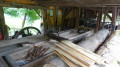
 Difficult
 Visorando Member
 Moderate