The Beucinière circular walk to Lepuix at the foot of the Ballon d’Alsace

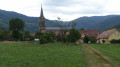
A lovely circular walk starting from Lepuix. You’ll discover a charming village with a beautiful church, an old sawmill that’s almost still in working order, and the Priory of Saint-Benoît de Chauveroche.

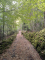
The walk takes place mainly through woodland. The cool, refreshing atmosphere is particularly welcome on hot summer’s days.

This route is signposted.

Details

3120703
Creation:
Last update:
Last review:
  • Walking
    Activity: Walking
  • ↔
    Distance: 5.49 mi
  • ◔
    Average duration: 4h 00 
  • ▲
    Difficulty: Moderate

  • ⚐
    Back to start: Yes
  • ↗
    Ascent: + 1,696 ft
  • ↘
    Descent: - 1,696 ft

  • ▲
    Highest point: 3,340 ft
  • ▼
    Lowest point: 1,644 ft

Photos

Description of the walk

Lepuix, which is easily accessible, is situated near the road from Belfort to the Ballon d’Alsace. Starting point: Rue de la Beucinière or near the church.

Marked on the Green Ring trail.

(S/E) Head due north along Rue de l’Église, following the River Savoureuse and the D495 as they wind down from the Ballon d’Alsace. The church is on the left.

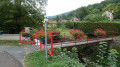
(1) After 150 m, turn left onto Rue du Moulin. Do not cross the footbridge over the Savoureuse. That is a different walk marked with a Blue Ring: the Mont Jean circular walk, which is also available on Visorando.
Walk behind the cemetery and you’ll reach Rue de la Charrière.

(2) Turn left onto this street and then immediately right to cross the Quartier de la Côte. The Green Ring signposting is very helpful. Walk up the street and continue along the path that enters the forest.

(3) At the junction, carry on straight ahead along the Route Forestière Quartier de la Côte. 200 m further on, turn left, following the signposts.

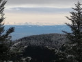
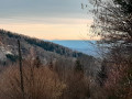
(4) You’ll reach a crossroads on a flat stretch offering stunning views. Continue along the path on the right, carefully following the signposting northwards.

(5) At the crossroads, take the sharp left-hand bend and follow the path downhill.
Note: the path marked with a Green Triangle leads to the Col de la Rougerie. If you have time, this could make for an interesting round trip.
At the next junction, take thethird turn on the right. Walk alongside the Beucinière stream, keeping to the higher ground above it. At the junction after four hairpin bends, continue straight ahead. Walk along the left bank of the Beucinière.

(6) At the forest track, continue downhill. At the next junction, turn left, staying on the left bank of the Beucinière. 100 m further on, turn right onto the path between the stream and the forest track.

(7) Turn left onto Rue de Chauveroche. At the next junction, marked by a fine cross, carry straight on.

(8) Continue to the right along Rue de Chauveroche.
Note: the road on the left leads to the Priory of Saint-Benoit de Chauveroche. A very pretty chapel and lovely grounds.
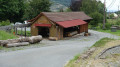
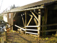
At the next crossroads is the former Demouge sawmill. Turn left and continue along Rue de Chauveroche.

(9) Carry on straight ahead along Rue de l’Église; do not cross the Ruisseau des Belles Filles. Admire the wash house, the town hall and the church, which are close to the starting point (S/E).

Waypoints

  1. S/E : mi 0 - alt. 1,644 ft - Rue de la Beucinière, Lepuix
  2. 1 : mi 0.1 - alt. 1,644 ft - Rue du Moulin, near the footbridge - Savoureuse (rivière)
  3. 2 : mi 0.32 - alt. 1,670 ft - Rue de la Charrière
  4. 3 : mi 0.76 - alt. 2,116 ft - Forest road, Quartier de la Côte
  5. 4 : mi 1.48 - alt. 2,792 ft - Replat
  6. 5 : mi 2.51 - alt. 3,337 ft - Green Ring – Green Triangle Crossroads
  7. 6 : mi 3.77 - alt. 2,211 ft - Forest track beside the Beucinière stream
  8. 7 : mi 4.55 - alt. 1,824 ft - Rue de Chauveroche
  9. 8 : mi 4.83 - alt. 1,762 ft - Saint-Benoît Priory
  10. 9 : mi 5.07 - alt. 1,693 ft - Rue de l'Église
  11. S/E : mi 5.49 - alt. 1,644 ft - Rue de la Beucinière, Lepuix

This route passes through a protected area, which may be subject to special regulations:

Worth a visit

In Lepuix, mines rich in lead, copper and silver were worked as far back as the Middle Ages. They were later replaced by weaving mills.

The Demouge sawmill in Lepuix
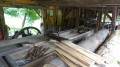
A water-powered sawmill dating from 1878, it is now owned by the local council. The sawing mechanism uses water channelled via an overhead wooden aqueduct to drive a bucket wheel. This method of harnessing water is ancient and was the main source of power for mining operations and mills.

The Priory of Saint-Benoît in Chauveroche
This is a monastic priory of the Order of Saint Benedict, founded in 1980. During the week, the community welcomes individuals or groups who wish to share in their prayer and daily life.

Reviews and comments

5 / 5
Based on 1 review

Reliability of the description
5 / 5
Ease of following the route
5 / 5
Route interest
5 / 5
User 20761615

Overall rating : 5 / 5

Date of your route : Mar 02, 2026
Reliability of the description : ★★★★★ Very good
Ease of following the route : ★★★★★ Very good
Route interest : ★★★★★ Very good
Very busy route : No

Thank you for this very comprehensive information from VisoRando. I plan to go on these hikes very soon.

Machine-translated

Other walks in the area

For more walks, use our search engine .

The GPS track and description are the property of this route's author. Please do not copy them without permission.