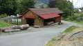
The Étang des Belles Filles from Chauveroche via Le Querty

This route starts at a place called Chauveroche in the Beucinière valley in Lepuix-gy.
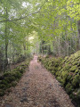
Above the Col du Querty, it follows a lovely forest track that allows you to stroll at the foot of the Planche des Belles Filles and the Ballon Saint-Antoine. This track leads to the shaded Étang des Belles Filles, and the return journey follows the stream of the same name.

Details

n°16099753
Creation:
Last update:
Last review:
  • Walking
    Activity: Walking
  • ↔
    Distance: 5.40 mi
  • ◔
    Average duration: 3h 40 
  • ▲
    Difficulty: Moderate

  • ⚐
    Back to start: Yes
  • ↗
    Ascent: + 1,362 ft
  • ↘
    Descent: - 1,365 ft

  • ▲
    Highest point: 3,022 ft
  • ▼
    Lowest point: 1,726 ft

Photos

Description of the walk

There is a large car park at the junction of ‘Quartier de la Gonfle’ and ‘Chauveroche’ streets in Lepuix.

(S/E) Turn left, heading north-west, onto thePR® trail marked with a Red Disc for about 300 m.

(1) ThePR® turns left and enters the Forêt des Sombres Mousseux. Follow it for about 2 km to the Col du Querty crossroads.

(2) Turn right onto thePR®, following the same markings towards La Chaume du Querty. About 400 m further on, the path meets a forest track (elevation 889 on the IGN map).

(3) Turn right onto the forest track and stay on it for about 3 km. This takes you round the east side of the Planche des Belles Filles to the crossroads, just before the bridge over the Ruisseau des Belles Filles.

(4) Head up to the left and reach the bank of the Étang des Belles Filles. Walk a few dozen metres to the right, along the bank, to take in the scenery and find a path on your right.

(5) Take this path to quickly return to the junction before the bridge.

(4) Follow thePR® marked with a Red Disc once more. Head down the path to the south-east, alongside the stream. Further on, the path approaches the stream. Continue to the right and rejoin the forest track.

(6) Turn left at the bend and continue along thePR®. It rejoins the forest track near a bridge over the stream. Cross the bridge, leave the forest track and turn right onto the opposite bank; you’ll soon reach a water intake point and a road.

(7) Carry on straight ahead, still heading south-east, along the road (Rue de Chauveroche), following the same signposting. The village and the car park are straight ahead, about 1.1 km away (S/E).

Waypoints

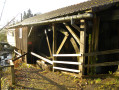
  1. S/E : mi 0 - alt. 1,729 ft - Former communal sawmill
  2. 1 : mi 0.2 - alt. 1,795 ft - Entrance to the Sombres Mousseux forest
  3. 2 : mi 1.5 - alt. 2,730 ft - Col du Querty (833m)
  4. 3 : mi 1.74 - alt. 2,923 ft - Junction with the forest road
  5. 4 : mi 3.69 - alt. 2,927 ft - Thalweg of the Ruisseau des Belles Filles - Ballon Saint-Antoine
  6. 5 : mi 3.83 - alt. 3,018 ft - Étang des Belles Filles
  7. 6 : mi 4.36 - alt. 2,454 ft - Forest track
  8. 7 : mi 4.7 - alt. 1,932 ft - At the foot of La Beucinière
  9. S/E : mi 5.4 - alt. 1,729 ft - St Benoît Priory

Notes

Walking poles are very useful for the descent from the pond to the bottom of the valley, from (5) to (7).

This route passes through a protected area, which may be subject to special regulations:

Always be cautious and plan ahead when you're outdoors. Visorando and the author of this route cannot be held responsible for any accidents occurring on this route.

The GR® and PR® markings are the intellectual property of the Fédération Française de Randonnée Pédestre.

Reviews and comments

3.7 / 5
Based on 2 reviews

Reliability of the description
5 / 5
Ease of following the route
4 / 5
Route interest
2 / 5
Stephkl1
Stephkl1

Overall rating : 3.3 / 5

Date of your route : Sep 23, 2024
Reliability of the description : ★★★★★ Very good
Ease of following the route : ★★★★☆ Good
Route interest : ★☆☆☆☆ Very disappointing
Very busy route : No

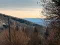
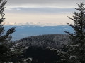
It started with a very steep 1½-hour climb; even the dog was struggling by the end. This was followed by a perfectly ordinary pond, of no particular interest. Then a steep 1½-hour descent – a real strain on the joints. The whole route was through woodland, with no views.
In short, there’s nothing to it apart from the physical challenge.

Machine-translated

bouledjouidja rabah
bouledjouidja rabah

Hello, “super” Walker
It’s true that the trails sometimes take on a “strange look”…
Anyway… Long live our southern Vosges.
Enjoy the rest of your walks.
Rabah

Machine-translated

jenny2
jenny2

Overall rating : 3.5 / 5

Date of your route : Jun 25, 2023
Reliability of the description : Not used / Not applicable
Ease of following the route : ★★★★☆ Good
Route interest : ★★★☆☆ Average
Very busy route : No

An enjoyable walk in hot weather as it’s relatively shaded. A magnificent pond (ideal for a picnic!). Two points to note. Please note: at point 2, the map (on GPS) shows that the Red Circles veer 20 metres to the right once you reach the forest track (this path cuts across a large bend in the track), whereas the ‘Red Circles – Haute Planche’ sign on the ground follows the forest track (which is about three times as long) all the way to point 3. As indicated by Visorando, follow the map rather than the markings on the ground.
Second drawback: the return route from the pond (starting from point 4) is rather marred by forestry work involving tree felling. Whilst the trunks have been cleared away, the foliage still clutters the path and the verges, making the path – which is already quite steep – rather unpleasant.

Machine-translated

Other walks in the area

For more walks, use our search engine .

The GPS track and description are the property of this route's author. Please do not copy them without permission.