Grand tour of the Savoureuse Valley

A day’s walk; it’s long but not difficult. The steepest section is the climb to the Planche des Belles-Filles from Lepuix; after that, it’s mostly a ridge walk between Haute-Saône and the Territoire de Belfort, all the way to the Ballon d’Alsace. On the return journey, you’ll descend into the valley to the starting point via theGR® 5.

Details

n°3441274
Creation:
Last update:
Last review:
  • Walking
    Activity: Walking
  • ↔
    Distance: 15.34 mi
  • ◔
    Average duration: 9h 50 
  • ▲
    Difficulty: Difficult

  • ⚐
    Back to start: Yes
  • ↗
    Ascent: + 3,219 ft
  • ↘
    Descent: - 3,235 ft

  • ▲
    Highest point: 3,852 ft
  • ▼
    Lowest point: 1,644 ft

Photos

Description of the walk

Park in the Chauveroche car park near the pond.

S/E: Take the Red Disc-marked path opposite and begin a steep climb to reach the Col du Querty.

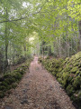
(1) Keep to the right on the path, which is still marked with the Red Disc. Leave the forest briefly to cross the beautiful Chaume du Querty. Continue back into the forest to reach the Roche Fendue crossroads.

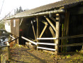
(2) Carry on following the same markings. Cross a picnic area where the markings are now dual-marked with a Green Rectangle, and walk past the Refuge de la Haute Planche. Pass the Planche des Belles Filles car park and you will come to a crossroads.

(3) Turn left, towards the Ballon d’Alsace, onto the Green Rectangle path – this is theGR® 533. Walk almost level along this wide track. After a right-hand bend, you’ll come across an old pond in the next circular route.

Stay on theGR® 533 (Green Rectangle)

(4) Continue to the La Grande Goutte mountain hut.

(5) After the refuge, turn left onto the path marked with a Yellow Disc and head towards the Ballon d’Alsace (mine clearance monument). From there, the path climbs gradually. You’ll reach the Col du Ballon.

(6) Turn right onto the tarmac road D 465 towards La Gentiane and join theGR® 5.

(7) Turn left onto theGR® marked with Red Rectangles, passing La Chaumière. Stay on theGR®, which runs parallel to the road, then cross the road to quickly reach the Gentiane building.

(8) Continue along theGR®, pass the Plain de la Gentiane and go round the Vierge de Wissgrut. You will then reach an X-junction in the hamlet of Wissgrut.

(9) Take the right-hand branch ofthe GR® through the Wissgrut hayfields and head for the Y-junction at a place called Le Gros Hêtre. Keep left on theGR® and continue downhill to reach a multi-way junction at the Col du Chantoiseau.

(10) Stay on theGR® and follow its Red Rectangle markings. Continue along this descending path, skirting the Ferme du Mont Jean at a distance. Then make a wide left-hand circular loop to reach another multi-way junction at the foot of Mont Jean.

(11) Leave theGR® behind on your left and turn right onto the path marked with the Blue Ring. Continue downhill, cross the D 465 and arrive at the junction with Rue de l’Église in the village of Lepuix.

(12) Turn right onto this street, which is signposted with Green Ring markers, and follow it to return to the Chauveroche car park (S/E).

Waypoints

  1. S/E : mi 0 - alt. 1,795 ft - Chauveroche car park
  2. 1 : mi 1.28 - alt. 2,726 ft - Col du Querty (833m)
  3. 2 : mi 2.24 - alt. 3,570 ft - Roche Fendue - Planche des Belles Filles
  4. 3 : mi 3.07 - alt. 3,294 ft - GR junction
  5. 4 : mi 5.38 - alt. 3,127 ft - Col de la Rougerie (1085m)
  6. 5 : mi 6.54 - alt. 3,327 ft - Refuge de la Grande Goutte
  7. 6 : mi 8.02 - alt. 3,848 ft - Col du Ballon (1174m)
  8. 7 : mi 8.7 - alt. 3,730 ft - GR5 junction
  9. 8 : mi 9.78 - alt. 3,474 ft - La Gentiane
  10. 9 : mi 10.91 - alt. 3,533 ft - Wissgrut
  11. 10 : mi 11.6 - alt. 2,976 ft - Col de Chantoiseau (920m)
  12. 11 : mi 13.67 - alt. 2,359 ft - Col du Mont Jean (720m)
  13. 12 : mi 14.59 - alt. 1,644 ft - Rue de l’Église, after the - Savoureuse (rivière)
  14. S/E : mi 15.34 - alt. 1,795 ft - Chauveroche car park

Notes

Note: there is an alternative route starting and finishing at Auxelles-Haut (Rue des Étangs car park), which adds 4 km to the route.

This route passes through a protected area, which may be subject to special regulations:

Worth a visit

(6) Alternative route: take a detour via the summit of the Ballon d’Alsace by following the GR®5, GR®5F, GR®7 and GR®59; the markings are: Red Rectangles and Yellow Discs, leading to:
- the statue of Joan of Arc,
- the Virgin of the Ballon, as well as a magnificent view over the valleys of Lorraine, Alsace, the Territoire de Belfort and the Haute-Saône,
(6) A distinctive feature of the Ballon d’Alsace is that it lies at the junction of departments 90, 68, 88 and 70.

Always be cautious and plan ahead when you're outdoors. Visorando and the author of this route cannot be held responsible for any accidents occurring on this route.

The GR® and PR® markings are the intellectual property of the Fédération Française de Randonnée Pédestre.

Reviews and comments

5 / 5
Based on 1 review

Reliability of the description
5 / 5
Ease of following the route
5 / 5
Route interest
5 / 5
Rando70
Rando70

Thank you

Machine-translated

bouledjouidja rabah
bouledjouidja rabah

Hello
The correction has been made...

Enjoy your walks

Machine-translated

Rando70
Rando70

Hello,

Please note that sections 4 to 6 are off-limits to the public within the Nature Reserve. Rangers are patrolling the area and may issue fines. It is therefore advisable to follow the GR 533 trail, which runs alongside it.

Machine-translated

Rando70
Rando70

Overall rating : 5 / 5

Date of your route : Jul 24, 2020
Reliability of the description : ★★★★★ Very good
Ease of following the route : ★★★★★ Very good
Route interest : ★★★★★ Very good
Very busy route : No

Hello,

Please note that sections 4 to 6 are off-limits to the public Nature Reserve. rangers are patrolling the area and may issue fines. It is therefore advisable to follow the GR 533 trail running parallel to it.

Machine-translated

Other walks in the area

For more walks, use our search engine .

The GPS track and description are the property of this route's author. Please do not copy them without permission.