Country:

 City:
City:


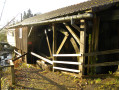
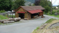
Parking is available at the Scierie Demouge car park in the hamlet of Chauveroche, Lepuix.
The route is signposted with a Red Disc up to the Haute Planche refuge. The Red Disc signposting can be found from this point (8).
(S/E) From the Scierie Demouge car park, keep to the left bank of the Ruisseau des Belles Filles. Head up Rue de Chauveroche, following it until you reach a right-hand bend, after a car park (with a table and benches) by a pond just past the water tower.
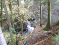
(1) Turn left onto the forest track. Cross the bridge over the Ruisseau des Belles Filles and immediately turn right, keeping to the right bank of the stream, onto the steeply sloping path. Further up, rejoin the forest track at a hairpin bend to the left.
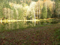
(2) Take the path on the right. Continue along the stream until you rejoin the forest track further up. Cross it once more and carry on straight ahead to reach the Étang des Belles Filles.
(3) Walk along the left-hand side of the lake. Follow the path which climbs to the left, due west, and winds its way through the trees to join the GR®533 (marked with a Green Rectangle) at an altitude of 1,001 metres. Turn left onto it and you will soon reach the Planche des Belles Filles ski resort.
(4) Turn left onto the path that climbs to the left of the ski lift. Pass by the monument to the FFI (French Forces of the Interior, who resisted in 1944). You’ll arrive near the Haute-Planche refuge, situated 100 metres to the right of the path.
(5) Turn left. Continue uphill until you reach the Roche Fendue, which is the highest point, about twenty metres to the left of the path.
(6) Take the track on the left which leads up towards Super Planche des Belles Filles to the summit at the top of the ski lift. Go and look at the orientation table and the signpost.
(7) Pass under the ski lift and begin your descent along the path: be careful, as there are no clear signposts. The path joins the one coming from the left and then another coming from the right at the Roche Fendue, situated a few metres to the left.
(8) Continue the descent south-eastwards to reach the Chaume du Querty and its mountain hut. Beautiful flora and superb views.
(9) After the refuge, turn right. Enter the forest and, after about 200 m, turn left. Further on, you’ll reach a forest track.
(10) Turn right and follow the forest track towards the Col du Querty. After a hairpin bend to the left, continue straight on to the pass.
(11) Leave the forest track by turning left at a 90° angle; the path heads due north then north-east before reaching a stream.
(12) Cross the stream and continue down the steep, stony path. You’ll come to the first houses in Lepuix and a tarmac road. Take the first street on the right and follow it straight on to reach the car park (S/E).




 Are dogs allowed?
 Visorando Member
 Local authority
 Difficult