Country:
 City:
City:


Access: Vallois – D914, Vallois exit.
Park in the Place de la Rivière car park, near the Vieux Moulin farm, on the side of the River Mortagne.
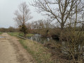
(S/E) From the car park, head towards Moyen, following the Blue Triangle sign. Cross the small bridge and head north-east along a tarmac-surfaced local track.
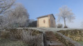
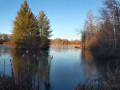
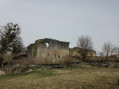
(1) Further on, on a stony track, you’ll see the River Mortagne on your right, lined with a beautiful riparian forest. You’ll then gradually move away from the river, now skirting wet meadows. In the distance, you can see Moyen Church and the Château de Qui qu’en Grogne. Head up towards the hill for 500 m.
(2) In the woodland, turn right onto a dirt track (Blue Triangle) and continue for about a hundred metres to the top of the hill.
(3) Turn slightly to the right towards Moyen (a short section which can be particularly muddy at certain times of year). Gradually descend the path for 700 metres and enjoy the view of the church and Château de Moyen once again.
(4) Pass under the old Nancy–Gérardmer railway line. At the farm on your left, carry straight on until you reach a picturesque old stone bridge spanning the Mortagne. To your right is a canoeing and kayaking route.
(5) Now cross the D914 with care (it’s a busy road); follow it a few metres to the left before turning right, then very quickly right again down a small alleyway, continuing to follow the Blue Triangle signposts.
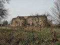
(6) At the top of the narrow lane, turn right for a few metres and then left past a house with a pale yellow façade (the Blue Triangle is barely visible at the bottom of the boundary wall). Turn left again to reach the ruins of the Château de Qui-qu’en-grogne, which you’ll walk past on your right.
(7) Turn round and head back to Vallois along the same route you took on the way there, until you reach the car park at Place de la Rivière in Vallois (S/E).

 Visorando Member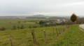

 Moderate