The hillsides of Baccarat

A lovely, easy walk through the countryside, passing through a village and a small town with a glorious past and an interesting heritage linked to crystal-making. The route mainly follows paths, small roads and narrow streets.

Details

n°72904157
Creation:
Last update:
Last review:
  • Walking
    Activity: Walking
  • ↔
    Distance: 4.38 mi
  • ◔
    Average duration: 2h 15 
  • ▲
    Difficulty: Easy

  • ⚐
    Back to start: Yes
  • ↗
    Ascent: + 240 ft
  • ↘
    Descent: - 246 ft

  • ▲
    Highest point: 1,040 ft
  • ▼
    Lowest point: 856 ft
  • ⚐ Country: France
  • ⚐
  • ⚐ City: Baccarat (54120)
  • ⚑
    Start/End: N 48.448673° / E 6.738306°
  • Accessible from the train station Gare de Baccarat.
  • ❏
    IGN map(s): Ref. 3516E
  • Hour-by-hour weather

Description of the walk

Park at the Saint-Rémy Church car park or Place Général Leclerc just behind it.

(S/E) Head to the Town Hall park by crossing the main road (D935) at the roundabout.

(1) Walk through the park along the River Meurthe to reach the small wastewater treatment plant.

(2) Take the path on the right and continue until you reach the first set of ponds, then a second set, continuing along the path through a large meadow.

(3) At the second pond, turn left onto an uphill path. Reach the plateau and continue along the main path until you reach a small road near the Moulin à Vent farm. Carry on straight ahead and, once you reach the bend, leave the road and take the path opposite, which leads to the D22.

(4) Follow the departmental road to the left with care until you reach the roundabout.

(5) Go straight on into a housing estate, following Rue des Gadines. Stay on this street until you reach the junction with the D935, which is called Rue de Ménil at this point.

(6) Follow the road to the right for about 50 metres, then turn left onto the small, downhill road called Rue des Trois Fontaines. Continue along this small road for approximately 450 metres until you reach a 90° bend to the left at the pumping station. Continue round this bend and look out for a small lane climbing between two houses on the left-hand side of the road.

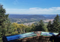
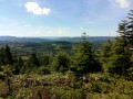
(7) Turn left to walk up this narrow lane, which very quickly turns into a footpath, and reach the car park above the cemetery: there’s a lovely view and you can take a short stroll through the orchards behind the cemetery. Continue to the junction.

(8) Take Rue du Bacha on the left, walk past the tower, then turn right into the cul-de-sac and emerge onto Rue des Halles, then turn right to join the Grande Rue. Continue left along this street and walk to the three-way junction near the small Parc du Musée des Sources d’Hercules.

(9) Turn right to follow Rue de la Porte Saint-Nicolas for about a hundred metres. Turn right at No. 13 into the narrow lane, which quickly becomes a short footpath and leads to the end of Impasse du Donjon. Turn left, continue along Rue des Moulins and go as far as the junction with Rue Adrien Michaut.

(10) First turn left then right to stay on this street, pass the medieval tower known as the Tour des Voués and reach the junction with Rue de Ménil.

(11) Turn right here, then right again to follow Rue des Trois Frères Clément. Take a right-angle left-hand bend and continue to the roundabout where the starting car park is located (S/E).

Waypoints

  1. S/E : mi 0 - alt. 876 ft - Car park at Saint-Remy Church in Baccarat - Meurthe (rivière)
  2. 1 : mi 0.08 - alt. 866 ft - Parc de la Maire in Baccarat
  3. 2 : mi 0.52 - alt. 863 ft - Wastewater treatment plant
  4. 3 : mi 1.17 - alt. 856 ft - Ponds
  5. 4 : mi 2.19 - alt. 994 ft - RD22
  6. 5 : mi 2.46 - alt. 1,037 ft - Roundabout
  7. 6 : mi 2.86 - alt. 965 ft - D935
  8. 7 : mi 3.24 - alt. 978 ft - Cemetery Lane
  9. 8 : mi 3.42 - alt. 1,027 ft - Rue des Halles - Tour du Bacha (Deneuvre)
  10. 9 : mi 3.7 - alt. 971 ft - Three-way junction
  11. 10 : mi 3.96 - alt. 873 ft - Crossroads
  12. 11 : mi 4.1 - alt. 873 ft - Rue du Menil. Near the - Cimetière militaire (Baccarat)
  13. S/E : mi 4.38 - alt. 876 ft - Car park at Saint-Remy Church in Baccarat

Notes

Trainers are all you need for the walk.

Bars in the centre of Baccarat.

Worth a visit

Reviews and comments

4.3 / 5
Based on 2 reviews

Reliability of the description
4 / 5
Ease of following the route
4.5 / 5
Route interest
4.5 / 5
User 19129728
• Edited:

Overall rating : 4.7 / 5

Date of your route : Jun 18, 2025
Reliability of the description : ★★★★★ Very good
Ease of following the route : ★★★★★ Very good
Route interest : ★★★★☆ Good
Very busy route : No

A very pleasant walk with my 10-year-old son. I highly recommend it!

Machine-translated

User 21311212

Overall rating : 4 / 5

Date of your route : Jun 06, 2025
Reliability of the description : ★★★☆☆ Average
Ease of following the route : ★★★★☆ Good
Route interest : ★★★★★ Very good
Very busy route : Yes

A few mistakes:
2) You don’t cross ‘a large meadow’; you carry on along the path...
6) It’s not Chemin St Christophe but Rue des 3 Fontaines.
8) If you turn left at the junction, it’s not Rue des Halles but Rue du Bacha, which takes you right past the Bacha Tower. Carry on straight ahead down the cul-de-sac until you reach Rue des Halles, then head towards the Grand Rue.
Kind regards
S. HENRY

Machine-translated

Other walks in the area

For more walks, use our search engine .

The GPS track and description are the property of this route's author. Please do not copy them without permission.