Country:
 City:


Coming from Bandol towards Saint-Cyr-sur-Mer, just over 2.5 km after passing the entrance to the Domaine de la Frégate, turn left onto the road that crosses the railway line towards La Madrague – Collège Don Bosco. A little further on, leave the road that continues straight on towards Port d’Alon, and turn right towards La Madrague.
Drive past Don Bosco College, which you’ll see below on the left, and park on the right-hand side of the bend opposite the college’s service entrance; there are plenty of good parking spaces available for around ten cars.
(S/E) Set off again eastwards along the road for about 400 m. On the left, opposite Don Bosco College, you’ll find the entrance to the Don Bosco forest track.
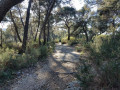
(1) Follow this track uphill; it initially runs alongside a lovely patch of vineyards before entering the Aleppo pine forest. On the left, you will soon see an old quarry which is no doubt of interest in terms of local history.
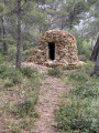
Further on, on the right-hand side in the forest, you’ll come across a charming old hut in good condition with an inscription painted in blue. Continue along the track, which climbs steadily, ending with a left-hand bend onto a clearing measuring around a hundred square metres.
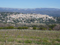
(2) To the west of this clearing, you’ll find the start of the rocky path leading to the summit, where there is a small covered viewing platform accessed via a metal ladder. From inside the lookout, enjoy the magnificent 360-degree view over the Bay of Saint-Cyr and La Ciotat, the Sainte Baume mountain range, the hills of the Beausset basin, the Gros Cerveau and Mont Caume, and the Bandol hinterland.
Continue then due west along the ridge, on a path that is initially very rocky and rugged, then sandy and gentler. Pass the access to the well-known descent down the southern slope of the sandy hill on your left – marked by its zigzagging wooden fences – and, a few dozen metres to the right, you’ll reach a fork in the path.
(3) Ignore the path which, if you continued straight on, would take you down along the ridge (described in“Another approach to the Colline de Sable in Saint-Cyr-sur-Mer”), and turn right to descend the northern slope via a winding path carved into a thick layer of sand. Take care on the descent, as the slope is often steep, and there are numerous roots across the path; whilst these help to protect the path from erosion, they also pose a risk of a serious fall.
The path leads out onto the main forest track which skirts the hillside halfway up. Cross this and head towards a large, sloping sandy area opposite. Descend this until you reach another track running parallel to the previous one, and take it to the left, after admiring a pine tree whose roots have been largely exposed by the erosion of the sand.
Continue along this track until you cross an area strewn with rubble – no doubt the remains of a very old building’s demolition – after which you’ll reach a clear, sandy clearing.
On the left, a path joins from the main track.
(4) Turn right onto the path that continues from here and descends towards the Route de la Madrague. Not far from this road, which can be seen through the trees, leave the path on your right that continues towards La Madrague, and turn left to head towards the Nartette vineyards. Walk alongside these vineyards, with the Nartette bastide visible on your left.
The route at the end of the route is the same as for the walk “Another approach to the Colline de Sable in Saint-Cyr-sur-Mer”.
You’ll reach the end of the vineyard plot at a small enclosure surrounded by wattle fencing, known as “la Pelouse aux Orchidées” (information board). Go round it on the right, follow the road alongside it and rejoin it shortly afterwards. Follow this road to the left to return to the car park (S/E).

 Visorando Member


 Moderate

 Difficult
 Association / Club / Walk leader