Country:
 City:
City:


From Arc-sur-Tille, head to Binges, then Etevaux via the D961. Continue along the same road before turning left onto the D25, at the Pont-Bourdin Forest Ranger’s House, to reach Drambon. Enter the village, walk past the church (on the right) and turn left immediately afterwards, at the Town Hall, to reach the car park (signposted) situated behind the village hall.
(S/E) From the car park, head towards the D25 (Rue du Parterre), cross it and turn left (north-north-east, away from the church).
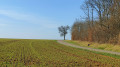
(1) On leaving the village, just after the wooden cross, turn right onto the tarmac road, which later becomes a gravel track. At the end of a straight stretch, it veers to the left and, further on, crosses the D959 (PC206). Cross with care.
(2) Continue straight ahead on the white, stony track, ignoring the side paths leading towards Saint-Sauveur. Pass under a medium-voltage power line (LEMT). After skirting a copse (signposted to the left), at the next fork in the road, keep to the left. The track turns into a grassy field path. You’ll pass successively under medium-voltage and high-voltage power lines. After the two lines, the track becomes a white gravel track again. Carry on straight ahead until you reach the entrance to Saint-Sauveur and the first junction.
(3) Turn left onto Rue du Petit Tremblois. Carefully cross the D25 and, on the opposite side, follow Rue Basse for a very short distance. Turn left onto Rue Neuve. At the next junction, turn left onto Rue du Tremblois.
(4) Follow this wide path, which is tarmac-surfaced at first and then becomes a gravel track, passing alongside a poplar copse right at the start (on the left). You’ll pass under a high-voltage power line (LEHT) and a medium-voltage line (MT) in quick succession. Continue straight ahead until you reach the end of the path.
(5) Twenty metres before the end, look out for a large, tall tree on the left. Then turn left to enter the woods, stepping over the first ditch. Continue straight ahead for 30 m until you reach a second ditch which forms a bend. Cross this ditch too and follow the path to the left for 20 metres. On the right, you’ll find the start of line 39, ‘Forêt Domaniale de Mirebeau’.
(6) Follow this woodland path straight ahead. Cross a ditched section and join a local road. Cross it carefully and continue along the same path on the opposite side (shifted 15 metres to the left). At one point, it follows a ditch (leading to the left) which ends at a T-junction of tracks. Turn right.
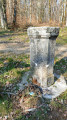
(7) Follow this new woodland path straight ahead to its end. It ends abruptly. Look out for a stone marker in front of you. Cross a ditch at this point and step onto a cross-country path. Turn left onto this path and then, shortly afterwards, right (where the vegetation changes). Continue straight ahead until you emerge from the forest.
(8) The grassy field path leads straight on, past an initial crossroads of tracks, to a second four-way junction situated directly opposite the bell tower of Cheuge (on the right). Then turn left, towards the woods.
(9) As you approach the forest, the stony path becomes grassy. At the Fork in the road on the edge of the woodland, keep left to follow the Sommière de Cheuge until you reach the Étoile crossroads higher up, marked by a tall engraved stone marker. Turn left towards Sommière de Saint-Sauveur.
(10) Follow this path all the way until you come to the village road.
(11) Then turn right and walk carefully alongside the road for a few hectometres until you emerge from the state-owned woodland.
(12) Turn left at the boundary between the woodland and the fields and follow a stony track until you reach the edge of a copse on the right-hand side of the track.
(13) Then turn right onto a grassy path at the boundary between the woods and the fields. It skirts around the Bois de Montmançon and joins the D959.
(14) Cross the road and walk carefully along its left-hand side for about a hundred metres before turning right onto a grassy track between the fields. Further on, turn left with the track.
(15) Join a stony track and follow it to the right. Pass under a high-voltage power line, before turning left one last time to join the D25 at its end. Head right towards Drambon.
(16) Walk carefully along the verge of the D25 (for about 400 m) until you reach the pavement in the built-up area of Drambon.
(1) Continue straight on along Rue du Parterre and you’ll soon reach the starting point (S/E).

 Visorando Member
 Easy
Easy