Circular route from Pontailler to Saint-Sauveur via Maxilly-sur-Saône

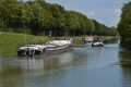
Starting from Pontailler-sur-Saône, the route takes us through the communal forests of Pontailler and Maxilly-sur-Saône to Saint-Sauveur, before heading back down via the Marne–Saône Canal and then along the River Saône to return to Pontailler.

Details

n°29278278
Creation:
Last update:
–
Last review:
  • Walking
    Activity: Walking
  • ↔
    Distance: 11.96 mi
  • ◔
    Average duration: 5h 45 
  • ▲
    Difficulty: Moderate

  • ⚐
    Back to start: Yes
  • ↗
    Ascent: + 269 ft
  • ↘
    Descent: - 269 ft

  • ▲
    Highest point: 758 ft
  • ▼
    Lowest point: 600 ft

Description of the walk

Head for Pontailler-sur-Saône. The starting point is on Rue Saint Éloi, opposite the doctor’s surgery, along the branch of the canal leading to the harbour on the Old Saône, where you can park your car.

(S/E) Start the walk heading towards the church. Walk behind the market square and the church to go round it on the right. Join Rue du 8 mai 1945. Take the pavement on the right and carefully cross the bridge over the Vieille Saône. Continue to the next roundabout.

(1) After a slight bend to the right, head up Place Saint-Jean on the left. At the first right-hand bend, leave the street and head up the steeper path opposite, between the houses, along a grassy track that ends in a stony path. Continue to the wayside cross, at the junction of four streets. Turn right into Rue aux Moines.
After 100 m, head up to the right towards the mobile phone mast and the statue of the Virgin Mary further on. Viewpoint offering a panoramic view of the Saône plain and the Jura mountains.

(2) Retrace your steps back towards Rue aux Moines. Walk gently down it to the right until you reach the railway line.

(3) Turn left until you reach a point where you must cross the railway line, just past some bushes. Continue along the path beside the railway line, keeping to the right, until you reach the RD959.

(4) Cross this road opposite the industrial estate. Follow Rue des Métiers until you reach the edge of the woodland, straight ahead. Turn left until you reach a dirt track crossing the road, near an electricity pole. Turn left and continue to the next junction.

(5) Head up Rue du Tillet on the right. The route runs between fields on your left and the edge of the Bois des Hies on your right. Carry on to the track junction after the clearing with the beehives.

(6) Just after the clearing with the beehives, turn right to enter the woods. Follow the path, which is clearly marked at first but gradually narrows. There are felled trees to go round. Cut left before turning right onto a better-defined path. Shortly afterwards, turn left to go down a wider track leading to the D976. Turn left twice to reach the Tree of Liberty.

(7) Turn round and head back to the crossroads of tracks.

(6) Turn right to rejoin the Bois des Hies path. At the next junction, keep to the right and follow it straight on until you reach the Chêne Rouvre junction.

(8) Take the path leading north-west on the left. Follow it straight ahead until it meets a cross-path. Turn right and continue until you leave the woods. Walk along the edge of the field, keeping to the right. Keep to the right onto the white track and continue to the junction with the D25g.

(9) Follow it carefully to the left until you reach the altitude of 195. At the bend, continue straight ahead on the white track, keeping the departmental road on your right.

(10) At the fork in the road, at altitude 198, keep to the right. Climb slightly until you reach a T-junction situated beneath the high-voltage power line. Turn right.

(11) At the fork in the road at the entrance to the village of Saint-Sauveur, keep to the right onto Rue du Treige Cachot. Continue straight on to the centre of the village. Head straight ahead and then turn right to go round the town hall and reach the church.

(12) Retrace your steps to pass behind the war memorial and join Rue Boucaud. Follow it to the right as far as the Marne–Saône Canal. Cross the bridge, then head down to the towpath.

(13) Continue to the right; the canal runs to your right until you reach Lock 42 at Maxilly-sur-Saône.

(14) Cross the bridge on the right, then immediately afterwards turn left onto the towpath; the canal curves to the left until it joins the Canal de la Saône.

(15) Turn right to pass the lock and the Maison du Tremblant. Follow the Saône, keeping to the left along the old towpath, until you reach the harbour master’s office at the entrance to Pontailler.

(16) Just after crossing a bridge, turn right and follow the stretch of water until you reach the car park on Rue Saint-Éloi (S/E).

Waypoints

  1. S/E : mi 0 - alt. 607 ft - Car park on Rue Saint-Éloi
  2. 1 : mi 0.27 - alt. 617 ft - Roundabout, right / left
  3. 2 : mi 0.6 - alt. 751 ft - Return journey. Statue of the Virgin Mary overlooking the Saône valley
  4. 3 : mi 1.02 - alt. 650 ft - Railway line – keep to the left
  5. 4 : mi 1.54 - alt. 633 ft - D959. Cross the industrial estate
  6. 5 : mi 1.82 - alt. 643 ft - T-junction, turn right
  7. 6 : mi 2.58 - alt. 719 ft - Beehives. T-junction: right-hand path to and from the ‘Arbre Liberté’ tree
  8. 7 : mi 3 - alt. 630 ft - Tree of Liberty
  9. 8 : mi 4 - alt. 682 ft - Chêne Rouvres junction, on the left
  10. 9 : mi 4.75 - alt. 636 ft - D25g, on the left
  11. 10 : mi 5.27 - alt. 650 ft - At the fork in the road, turn right
  12. 11 : mi 6.48 - alt. 656 ft - Entrance to Saint Sauveur, on the right
  13. 12 : mi 6.82 - alt. 650 ft - Return trip: Saint Sauveur Church
  14. 13 : mi 7.13 - alt. 630 ft - Canal bridge, on the right
  15. 14 : mi 8.81 - alt. 633 ft - Maxilly lock. Turn left after the bridge
  16. 15 : mi 9.75 - alt. 620 ft - Marne–Saône Canal
  17. 16 : mi 11.89 - alt. 614 ft - Bridge, on the right
  18. S/E : mi 11.96 - alt. 607 ft - Car park on Rue Saint-Éloi

Notes

Picnic spots:
1) Mont Ardoux, table and benches behind the statue of the Virgin Mary.
2) Arbre de la Liberté, Pontailler-sur-Saône forest, rest area under the trees, with a table and benches.
3) Near Maxilly-sur-Saône, a picnic area under the trees, near the Chêne Rouvres.
4) Along the canal, at Lock No. 42 in Maxilly, a picnic area with tables and benches, sheltered and with a drinking water tap and toilets (except in winter).

Outside wooded areas, in strong sunshine, bring a hat or cap. It can get hot on the dirt tracks.
In winter or in wet weather, wear walking boots for the grassy sections, which can sometimes be damp and therefore muddy.

(6) Please note! Depending on the season, the route takes you through woodland in places that may be difficult to navigate.
Otherwise, bring walking poles for the ascents and descents through wooded areas,

(9) Note: There is a possible shortcut avoiding the Saint-Sauveur circular loop and heading directly to Pontailler from (9) via Maxilly. A short loop of around twelve kilometres.
As you leave the dirt track, turn right onto the D25g. Pass the cemetery on your right. On entering the built-up area of Maxilly-sur-Saône, the main road veers to the left and then immediately to the right. Shortly afterwards, turn left into Rue de l’École. At the junction with the D976, turn left (stick to the left-hand pavement after the traffic lights) and cross carefully, then immediately turn right towards Heuilley. There is a fairly steep slope for 10 metres to the left of the bridge over the canal, leading to the tarmac-surfaced towpath of the Marne–Saône Canal.

Worth a visit

Pontailler-sur-Saône
Pontailler has an old harbour where barges used to moor, and today a marina for river tourism along the banks of the Saône.
The village is divided into two parts: on the one hand, the old village situated on the Saône plain; and on the other, the hill of Mont Ardoux, which is home to two residential estates. The historic town centre is built on an island formed by the Saône and the Vieille Saône, which converge to the south and are linked to the north by the Canal Saint-Éloi, within which a marina was established in 1994.

In what is now the Mont Ardoux district of Pontailler, slightly overlooking the Saône plain, there was a major Gallic settlement (probably of the Sequani tribe, with a Lingones presence) several centuries BC, as evidenced by the large number of archaeological artefacts discovered there.

After the Roman conquest, during the long period of peace in the 1st and 2nd centuries AD, this village ‘migrated’ to the banks of the Saône and took the name Pontiliacus. It was situated on the site of a ford (due to the presence of islands and several branches of the river), and later a bridge on the major road linking Langres (Andemadunum) – Mirebeau (Mirebellum) – Pontailler (Pontiliacus) – Besançon (Vesontio).

In the Middle Ages, there was subsequently a major fortified castle there. However, by the end of the 13th century, this feudal house relinquished Pontailler (and the viscountcy of Dijon in 1276) in favour of the Dukes of Burgundy, having previously ceded its rights over Champlitte to the Vergy family, who already held part of it through their Fouvent ancestors.

Pontailler then became the seat of a ducal, and later royal, castellany, although the original feudal family retained the name Pontailler.

In 1918, the villages of Pontailler and Vonges were affected by the disaster caused by an accidental explosion at the Poudrerie, a famous explosives factory (black powder).

The village is home to the 18th-century Church of Saint-Maurice, which has seen better days. Of particular note is its unusual pediment adorned with columns.

The Mont-Ardoux Statue
This statue of the Virgin Mary is situated at an altitude of 233 metres, at the highest point in Pontailler, which offers a panoramic view of the Saône.
It was erected in 1862 and, even today, remains a place of pilgrimage on 15 August.

An overflow washhouse
This washhouse still stands on the Vieille Saône and has been restored.
It adapts to the river’s rising and falling waters: mechanisms dating from the early 20th century allow the washhouse floor to be raised or lowered.

Church of the Holy Trinity of Saint Ursula in Saint Sauveur
It dates from the 13th century. It is not open to visitors. Its brick tower is rather unusual. A statue stands on the roof.

Reviews and comments

4 / 5
Based on 2 reviews

Reliability of the description
5 / 5
Ease of following the route
4 / 5
Route interest
3 / 5
saint-apollinaire
saint-apollinaire

Overall rating : 4 / 5

Date of your route : May 17, 2023
Reliability of the description : ★★★★★ Very good
Ease of following the route : ★★★☆☆ Average
Route interest : ★★★★☆ Good
Very busy route : No

Hello,
Part of the walk was through the woods; good for shelter from the sun.
The path between waymarks 5 and 6 was difficult as it hadn’t been maintained, with very thick, tall grass.
The fork at marker 6 leading to the Tree of Liberty is barely visible; the path is invisible and can barely be made out.
The tree is impressive – well worth seeing.
For the climb back up, a GPS or compass is useful, as the path is not visible.
At point 9, we reached the canal at point 15.
It was still an enjoyable walk thanks to the varied scenery and the chance to explore the canal, the locks and the Saône.
Thanks for this walk.

Machine-translated

cuzcodom
cuzcodom

Overall rating : 4 / 5

Date of your route : Feb 12, 2023
Reliability of the description : ★★★★★ Very good
Ease of following the route : ★★★★★ Very good
Route interest : ★★☆☆☆ Disappointing
Very busy route : No

Not much to catch the eye, but some pleasant encounters: Saint Ursula’s neighbour, then the people who held the key to the church: magnificent cobblestones in the sacristy that linked the church to the prior’s modest dwelling.
Also worth seeing is the church’s roof on the street side (walk round it), with its glazed tiles (to impress passers-by); and as you walk along the canal, the beautiful house you can see on the right belongs to that same, modest prior… (a house now owned by a Parisian).

Machine-translated

Other walks in the area

For more walks, use our search engine .

The GPS track and description are the property of this route's author. Please do not copy them without permission.