Country:
 City:
City:


Head to Montmançon (21) via the D25 and park in the car park on the left, opposite the school and the town hall.
(S/E) Facing the town hall, turn left onto Rue du Pré Barré, then turn right at the first three-way junction onto Rue du Meix Rameau. At the three-way junction that follows, keep left onto Rue de la Chassaigne. At the last house, the street turns into a grassy track. It passes between meadows and then runs (keep left) along the edge of the Bois de Chassaigne. Follow it all the way to its end and the edge of the woods.
(1) Turn left onto a dirt track and follow it straight ahead all the way, first along the edge of the woods and then across fields, ignoring any side paths, until you reach Saint-Sauveur. At the first junction, turn left.
(2) Follow Rue du Petit Tremblois until it intersects with the D25. Cross this road and continue straight ahead before taking Rue Neuve, the first on the left. At the next junction, turn left onto Rue du Tremblois. On leaving the village, keep to the left, following a row of poplar trees. The tarmac road turns into a dirt track just opposite two power lines (medium and then low voltage). At the end of a long straight stretch, the track enters the woodland. From this point, count six woodland paths branching off to the left and turn onto the seventh (signs 10/12 and hunting post no. 9), well before a right-hand bend visible in the distance.
(3) Turn left and continue straight ahead. Cross two ditches in succession. When you reach the end of a third, cross it and immediately turn right, following this path – off the existing track – for about sixty metres (with the ditch on your right). When you reach a woodland track (signs 7/6), turn left and follow it uphill, with your back to the ditch.
(4) Cross over a large fallen tree and continue straight ahead until you reach a grassy track. Cross this to continue along the original path, whilst avoiding any obstacles (dead trees). At the second junction with a perpendicular path, continue straight ahead after a very slight detour to the left. At the third crossing, do the same, this time veering very slightly to the right. At the fourth crossing, the landscape differs from the IGN map due to forestry work. Follow the existing path (not shown on the map) which continues in the same direction, towards a field visible in the distance.
(5) Turn onto a white track opposite the Pont-Bernard farmhouse and turn left. Follow it to the edge of La Castillère wood before turning right onto a grassy path (with the wood on your left). After a long bend to the left, just as the path straightens out, turn left onto a wooded track that is partially passable by vehicle.
(6) It winds its way before emerging at the edge of a field, with the bell tower of Montmançon church in sight. Continue straight ahead, passing through a crossroads of tracks with a wooden cross at the corner. Enter Montmançon and keep to the left. You’ll reach the municipal weighbridge and, a few metres further on, the car park, which is the starting point (S/E).

 Visorando Member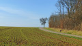
 Moderate