Between Sommières and the ponds of the Saint-Léger Forest

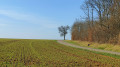
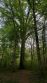
A pleasant forest walk through open clearings and rugged woodland paths, leading to two ponds where you can observe wildlife.

Details

4517919
Creation:
Last update:
Last review:
  • Walking
    Activity: Walking
  • ↔
    Distance: 5.90 mi
  • ◔
    Average duration: 2h 45 
  • ▲
    Difficulty: Easy

  • ⚐
    Back to start: Yes
  • ↗
    Ascent: + 66 ft
  • ↘
    Descent: - 66 ft

  • ▲
    Highest point: 699 ft
  • ▼
    Lowest point: 620 ft

Photos

Description of the walk

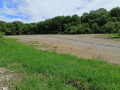
Start from the car park situated to the right of the D961, at the junction by the Pont Bourdin forest house, in the commune of Saint-Léger-Triey.

(1) Take the main tarmac track heading south-west.

(1) At the first road/track junction, keep to the right onto the Sommière de la Grisière. Continue straight ahead and turn left at the second track junction to return to the main track.

(2) Turn right and follow it south-west to the 208-metre mark. Turn left onto the road that curves in a semicircle.

(3) Turn left again onto the Sommière de Cirey and carry on straight ahead.

(4) Ignore the 7/8 line on the left – you’ll take that later – and carry on straight ahead. After two large fallen trees blocking the way for vehicles, keep to the left and continue along the path, which has become grassy and loose. Follow it until you reach the shore of the Grand Étang.

(5) Retrace your steps back to the 7/8 line, past the fallen trees blocking the way.

(4) Turn right and follow this track until it joins the Sommière du Clausel, near a hunting lodge.

(6) Turn left onto the Sommière, then right onto the first path (line 5).

(7) At the T-junction, turn right to reach the bank of the Étang Bouques. Then retrace your steps.

(7) Continue straight on (west) until you reach the main path.

(8) Follow it up to the right, heading north-east, to reach the car park where you started (S/E).

Waypoints

  1. S/E : mi 0 - alt. 646 ft - Pont Bourdin forest house car park
  2. 1 : mi 0.09 - alt. 646 ft - Junction of the circular loop
  3. 2 : mi 1.16 - alt. 646 ft - Junction with the main trail, on the right
  4. 3 : mi 1.98 - alt. 699 ft - Sommière de Cirey
  5. 4 : mi 3.11 - alt. 646 ft - Line 7/8: L/ straight on – R/ turn right
  6. 5 : mi 3.63 - alt. 620 ft - Grand Étang (Forêt de Saint-Léger)
  7. 6 : mi 4.66 - alt. 650 ft - Sommière du Clausel, on the left
  8. 7 : mi 5.08 - alt. 640 ft - Crossroads - Étang Bouques
  9. 8 : mi 5.54 - alt. 643 ft - Main signpost, on the right
  10. S/E : mi 5.9 - alt. 646 ft - Pont Bourdin forest house car park

Notes

Bring walking sticks as the ground is soft near the ponds and when crossing ditches.
Don’t forget to take a pair of binoculars (Grand Étang).

Worth a visit

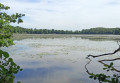
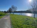
Unobstructed view across a beautiful stretch of the Grand Étang, with La Tuilerie visible in the distance.
Numerous tracks on the ground left by wild animals.
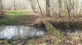
Approach to Étang Bouques.

Reviews and comments

3.9 / 5
Based on 3 reviews

Reliability of the description
4 / 5
Ease of following the route
3.7 / 5
Route interest
4 / 5
Charly
Charly

Overall rating : 4 / 5

Date of your route : Jun 13, 2024
Reliability of the description : ★★★★☆ Good
Ease of following the route : ★★★☆☆ Average
Route interest : ★★★★★ Very good
Very busy route : No

Hello
Route completed on 13 June 2024.
Please note that the sections running along the plot boundaries are well hidden by the vegetation (and brambles) that has taken over the undergrowth.
A lovely walk through a beautiful forest.

C. Perrin


*****************

Machine-translated

NanaDidi
NanaDidi
• Edited:

Overall rating : 3.7 / 5

Date of your route : Mar 20, 2024
Reliability of the description : ★★★★☆ Good
Ease of following the route : ★★★★☆ Good
Route interest : ★★★☆☆ Average
Very busy route : No

The walk is indeed a bit monotonous along the main (tarmacked) path. We shortened the route by taking the many side paths.
The paths were very muddy during this rainy spell. The areas around the ponds have changed, but it’s always a pleasure to see them, even when there aren’t many birds about.

Machine-translated

Vivibelo
Vivibelo

Overall rating : 4 / 5

Date of your route : May 30, 2022
Reliability of the description : ★★★★☆ Good
Ease of following the route : ★★★★☆ Good
Route interest : ★★★★☆ Good
Very busy route : No

At the end of the Grisière path, I couldn’t find where to turn to rejoin the main path. There were felled trees lying on the ground, which may have been blocking the start of the path, so we turned back.
The large pond is well worth a look; it was full of flowering water lilies.
Unfortunately, the Bouques pond was dry.
A very easy walk, though the straight stretches on the tarmac were a bit monotonous.

Machine-translated

Other walks in the area

For more walks, use our search engine .

The GPS track and description are the property of this route's author. Please do not copy them without permission.