Country:

 City:
City:


(S) From the ‘Le Tieppo’ lodge in La Chalp, walk up Rue d’Aval to the corner of ‘Les Jouets du Queyras’. At the end of this street, turn left.
(1) Immediately turn right onto a path heading east then south-east.
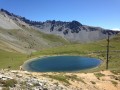
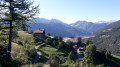
(2) At the hamlet of Les Maisons, take the path that runs above the houses. On leaving the hamlet, take a path on the left opposite three houses. TheGR®® 5 winds its way up a few bends before continuing eastwards across a meadow. The path soon joins a forest track. Follow it gently uphill to Lac de Roue.
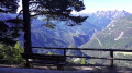
(3) Just past the lake’s spillway, at its southern tip, choose one of the two paths leading off to the right into the forest to admire the panoramic view from a bench. Continue along the path heading west, which soon turns north. After 300 m, rejoin theGR®® 5. Turn right.
After a descent via tight hairpin bends, the path joins the road.
(4) Take care here: there is heavy traffic on this road in summer. Take the road to the left to pass through Château Queyras. Top up your water supplies at the public fountains. Head down the street to the right, opposite the school, to the bridge crossing the Guil.
(5) Cross the bridge, then, after the torrent, take the very steep cobbled path opposite the bridge. Continue south at the next junction. The path approaches the Torrent de Bramousse.
(6) The GR®5 joins the Route du Sommet Bucher for about 500 m before leaving it, then rejoins it again; follow it for about 400 m before turning right onto the path that runs along the right bank of the Bramousse torrent. You will reach Pré Premier.
(6) Here, two paths lead south. At the three-way junction, take the one that climbs to the left and turns into a footpath at a paddock. Continue south through the meadow. At the Fontaine Rouge crossroads, join a forest track.
(8) Ignore this track; carry on straight ahead on theGR®®5. Shortly afterwards, the GR® takes a sharp bend north-west, then turns south again and climbs gently to reach the Col Fromage.
(9) Leave theGR®® here, turn right and follow the path in a west-south-westerly direction. Wind your way along, ignoring the direct route, to reach the Crête des Chambrettes and the observation post.
(10) Descend a few metres to rejoin the path on the right. Reach the junction at Combe Chevalière.
(11) Turn sharply left at a hairpin bend and head due south. The path then turns north-west to reach the pass.
(12) Take the path on the left heading south; this is theGR®®58.
Note: work carried out in 2019 slightly altered the route; you must follow the route shown here. You’ll reach the Ravin des Aiguillettes junction in a large meadow.
(13) Stay on theGR®®58, following its red and white markings. Descend via a series of tight hairpin bends to reach the Queyras district at the entrance to Ceillac.
(14) Walk through Ceillac, passing the church square and the town hall. You’ll reach the Lodge des Baladins (E).
 Visorando Member
 Difficult
 Moderate